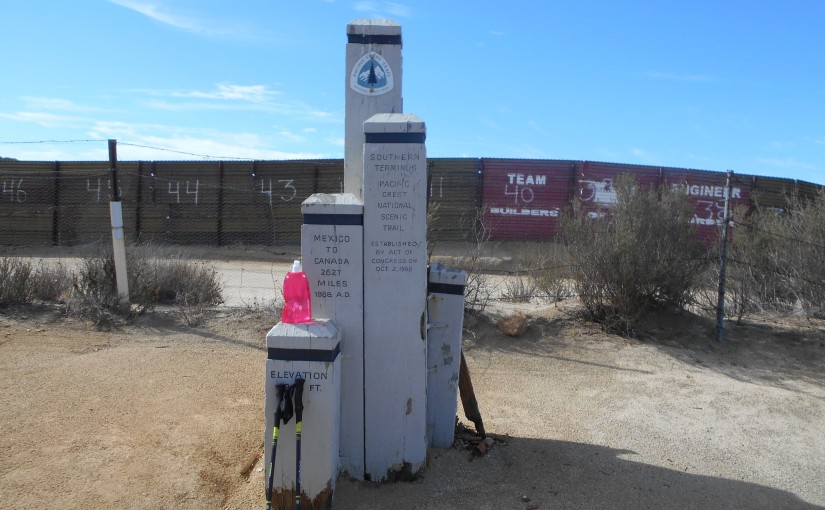
On August 22, 2014, I drove down to San Diego. After staying with my parents for a night, they drove me the US/Mexico border south of Campo, California. At the Pacific Crest Trail trailhead, I began hiking. Over the next 8 days, I hiked 138 miles (plus 4 miles hitchhiked from Ranchita, CA back to the trail) to Indian Flats Campground in the Cleveland National Forest north of Warner Springs, CA. The final day, a friend picked me up from the campground and drove me back home after a good cheeseburger and slice of Julian baked pie. On Sunday, August 31, I then walked to the Vista Transit Station, where I hopped onto the Sprinter to the Oceanside Transit Station. My parents had sailed their boat up to the Oceanside Harbor, where I stayed that night. On Labor Day, September 1, we then sailed the entire day back to San Diego, where I picked up my car and drove back home.
Category: Pre-Nomad
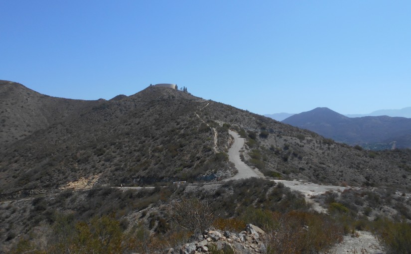
Black Mountain Open Space Preserve (2014-08-16)
Location: Black Mountain Open Space Preserve, Poway, CA
Difficulty: Easy to Moderate
Hike Statistics: 6.57 miles, 4392ft elevation change (2173ft gain), average slope of 11.2% (60.8% max slope downhill; max uphill slope of 44.5%)
Conditions: 80 to 90 F ; Some shade
Trailhead: 32.999111, -117.098028 (Hike Described Below) ; Hilltop Community Park ; Miner’s Ridge Loop (North Facing Trailhead)
Sierra Club 100 Peaks List: Black #2, #87
GPX Track: Google Drive (Note: Accuracy Not Guaranteed; Only includes hike described below, not additional trail options)
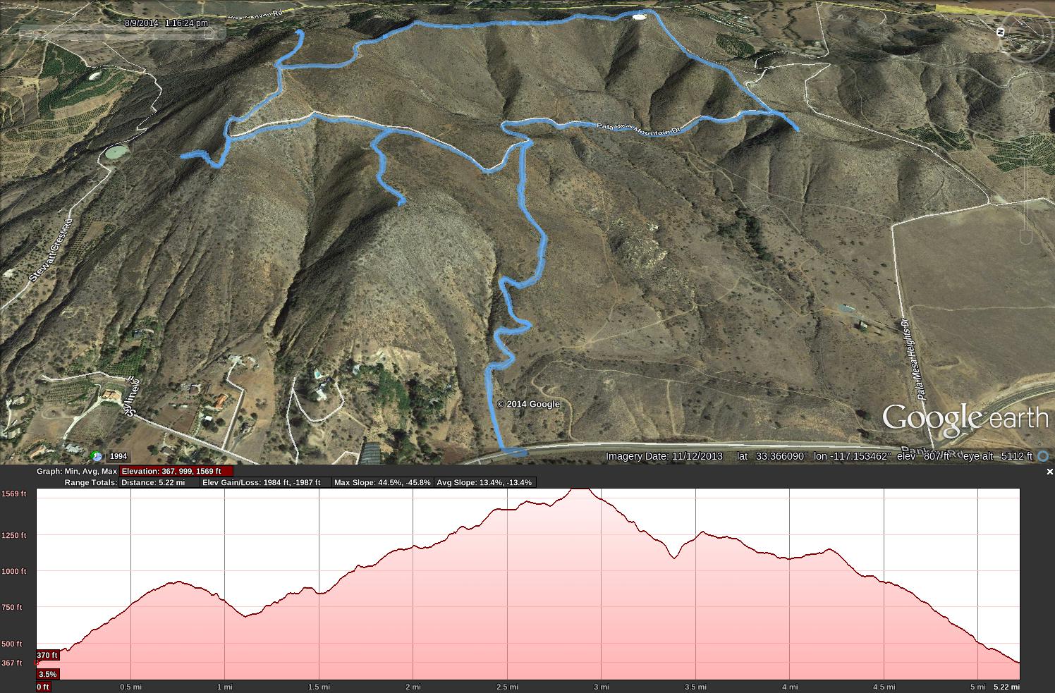
Monserate Mountain (08-09-2014)
Location: Monserate Mt, Fallbrook, CA
Difficulty: Moderate to Difficult
Hike Statistics: 5.22 miles, 3971ft elevation change (1984ft gain), average slope of 13.4% (45.8% max slope downhill; max uphill slope of 44.5%)
Conditions: Upper 80s F, No shade
Trailhead: 33.366000, -117.157667
GPX Track: Google Drive (Note: Accuracy not guaranteed; Only includes hike described below)
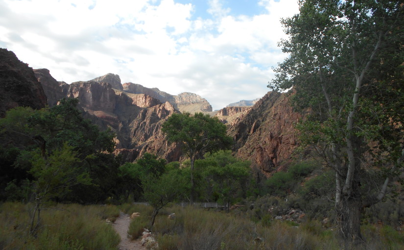
July 2014 Grand Canyon : Rim to River and Back in One Day
I am writing this account of my adventure mostly for my own sake. I know others may find enjoyment or some other benefit from it as well, so I am sharing it.
Disclaimer:
I want to say up front that I do not encourage doing the hike I am documenting here. Yes, it is a doable hike. However, your best bet is to listen to the National Park Service, who will try to convince you not to do it. Many others who have also completed this hike in one day will say the same as well. I am not documenting my preparation for this, but it includes massive amounts of research, training, and getting the proper supplies. You should have a very comfortable knowledge of many sides of the Grand Canyon going into this, ranging from the geology, history, ecology, etc. to the many ways that people DO die–there are many ways. Just a week before I did this adventure, a man from Ohio died hiking out of the Grand Canyon with three other people. It can be very dangerous.
With that said, here is the account of my adventure: