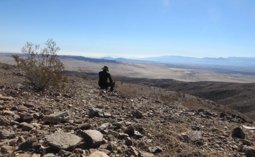
Since coming over to boondocking near Borrego Springs, I have been staring at Coyote Mountain with dreams of hiking it. For me, of course, it doesn’t take long for me to cave to these thoughts, and yesterday, I went on that hike! At 11.65 miles with steep bushwhacking and scrambling, it’s a difficult hike, but I made it to the summit for lunch and back before sunset.
 I have been camping at the southern end of the mountain for the last few nights, so I decided to just start straight from camp. The foothills of the mountain are just across the road from my camping spot, so I just hit right on up those.
For reference, my starting location was off of Rockhouse Road (33.296930, -116.287503), where there is plenty of parking for just about any vehicle. The peak itself is #10 on the San Diego Sierra Club chapter’s 100 peaks list. Download my GPX here.
The initial burst was just a quick bushwhack through the desert hills until I started hooking up onto some visible trails cutting around the area. I was able to follow that trail for a short while, before I headed off-trail to start the ascent towards the mountain peak.
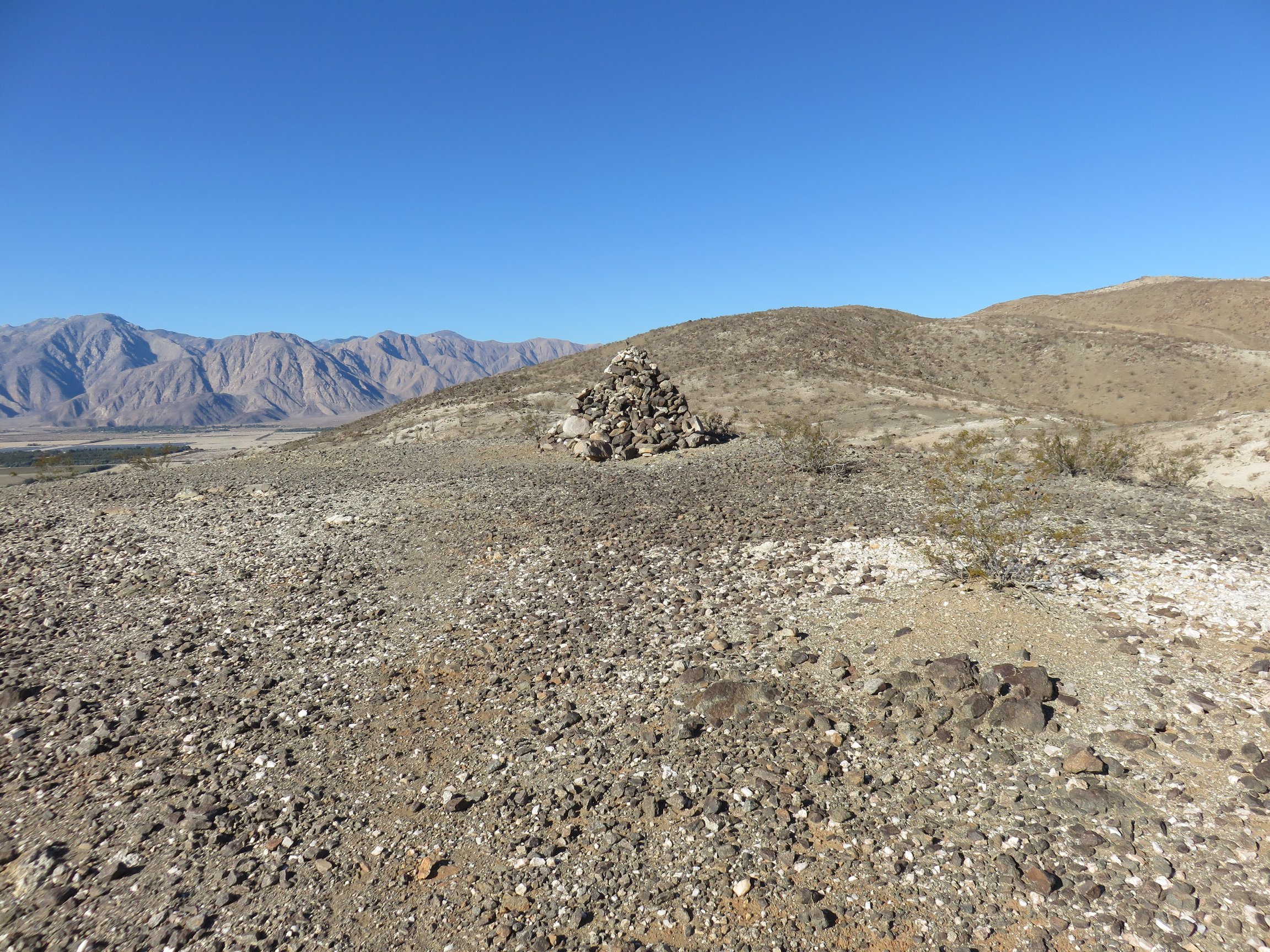 As I kept going, I was surprised to continue running into trail. Some of the trail was nothing more obvious than some strategically placed cairns through the terrain, but I decided to follow it as much as possible anyway. At one point, there is even a large pile of rocks someone constructed at some point. It doesn’t seem to mark anything specific, but it was interesting, and along one of the more obvious sections of trail.
The downside to following the trails as I did is the up and down nature of following the ridges it does. In some ways, this was nearly unavoidable without difficult and potentially dangerous alternatives anyway, but it got demoralizing towards the end to see the large, steep drops necessary before the next big, steep climb.
Throughout the entire time of this hike, I would often lose the trail as well. I simply followed my map that I had planned a rough estimate of the best route, and hoped to maybe get some inclination later. For the most part, I would end up running into an obvious path to follow, or even back on the cairn marked trails.
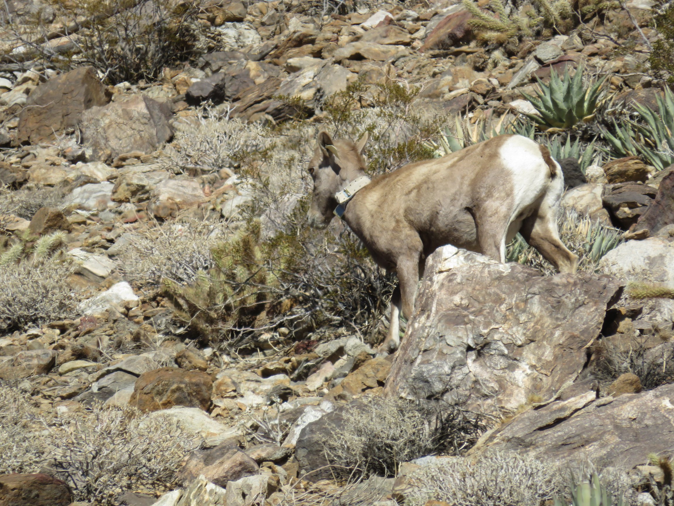 The last mile to the summit was actually the most brutal. Everything before was just a desert bushwhack, walking around some ocotillo and cacti every so often, but nothing big. The last mile, however, became a steep scramble, and it only seemed to get more difficult the closer I got to the summit. I did spot a big horn sheep up in this section, however!
And then the false summits. Two or three of them, the route I decided to go. They just kept coming. Reaching one, looking over, and there’s a higher peak. Reach that one, and then there’s another! It was frustrating, but made reaching the final, true summit wonderful.
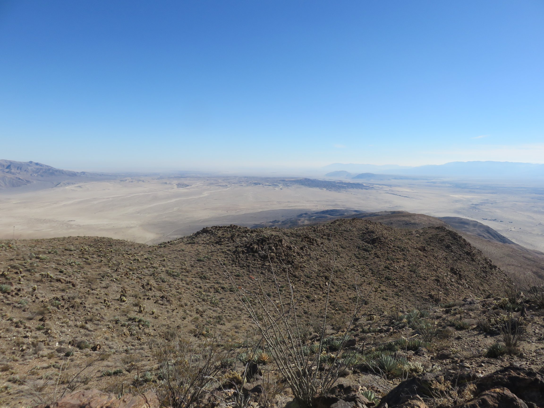 I stopped and at lunch at the top, after signing the registry and taking a few pictures. I noted that, if I looked really hard, I could see camp down below: just a few specks of sparkling from all of the trailers and RVs camped together down there. The view went on for miles from there, and it was a great spot for lunch!
Finally, I headed down. I stuck roughly to the same route that I went up, with just a few corrections and a few missteps off in the wrong direction from time to time. I was concerned about getting in before sunset, with the rough terrain and stopping slowing me down a good deal. Alas, I did make it back in, and had time to enjoy the sunset and some wonderful dinner!


