Yesterday, I decided to spend the morning and afternoon exploring on some hikes around Southeast San Diego. I returned to the Alverson Lava Flows nearby, with the goal of reaching the summit of Red Hill–the high point of the Volcanic Hills mountain range. Once completed with this, I also drove out to the McCain Valley Recreation Area, where I hiked to the summit of Mount Tule and explored some of the trails around the Carrizo Overlook, overlooking the Carrizo Gorge.
Red Hill
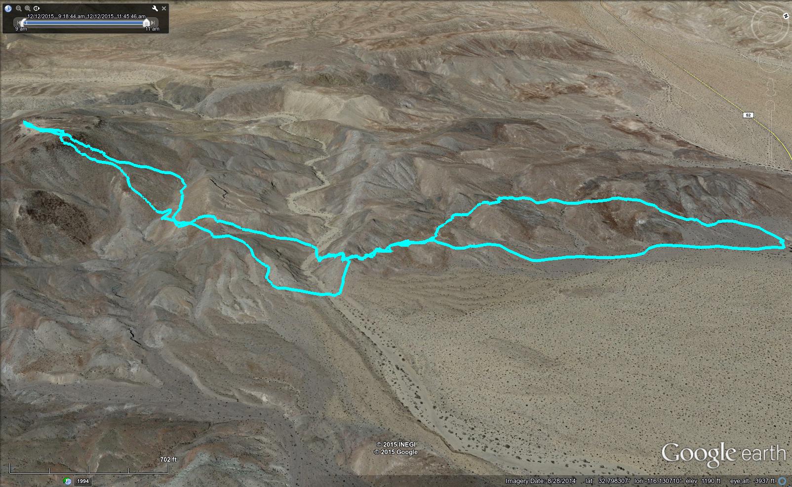
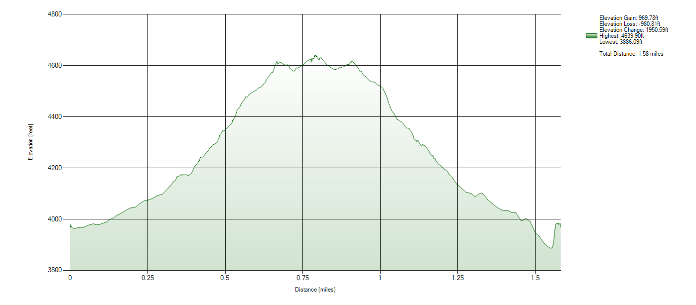
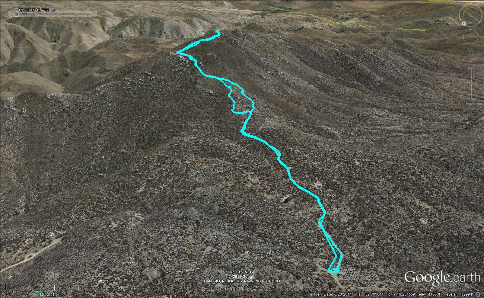
I have been spending quite a bit of time staring at Red Hill, considering hiking to the summit. Having explored the lava flows already, I knew this would be possible. I opted to park at a parking area (Coordinates: 32.806482, -116.1265762) central to the lava flow area and begin hiking from there. There are at least 2 additional possibilities for this hike, with one located further South allowing access via the Lava Flow Wash to the same summit. From my parking location, I utilized the coordinates specified on the Sierra Club’s 100 Peaks List for #73 Red Hill to locate the summit.
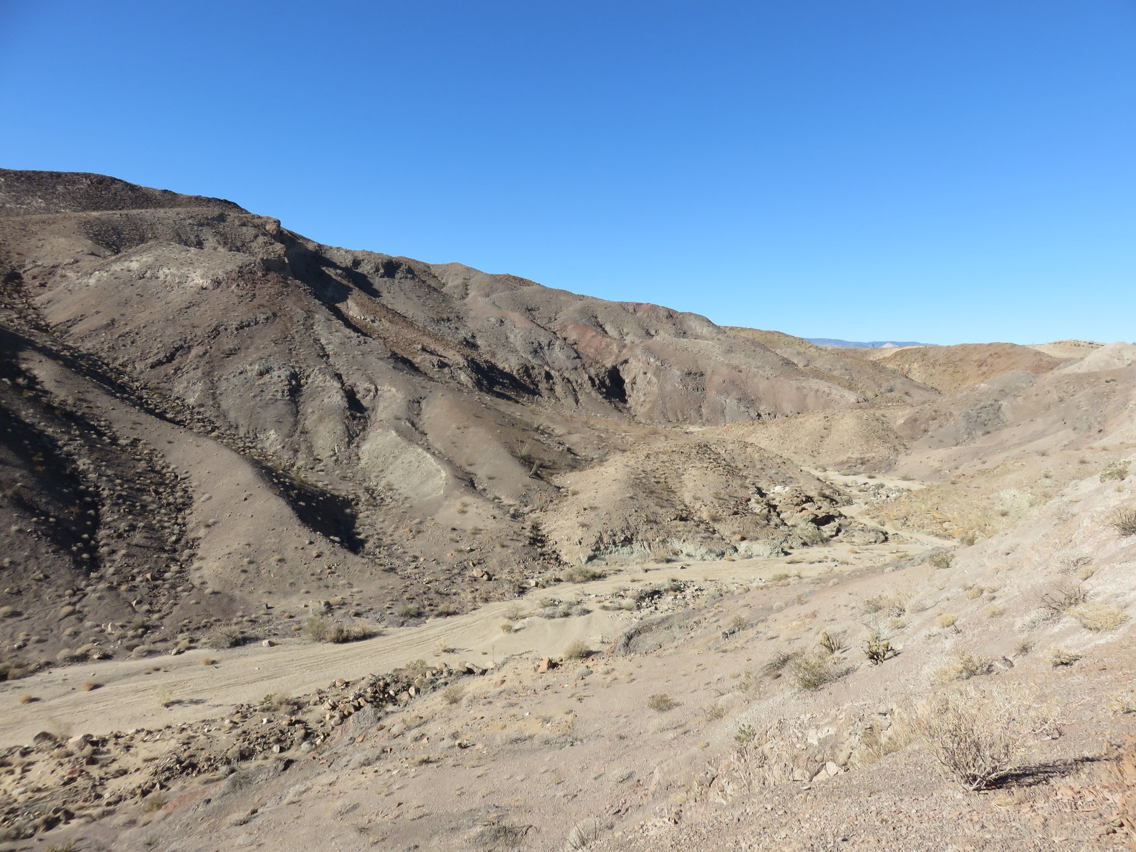 Although following the washes most of the way up would be the easier route, I opted instead to follow the hills starting at Sweeny Pass Road. I straddled the side of these hills until I came up to a wash that carves a canyon through the Eastern side of the hills about one mile in.
It was at this time that I suddenly realized that my cell phone and wallet had vanished somewhere on the ground behind me. With a mile of no trail wandering among the igneous rocks that I could have lost everything on, I only bothered to do a quick wandering about. I couldn’t find it anywhere near the area, so I finally opted to carry on, climbing to the summit.
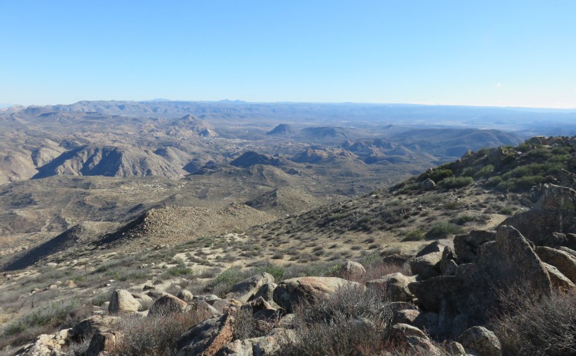
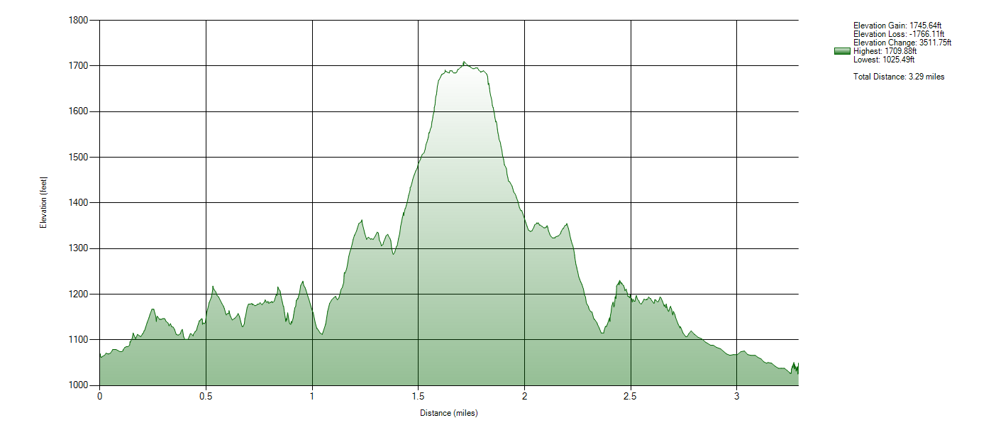
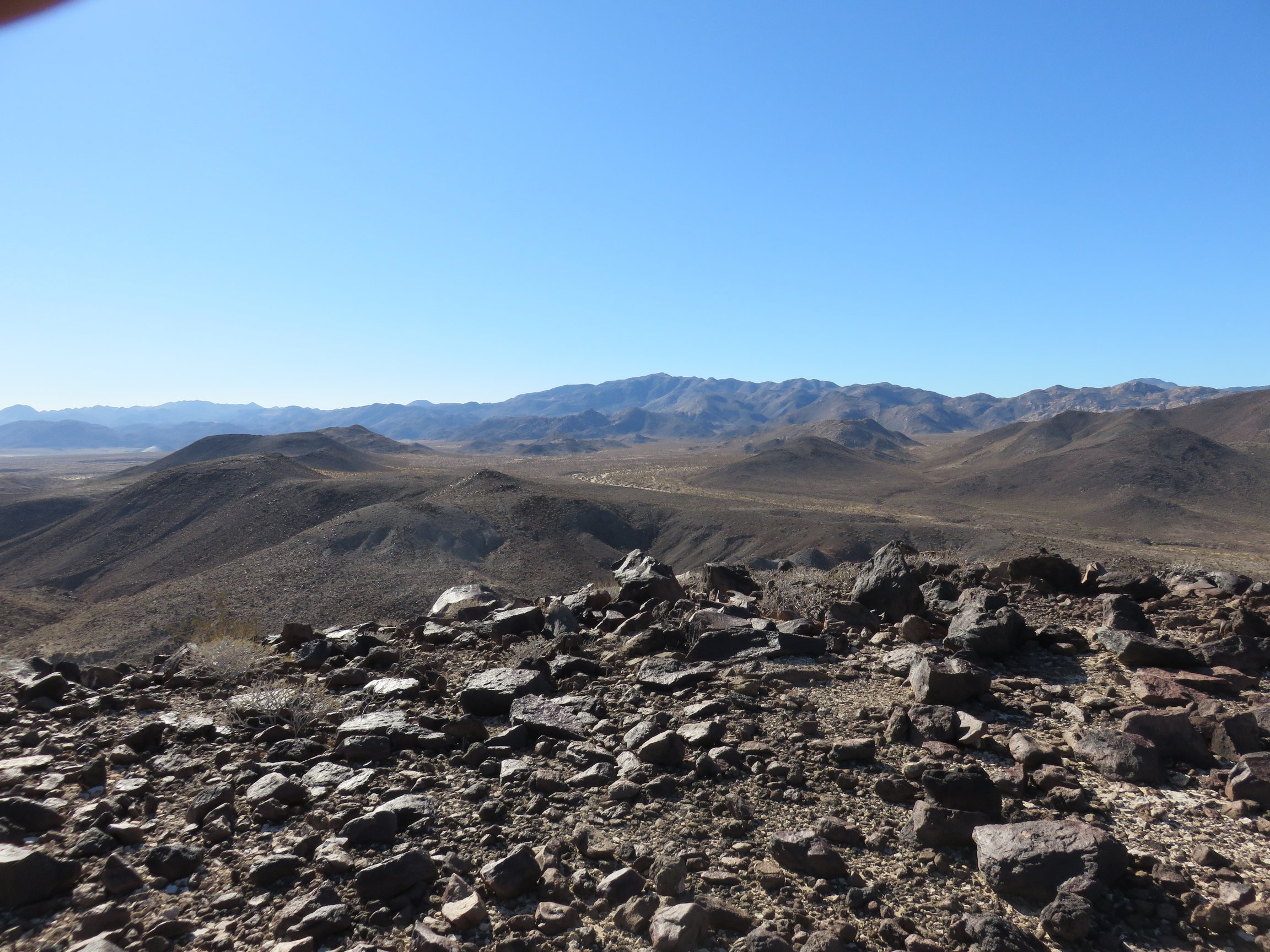 After dropping into the canyon wash, I followed smaller washes up the side of Red Hill, aiming simply to follow the most clear path. Eventually, however, the easier traversing ended, and the last, steep climb was entirely scrambling over igneous boulders. It can be a tiring climb, but it is quite short before the ground levels near the summit. I walked pretty forward, finding the summit register, where I rested and wrote in my name on the notepad.
It was then time to turn back. I allowed myself to traverse back down to the canyon below, aiming only to get back to the location I had realized that my phone and wallet were gone. I climbed up the walls of the wash, trying to retrace my steps as best I could.
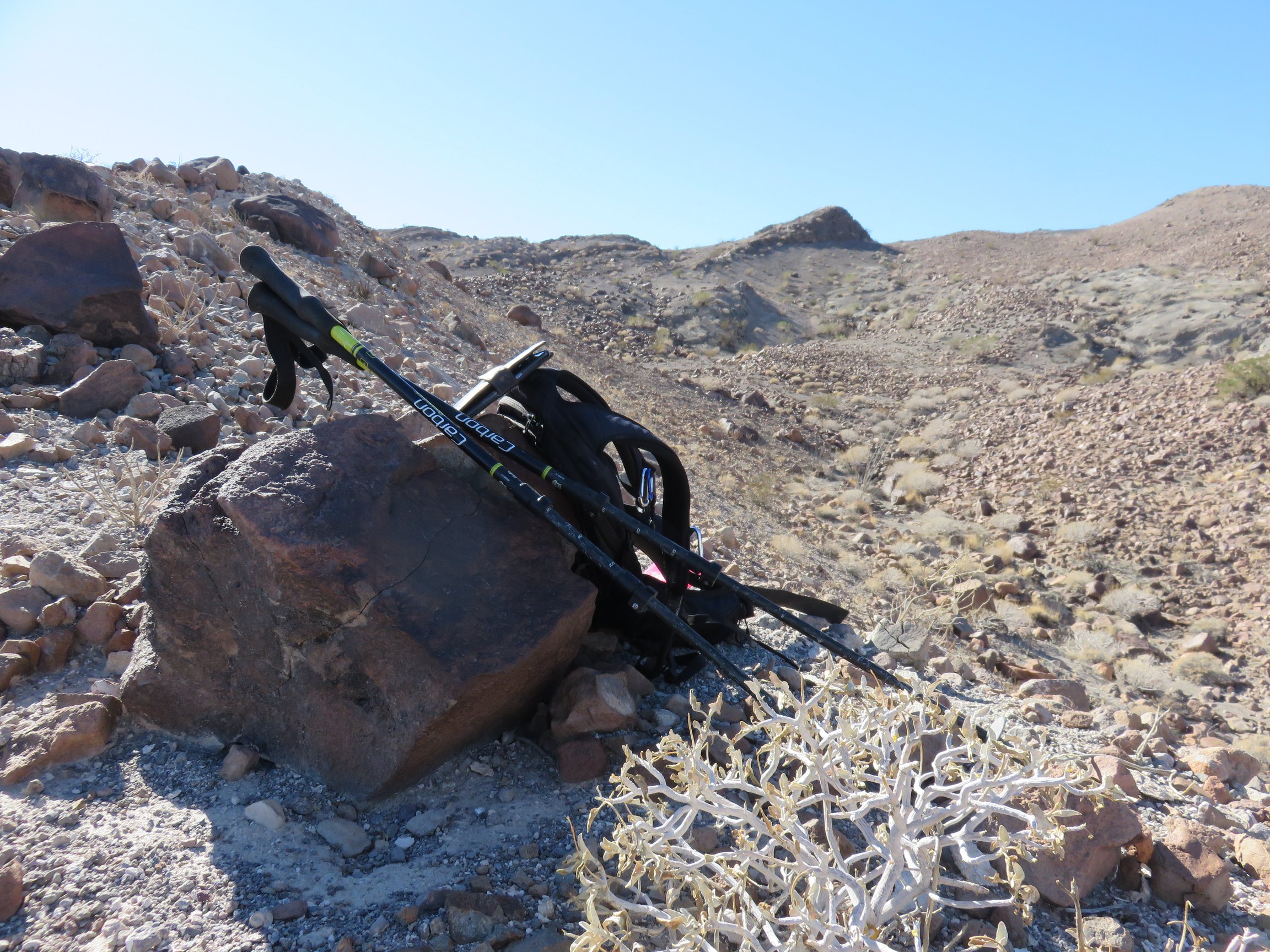 It was quite a while before I ran into extreme luck. For no reason whatsoever, at one point, I turned around, looking back towards Red Hill. I was feeling defeated, my phone and wallet gone. Suddenly I realized that I had walked right by without seeing it; there it was, lying on the ground in the rocks.
With relief, I took off my pack and rested at this location. It was one of the most wonderful of feelings to have such luck in finding what I had lost out there, and I reveled in it briefly.
Alas, I dropped off of the hills and followed light paths through the sand below, back to the car. The hike was successful, and I was ready to go on to the next!
Mount Tule
I looked at my map of the Sierra Club 100 Peaks list and noticed #83 Mount Tule appeared quite accessible. I decided to drive out to the McCain Valley Recreation Area, finding a dirt road that went near to the base of the mountain (Coordinates: 32.706745, -116.235045). Parking, I set up the mountain.
 This climb began on an increasingly difficult dirt road, which suddenly disappeared into a bushwhack to the summit. There seemed to be a use trail off and on, but I kept losing it. Nonetheless, I could see the summit and just kept heading towards it in a manner that seemed to make the most sense.
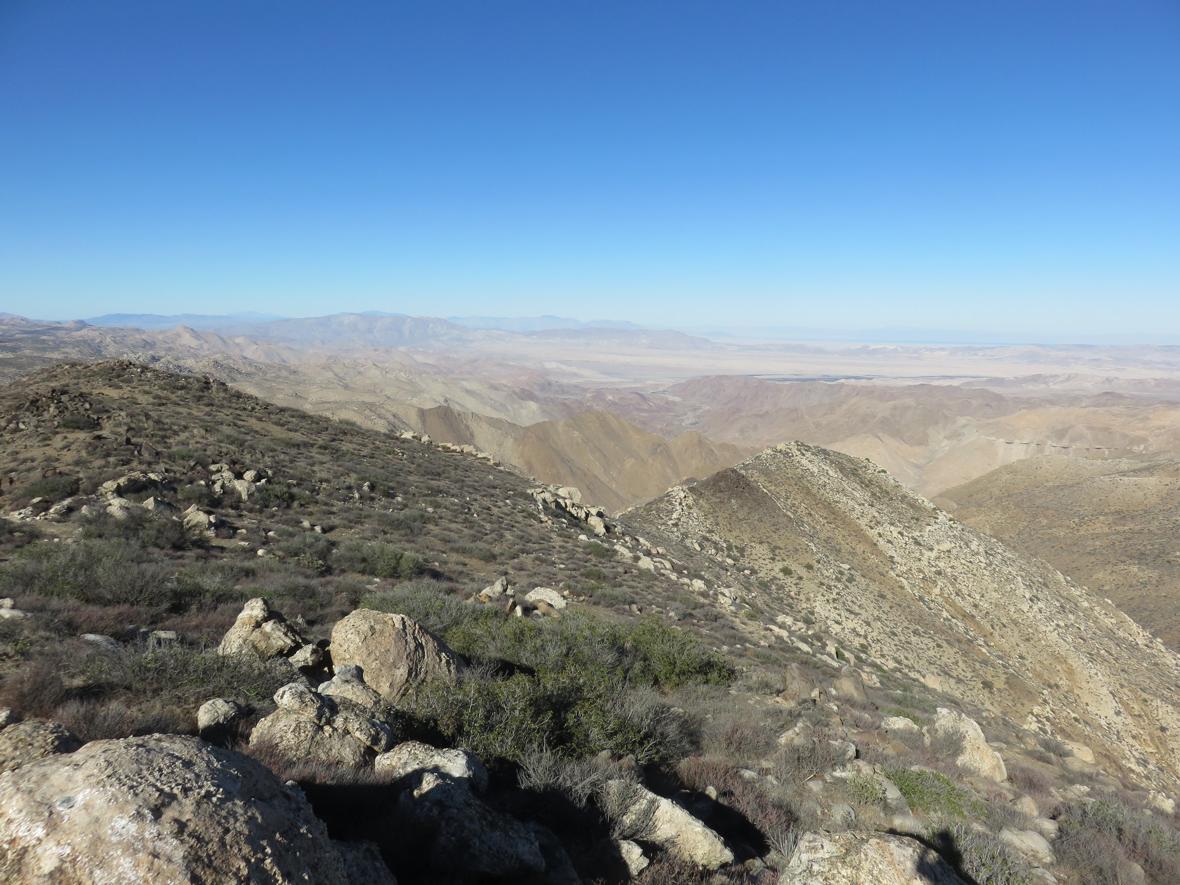 Eventually, I reached what actually turned out to be a false summit, but the true summit was just a quick dip and up to the true summit. I found the summit register and benchmark marking the summit. There, I sat, enjoying the view over lunch before traversing my way back down.
On the way down, I lost the path briefly, before meeting back up near the end of the dirt road. This took me all of the way back down to the car. A short, rather easy, but vastly enjoyable hike!
Carrizo Overlook
Finally, I set off from Mount Tule to the nearby Carrizo Overlook, which overlooks the Carrizo Gorge Wilderness Area. I saw Peak 3339 on the Sierra Club’s list, and considered attempting this hike.
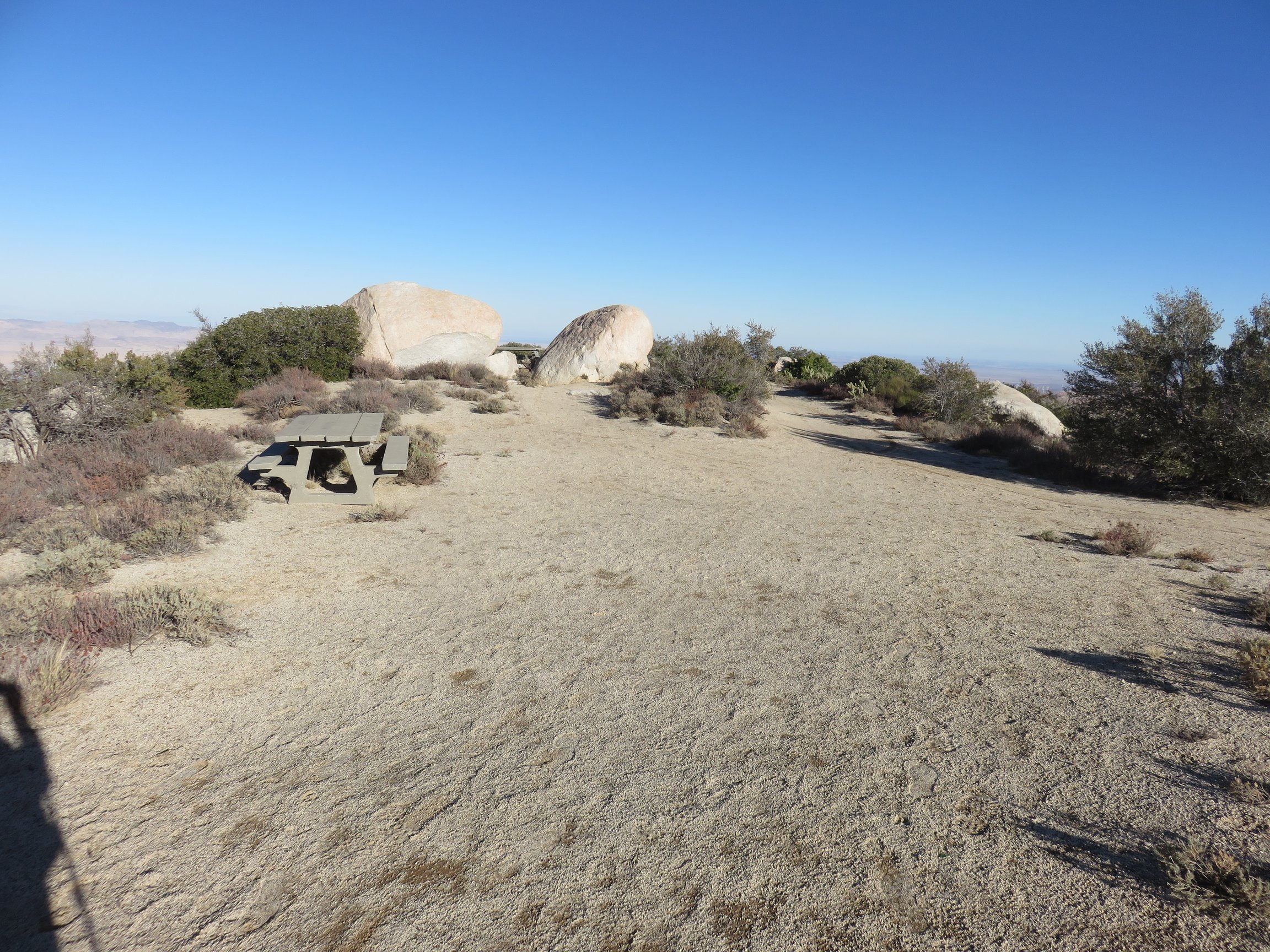 I reached the overlook and hiked out, noting tables and a plaque describing the area.
I didn’t take the correct path to reach Peak 3339, and ended up hiking off away from it instead for a while. Eventually, I decided to turn around and not reach that peak this time. I will have to save it for another time. There seems to be trails all around the area, although they can be confusing and easy to get lost on them without any true idea of what you’re doing!
Pictures


