This weekend, I joined a group of friends hiking up Mt Wilson in Angeles National Forest. We started at Chantry Flats and did a full loop that came to over 14 miles and over 4000 ft of elevation gain.
Starting from Chantry Flats, we already had to park down the street a ways due to the parking lot already being full. Plenty of people were already here for hikes today. Some would go similar routes to us, up Mt Wilson, while others took easier treks somewhere else in the beautiful country.
The first section of the hike went down a paved hill into an area full of many cabins. Although we were in woodland areas the vast majority of the hike, the cabins added an interesting touch of less wilderness-like feel to it. To each their own, but it’s not really my thing. So I didn’t end up taking a whole lot of pictures on the way up.
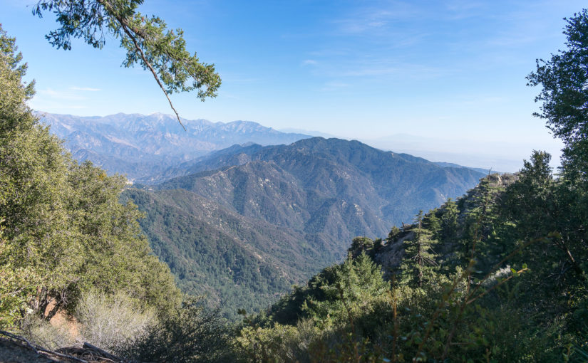
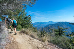 It wasn’t until well on our way up the Sturtevant Trail that new views looking over the valley below opened up, and even then, the views were covered in smog and haze. The views grew ever farther and more impressive, but the smog kinda choked it all away. But alas, we made it to the top and enjoyed some lunch.
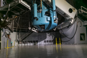 We even decided to stop into the 100-inch telescope on top, which at one point was the largest of its kind. Others may have outpaced it now, but it has its special place in history. It was pretty cool to see this stuff up there. I haven’t actually been to an observatory before. Which is probably weird because most people I know seem to have done so at some point in the past. Oh well. Now I can say that I have!
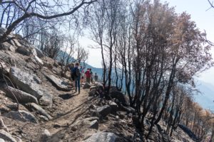 After hanging out for a bit, we took the Mt Wilson trail back down. Near the top, a large area of burn scar made for some interesting hiking, while the smog-covered LA was visible with its skyscrapers sticking up out of a sea of nothing. Apparently, I didn’t actually get as good of a shot of that as I thought I did; I thought it was kinda cool, if more than a little disturbing as well.
Ultimately, we ended up back at the bottom of the one hill that we started our hike going down, and made one final push to the top. It was a good hike!
I normally go into a bit more detail and things but this was just a fun hike. There’s plenty of other sources for a full guide on how to do this hike. For us, it came to about 14.4 miles and over 4000ft of elevation gain. Most sources I have read put it around 4100ft. My altimeter gave me around 5400ft of cumulative elevation gain but clearly gave different elevations for the same points at the start and end of the hike among other discrepancies. And adjusting my GPS track to USGS DEM data ended up will over 7000ft. Because of these weird numbers, I’m not including an elevation chart like I usually do either. Overall, it’s just a big, tough hike. And a good one.
Lots of other people were also on the trail, which tends to result in me writing these shorter ones. It felt kinda like a typical national park trail at times: just tons of people. There’s a road that goes to the top and plenty of parking, so I’m sure that really didn’t help. There were also several groups of people all together doing this thing this day. It was a busy trail. Gorgeous and worth it, but I’m no fan of crowds, so…


