I have been staring out over the different badlands around Anza Borrego Desert State Park and Ocotillo Wells SVRA for years now. For the last few, a thought has been stirring endlessly in my mind: there must be a route through it all! Well, with some staring at maps and working on Google Earth, I made a prototype route and set out to give it a try.
What is it?
The full intention of this hike was to see the absolute best of what this desert has to offer. In many ways, this was to be more of a sight seeing tour than an efficient walk. So it starts off right away with a cross-country scramble down a sketchy ass ridge into a remote canyon in the desert. And that is basically the mood of this hike.
I’m not really a competitive type, to be honest, and I don’t hike to beat myself up or anything like that. At the same time, I enjoy growing my own skill sets and strengths, and I find something deeply cathartic in the challenge of backpacking. So, yes, I kind of did purposefully make this one a pain in my own ass.
That all said. This is not a formal trail or route or anything of the sort at this point. If it was, it should be longer, in my honest opinion. It should go see some things that I missed. See my reflections at the end. I welcome anyone to try it, although you do so at your own risk and responsibility. This hike should be considered advanced, requiring skills in cross-country route finding and scrambling, and open desert hiking. I cut the route short and found an alternate path as the mileage poured well over my estimates. Anyone following should be prepared to do the same.
In total, I did over 80 miles on this route in 4 days. You can look at my trip reports preceding this to see that I’m in pretty active shape and experienced at this kind of hiking. That kind of mileage is particularly difficult on some sections of this hike, though others make it a bit easier. In the future, I’d hope to expand the route well beyond 80 miles, but this is a solid version of the route. Plan according to your own skills, if you want to follow.
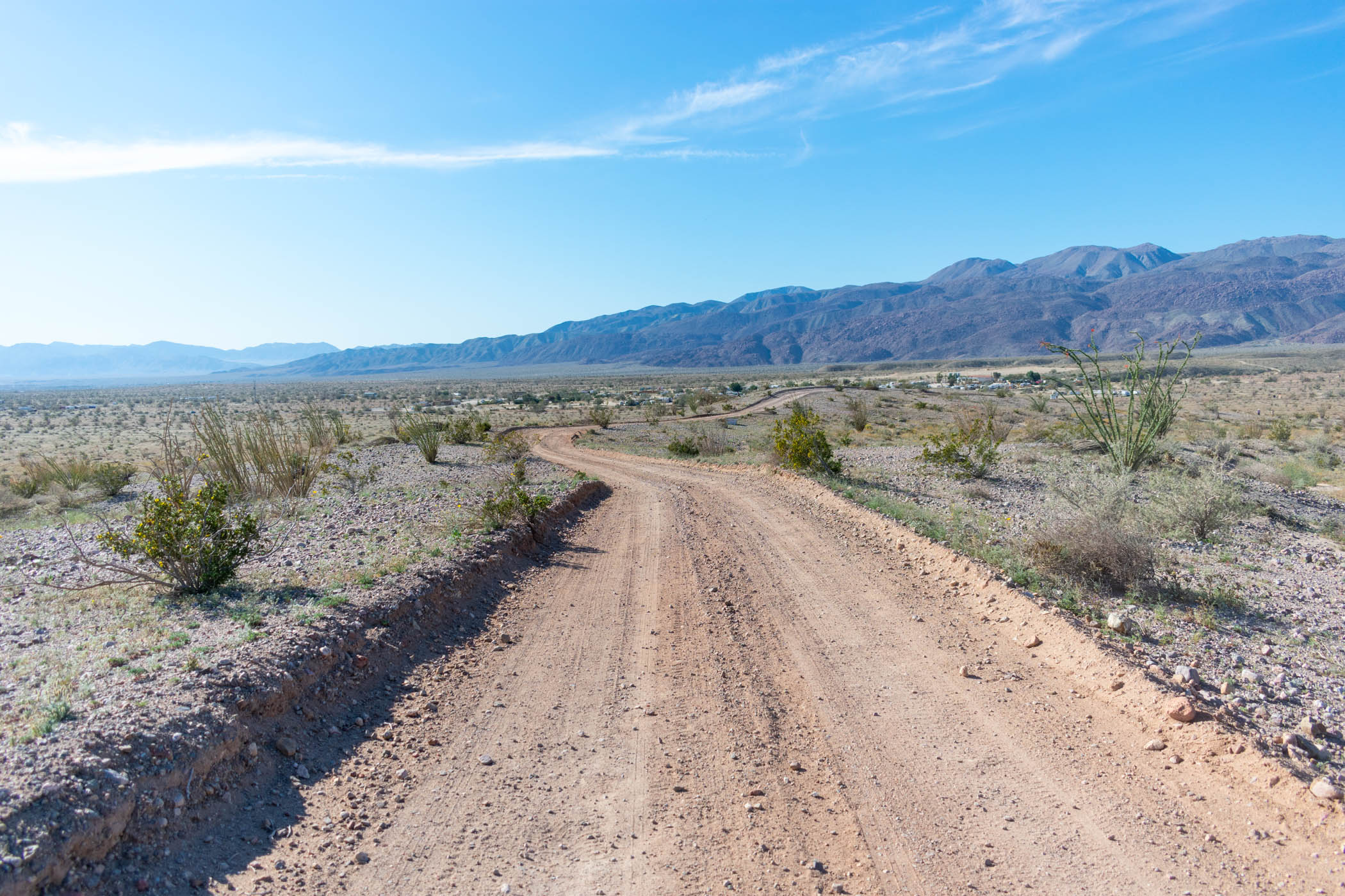
Day One : Down Carrizo Gorge
About 17.5 miles

Day one of the hike started at the highest elevation of the whole thing, in McCain Valley Recreation Area. It was a ridge scramble down the enormous Carrizo Gorge, via Gasp Benchmark. This canyon has tried to kill me before, and any scramble down this ridge to the canyon below feels like it’s going to try again.
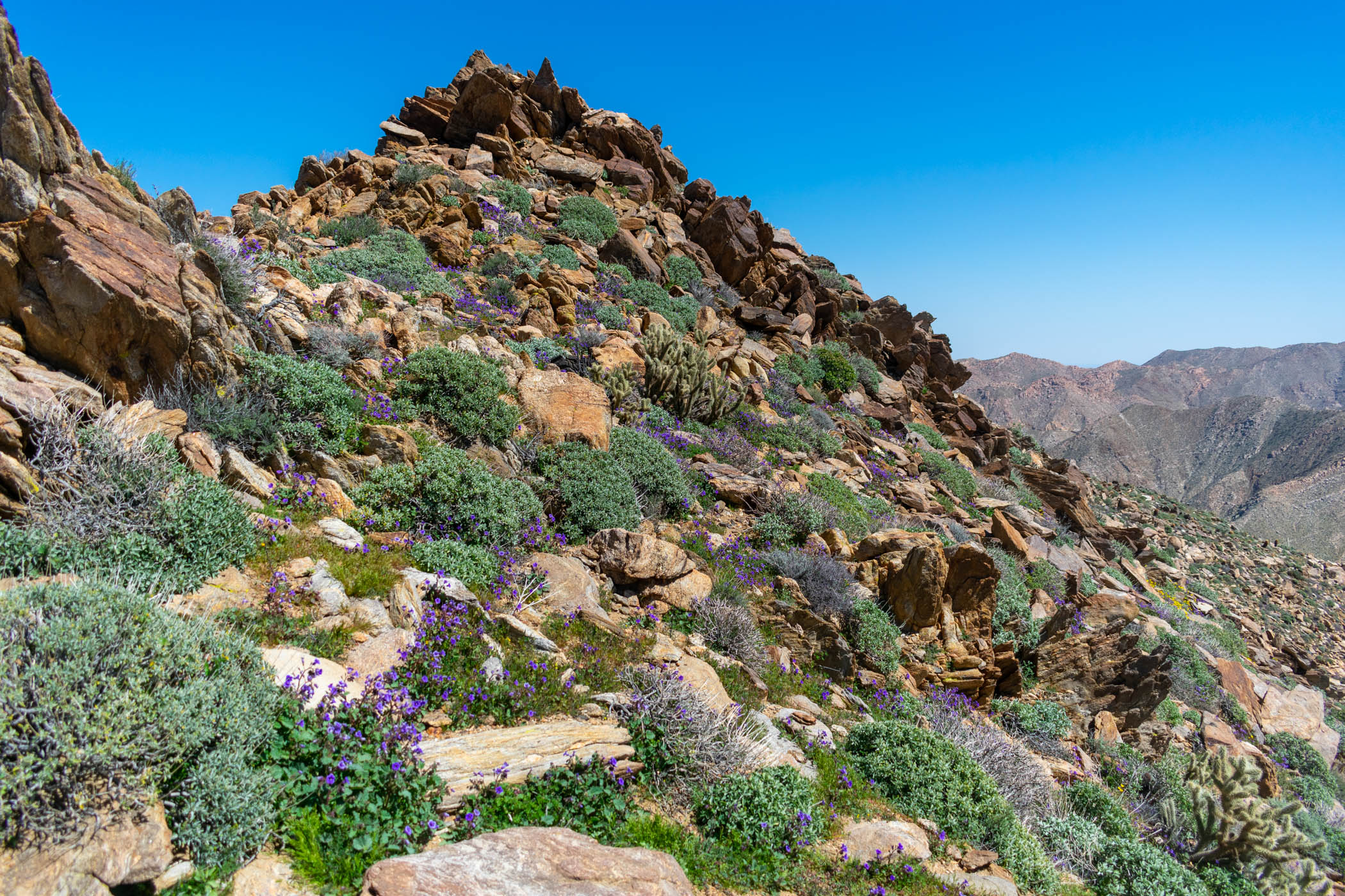
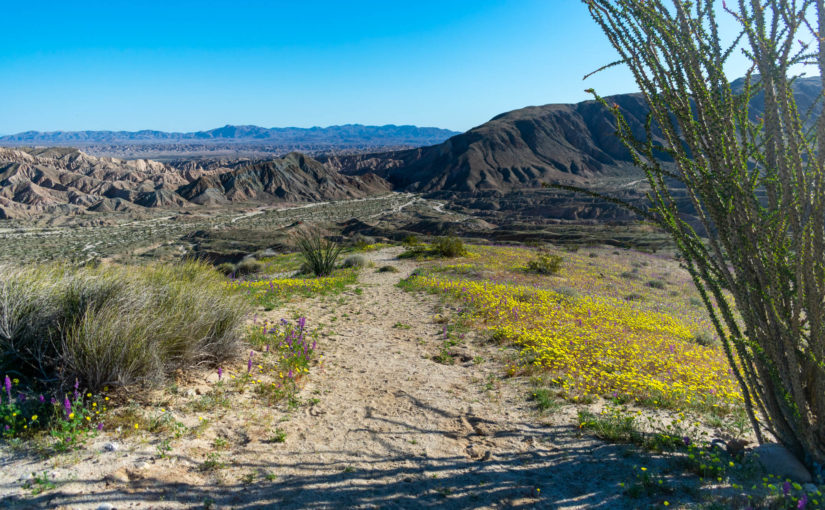
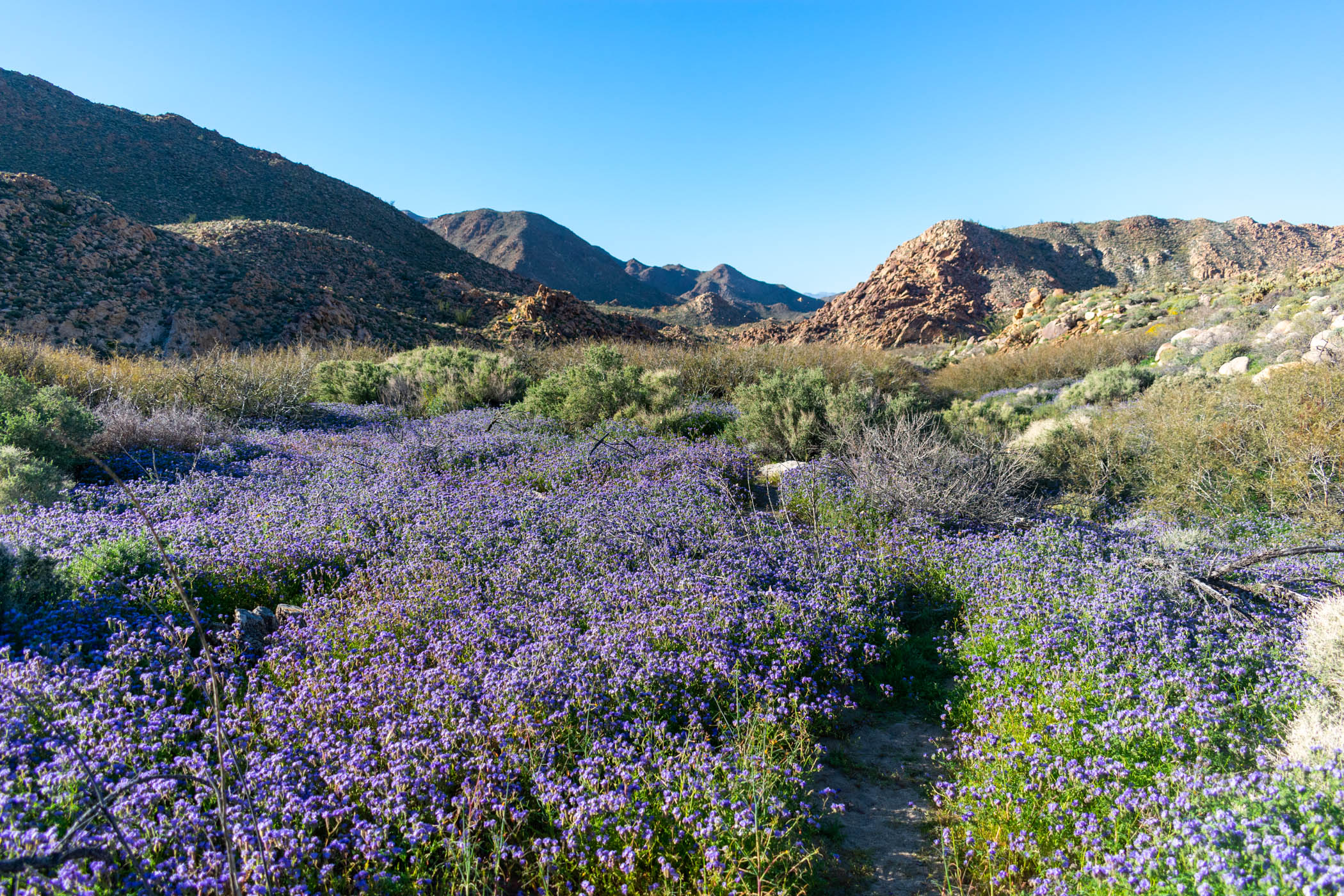
Purple wildflowers littered the ground everywhere. The route is cross-country. No trail. Desperately trying to avoid stepping on flowers, I hopped from rock to rock and empty spot to empty spot. Trying to follow light game trails and not lose the ridge. It made 5 miles feel like 15. And to start a 4 day trip, no less.
This is what this hike was about. A little challenge but the highest rewards. The ridge down to Gasp Benchmark and from there to the Carrizo Gorge floor is easily one of, if not my absolutely favorite scramble in San Diego. Some routes require a use of hands. You could take a rope for some bigger sections or just walk around them. I just walk around. Some parts feel extremely exposed, especially if you’re scared of heights, and the thought of falling to your death might occur as a real possibility. But it’s all probably just an exposed class 2 at worst (and not actually as exposed as it feels at that). Enough to test your strength and break your spirit. And leave you gasping in awe at how damn amazing it is the whole way.
Along the way down, my knees began to ache pretty bad. My left knee, in particular, had been bugging me since hiking the Trans-Catalina just a couple weekends before, and the downhill scrambling was aggravating it further. A fear of that going wrong crept in my head.
Suddenly, as I bent my knee going down a small boulder, I heard and felt a pop in the knee. I quickly jumped onto my other leg in reaction and began slowly bending my knee to test the range of motion. I had full ROM with actually less pain than before… I put the leg down and tested bearing weight. It actually hurt less than before. There was still a soreness to the knee not quite as present in the other, but whatever popped, it seemed to be a helpful sort of pop. I continued on.
The day then finished with a walk out of Carrizo Canyon. While the day began with fields of California Poppys, and the more mountain friendly purple flowers and such, the desert below exploded with an even larger variety of color and diversity.
I’ve hiked through burn scars for hours and felt like the lifelessness of it drains something out from deep within you. Hiking through this kind of biodiversity in such intense, colorful display does the exact opposite. I was singing and cheering about how much life surrounded me. Every muscle in my body ached, every bone complained, and I ran out of water a couple of hours before sunset. But I didn’t care. With every step of my dancing walk, butterflies and ladybugs kicked up and swirled around me as if to join me in my joy. Birds sang along, lizards and jackrabbits scurried behind the next bush. I was alive. The desert was alive with me. Like making love in some ridiculous way.
Unfortunately, the sun set with miles left to hike out of the canyon to my water cache, and I was out of water.
I hiked for a ways, reaching about 15 or so miles on the day. Stopping alongside the road, I thought about setting up camp for the night. I pulled out my tarp and began setting up before realizing that I was just too uncomfortable with this on the first night. So I packed back up and walked the 2.5 miles to the road and towards Sweeney Canyon, where I had cached some water.
The water cache was uncomfortably close to the road for camp. But I was exhausted. Only 17.5 miles, but with the scrambling and hours of hiking without water, I felt exhausted. My knees ached and I was still somewhat paranoid about that pop earlier in the day. Sleep was nonetheless easy.
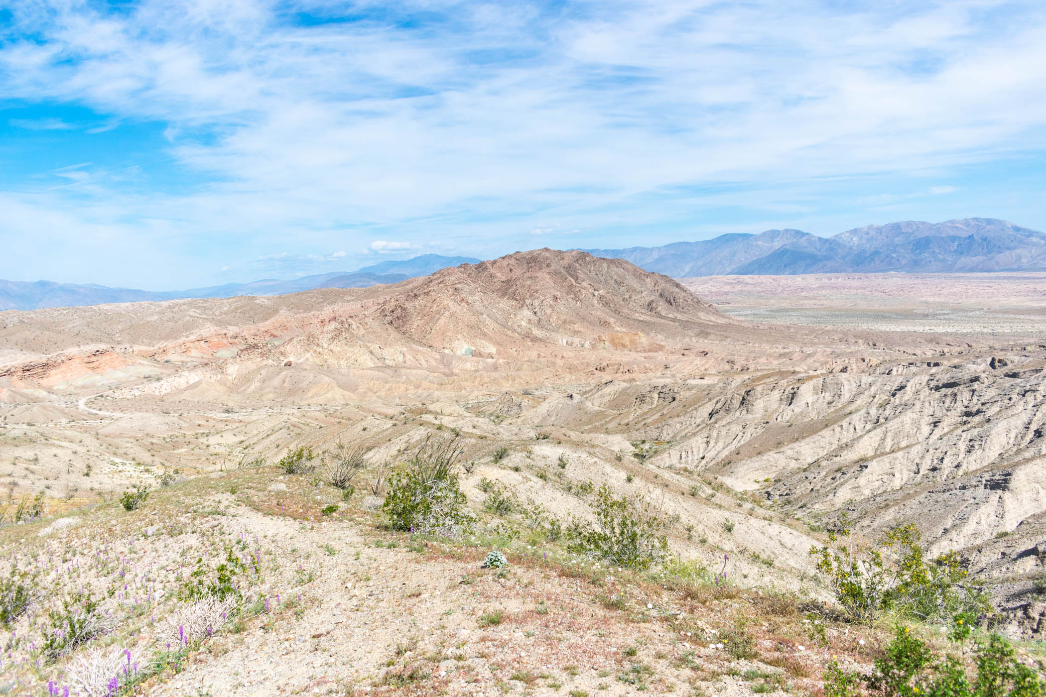
Day 2 : Carrizo Badlands
23.7 miles
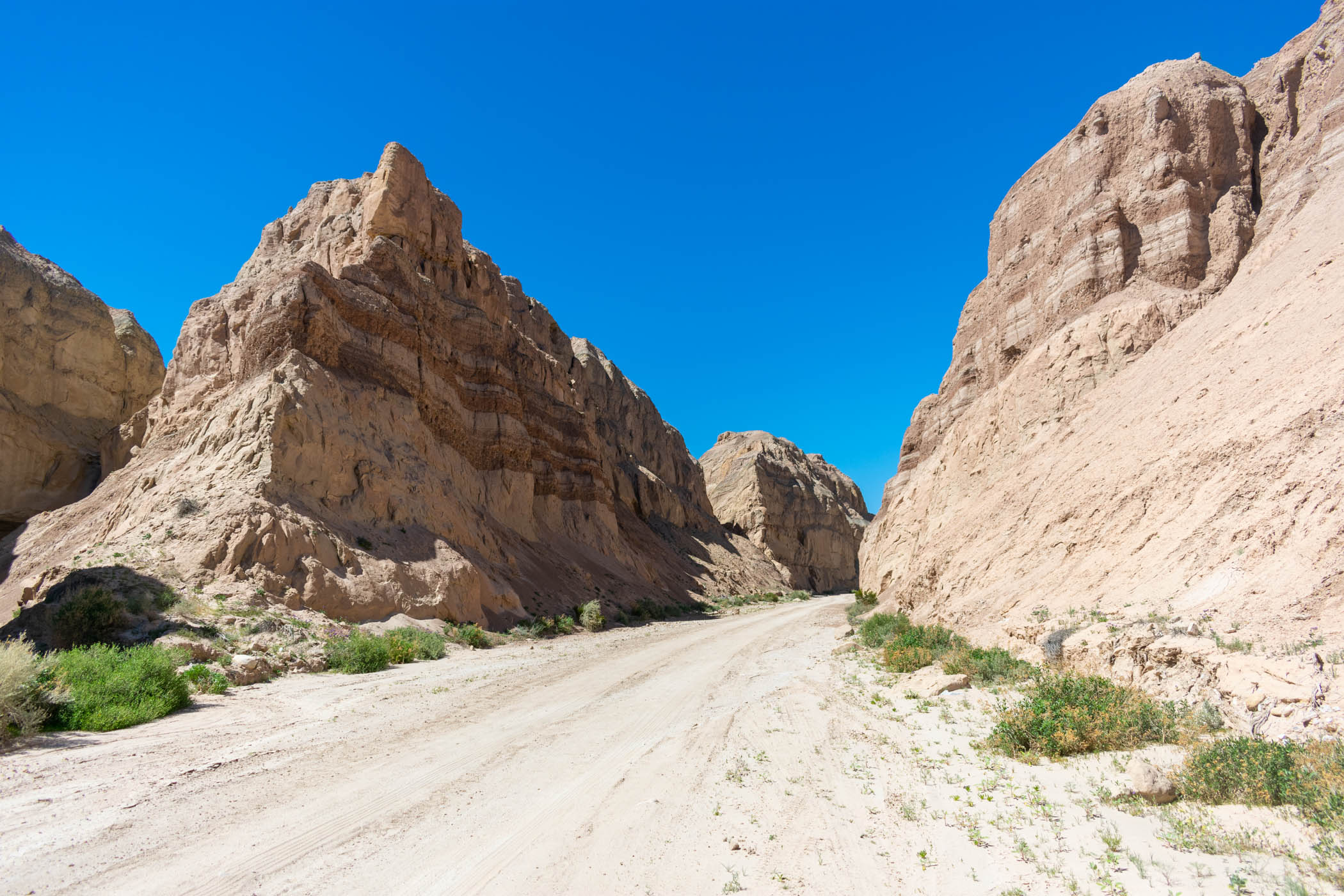
Waking up at the mouth of Sweeney Canyon, I packed up and headed up the canyon. I have passed by this canyon, driving up Sweeney Pass Road, countless times. This was the first time hiking into it, and I was rather excited. It’s a wide wash that has a small narrows before opening up into basically cross-country travel.
Following my map, I picked a side wash about on par with the Carrizo Badlands Overlook and cut over. Crossing the road, I made it to the overlook and began a descent down into the badlands, via Canyon Sin Nombre.
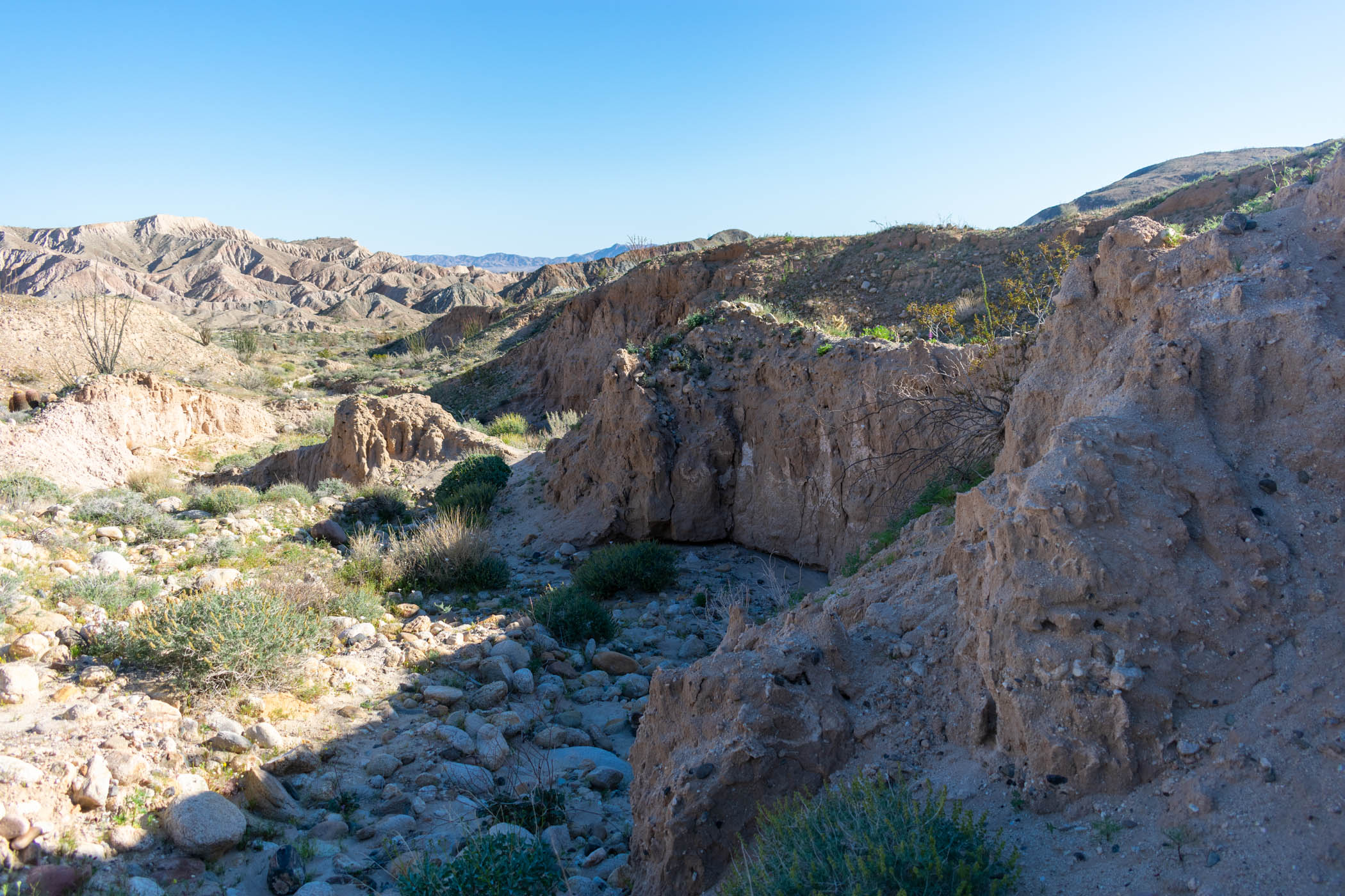
I have done some day hiking in Canyon Sin Nombre in the past, and that is basically why I decided that it HAS to be part of this route. There are multiple slot canyons worth exploring on the side, along the way, and the primary canyon itself is a geologist’s dream. I love hiking in it, and this time I actually hiked all of the way to the Carrizo Valley beyond, which I have not done before.
By the time I made it into the Carrizo Valley and began the extremely exposed hike, I had already drank quite a bit of my gallon of water I started the day with. I accidentally made a wrong turn directly out of Canyon Sin Nombre, adding a couple of miles onto the day, and further drawing my water supply down as the wrong turn was entirely exposed in the heating up sun.
Spotting a truck with a camper shell on back, I stopped and asked if they might have some spare water they would share with me. They did! They even handed me a beer before driving on. I sat and ate lunch with 4L of water total on me, plus the beer.
The route I decided to take would be the Indiana Jones feeling Arroyo Seco del Diablo. This is a route I drove the Outback down in years past, so I was familiar with it. Although it was quite interesting to see it moreorless unpassable by the same vehicle now. I didn’t see any vehicles making it all of the way through, though I did see quite a few get about as far as they could and explore further by foot.
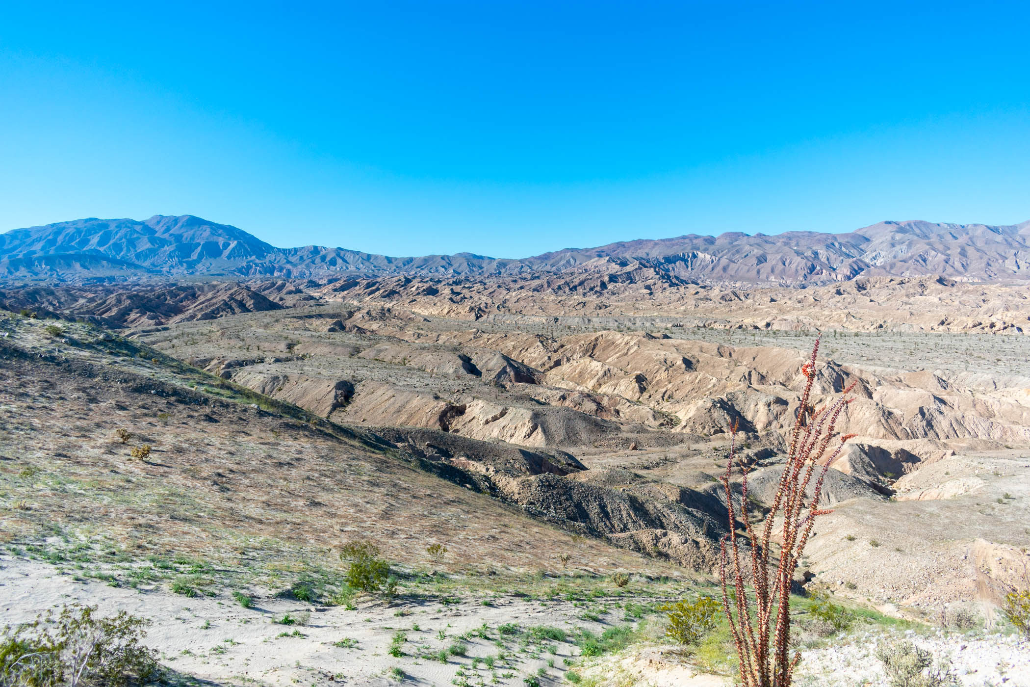
Eventually, I reached the turn off to Diablo Drop-off, and followed the mesa to the drop-off, itself. There is a really cool viewpoint of the badlands at this point, and it became painfully enlightening just how much of these badlands I was going to completely miss on this route. I would like to expand this route to hit a lot more in the future.
Eventually, I ended up on Fish Creek Wash as the sun set. Again, I ran out of water and hiked for miles without. As Elephant Knees came into view at twilight, I decided I would be comfortable setting up camp within a pretty nice view of the sandstone feature. No water, and miles to hike yet before my next water cache. But it was a great campsite for the night, and I slept comfortably.
Day 3 : Split Mountain to Ocotillo Wells
16.5 miles
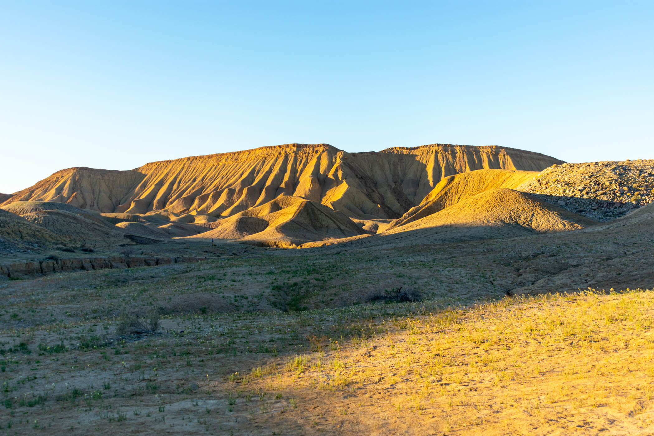
From my campsite near Elephant Knees, I woke up and hit the trail. I actually camped not quite in the view of Elephant Knees itself, so I quickly walked upon it in the morning and found an area that could have made for an even better campsite nearby. Oh well. I’ll have to keep it in mind for next time!
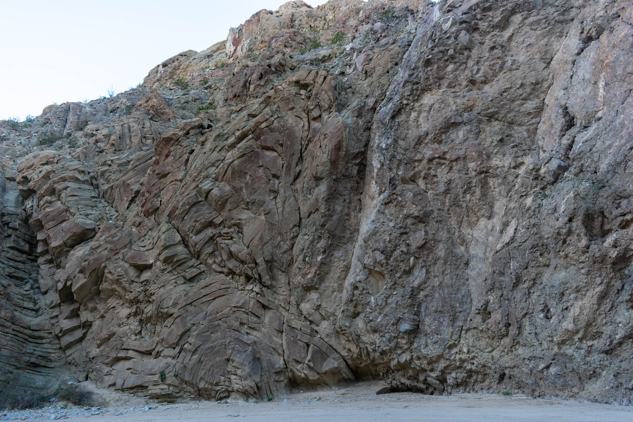
From Elephant Knees, Fish Creek Wash cuts through Split Mountain (thus the name!). As if all of the badlands and everything before on this hike weren’t already a geologist’s dream, this mountain and the wash cutting through it are even more. While not actually a geologist myself, I’ve become particular fancy to staring at these crazy formations and considering what caused them. This canyon did not disappoint my curiosity at all.
My gallon of water was cached moreorless at Split Mountain Road, which meant a lot of hiking in the morning, without water. Thankfully the morning was cool, and the canyon was shady. It began to suck once I came out of the canyon into more open desert. But I made it alright and stopped to fill my water and relax before taking the long road walk into Ocotillo Wells.
This road walk sucks. It’s asphalt. There’s no shade. It’s the desert. It sucks. It sucks. It sucks. I considered stopping by Elephant Trees, but ultimately, I just wanted to get into town.
Alas, I did. And the store at the RV park was closed, because it was Monday. Shit.
I hopped over to the local bar and stopped in. The bartender was lovely and filled up all of my water bottles. I bought a couple of beers and hung out with the locals, chatting and playing a game of pool. In some way, I don’t do a lot of this on my short thru-hikes, but it’s an important part for me to encorporate from time to time.
By the time I headed out of the bar, it was getting pretty late. I started walking along the airport, thinking I would head towards the Pumpkin Patch. But I stopped and took out my map, realizing it would be a hell of a lot more realistic to take The Slot to Borrego Springs directly instead. I had a water cache at The Slot and one a few miles up the route I planned from The Pumpkin Patch. One was going to be unused. I decided to take The Slot route and turned back, headed that way.
Along the way, I ended up joining someone else walking along, aiming for the showers in the campground. We chatted as we walked, and getting to the campground, I decided to just setup camp there for the night. There were nice spots, I had actually hiked a decent amount on the day, water was available, and I was tired. I setup and went to sleep.
Day 4 : The Slot to Borrego Springs
23.7 miles
Waking up early in the campground at Ocotillo Wells, I packed up and began walking along the ATV trails paralleling the road. Eventually, it stopped at a dirt road heading up Borrego Mountain. This would be the route to get to The Slot. It was an open desert climb. Thankfully, the morning cool air helped it from being oppressive, but the heat of the day could be felt clearly setting in. The views made up for it.
I was actually really surprised how scenic the dirt road on this route is. There are tons of views along the way, and I thoroughly enjoyed stopping and enjoying them. From the wildflowers carpeting the ground lightly to the alien planet landscape of the badlands below. It was a wonderful start to the day.
I reached my gallon of water cached near The Slot, and still had enough that I couldn’t even use all of the cache. I ended up carrying the gallon into The Slot.
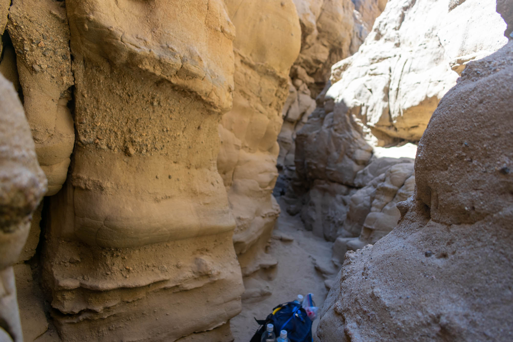
The Slot is… exactly what it sounds like. A slot canyon. This particular slot canyon is thin enough that I had to take off my pack and hoist it over and around all of the crazy bends. So much for a lumbar pack. I really only get claustrophobic when I’m having some bad anxiety, which I was not having, so I got to enjoy the slot canyon quite a bit. But it seemed to add an entirely new element of adventure to the hike.
There were a lot of day hikers at The Slot. This actually worked out really well for me. By the time the slot canyon opened up into a wider canyon, I had downed all of the extra water in my cached gallon. A day hiker kindly took the bottle off my hands and carried it out for me. I got to enjoy the hike out to the Borrego Sink Wash without the extra baggage.
By the time I did get out to Borrego Sink Wash, the hottest part of the day set in. Mid 80s. There was absolutely no shade anywhere to be found along the wash; any shade was too small as the sun stood firmly overhead. Somehow, I began to just enjoy it. I took frequent breaks, not that they really helped just sitting in the exposed sun. But they felt nice as I headed into sand dunes. There were a lot of cool badlands features to look at around, even if the route didn’t go directly through any here. I began to think that this should be the official route anyway.
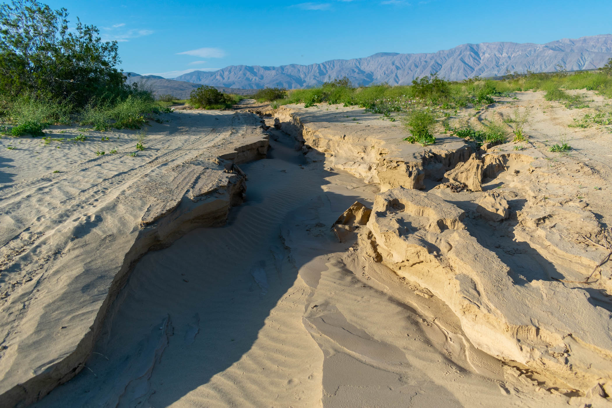
Finding my way from the wash, through sand dunes, to the Borrego landfill was an interesting adventure. The route is actually quite obvious, except that it intersects with a surprising number of routes that don’t quite go the same way, and the intersections can be really confusing. Staring at satellite images on my phone, I figured it out and made it to the landfill.
There are tons of flies around the landfill and it sucks.
Also, after the landfill, it’s a big long road walk. In the future, I want to continue from here by going through more sand dunes, up the badlands to Inspiration point, and perhaps make this more of a lollipop shaped thru-hike, finishing in Ocotillo Wells. For this time, I took the long road walk to finish in Borrego Springs. And I hate this road walk. This is now the third time I’ve done it. I’ll do it more in the future. I never get a hitch on this road, so it’s just a big long ass walk into town. It sucks!
Alas, though, I made it into Borrego Springs and jumped right into Carlee’s. My car was across the street, and I didn’t even look to make sure it was still there. I just wanted a damn burger. I wanted that damn burger so bad. And it was so good when I got it.
And my car was good at the end. I can’t recommend leaving your car in Borrego Springs like I did, and so I don’t really want to specify where I did. That is a logistics of this hike that is difficult. Good luck to anyone trying to figure that out!
Reflections
This was an absolutely amazing hike. I want to do it again in the future, adding more to it. I suggested a few things I’ve considered above, but here’s some more thoughts:
- From Arroyo Seco del Diablo, instead of the Diablo Drop-off, go down Arroyo Tapiado (explore some mud caves, if you want), then up June Wash to Diablo Benchmark. From there, the route can drop down Sandstone Canyon to Fish Creek Wash, where the Drop-off also goes. Consider doing the Mud Palisades as a side trip on this version. This adds a lot more mileage, but it is all possible.
- Loop Wash is a long version of the same Fish Creek Wash route before Elephant Knees. It looks kinda cool. I accidentally went down about a half mile but turned back around to go down the main route. I’m curious about it, though.
- Wind Caves, Split Mountain peak, etc. are cool side trip opportunities. Along with Elephant Trees.
- I originally drew a route around Ocotillo Wells that explored the Ocotillo Badlands. I really want to encorporate that into the route. They look chewy.
- I want to include The Pumpkin Patch and Inspiration Point. Consider Font’s Point and Vista del Malpais as well. The easiest/best may be to actually make this a lollipop shaped hike finishing in Ocotillo Wells. This would also mean you can leave a vehicle with supplies in Ocotillo Wells, perhaps, which would be useful after coming out of the Carrizo Badlands.
This run was just a trial of what I hope to make into a much more thorough, improved route. I’m excited that I proved it can be done, to begin with. Now, to improve it into the route I really imagined. Which means making it longer. Unfortunately, that’s gonna have to wait til next year as the desert heats up and the hiking becomes a bit unreasonable out there.
I’ll welcome anyone to try to piece this together. I have a GPX track of what I did here that may be helpful, so feel free to reach out if you’re interested.


