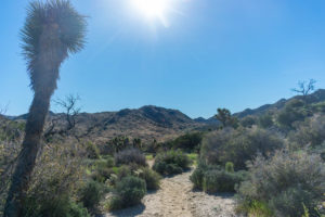
In April, I went up to Joshua Tree National Park to hike the section of the California Riding and Hiking Trail that makes its way through the park. The trail totals about 35 miles per the mileage on my topo map. Really, a great short thru-hike that would serve great for those new to desert backpacking, with the appropriate planning.
At this point, it has been a while since I did this hike. Sorry for that. I’ve been starting full time school for the last almost month now, and I’m even starting up a new job now, too. I didn’t really know what I was going to do after this hike, and I ended up reluctant to type up the trip report without a plan of what to do next. Long story short, I ended up traveling to Northern California now, but I still need to write up this trip report and leave all of the travel stuff to another post or something!
While looking over and planning for this hike, I decided to do it in 2 days. I would take a pared down version of my usual pack, sans tarp and elements that I didn’t need. I got a new silver umbrella to hike in constant shade, and I was excited to try that out. Otherwise, I drove out the night before I began to drop off 3 gallons of water and began the hike Saturday morning.
Day One
~16 trail miles
The day started off pretty awful. I woke up before sunrise and headed to the Eastern trailhead. I had called the taxi company before and scheduled a pickup at a ridiculously early time, hoping that they’d get there and I could start a potentially big day of hiking early. Of course, the taxi ended up 2 hours late. So my sunrise start turned into a pretty standard start time. I was frustrated, but I gathered myself and hit the trail.
I’ve hiked some of the first section in the past, so I knew what I was getting into. I decided to run some downhill and jog along some flat to warm up and test out the idea of adding a little bit of running into my hiking for some extra challenge.
About 5 miles into the hike, I had stopped for a short break and began to put my pack back on when the waist strap snapped. This was a lumbar pack, of course, so the waist strap means the entire pack was compromised. Of course, I do have the shoulder straps attachment, but this is only meant for stabilization and extra weight support. It does not suddenly turn this clear lumbar pack into a normal backpack with any legitimacy whatsoever.
I fumbled around with the pack before figuring out a way of tieing it together to at least last. Would it last the rest of the hike? It didn’t really feel like it. It kinda felt like it was falling apart with every step I took. But after another mile, it seemed to be holding on… Uncomfortable as it was–it was uncomfortable as hell for the remainder of the hike–I figured it was good enough and carried on.
My original plan for the day was to try to make it to Eureka Peak and out on to the Covington Crest Trail. With the late start and the broken pack, hopes of these side trips began to wane. I skipped past Eureka Peak in something like defeat and stopped in Upper Convington Flat to consider my options, ultimately just pressing on towards Juniper Flat.
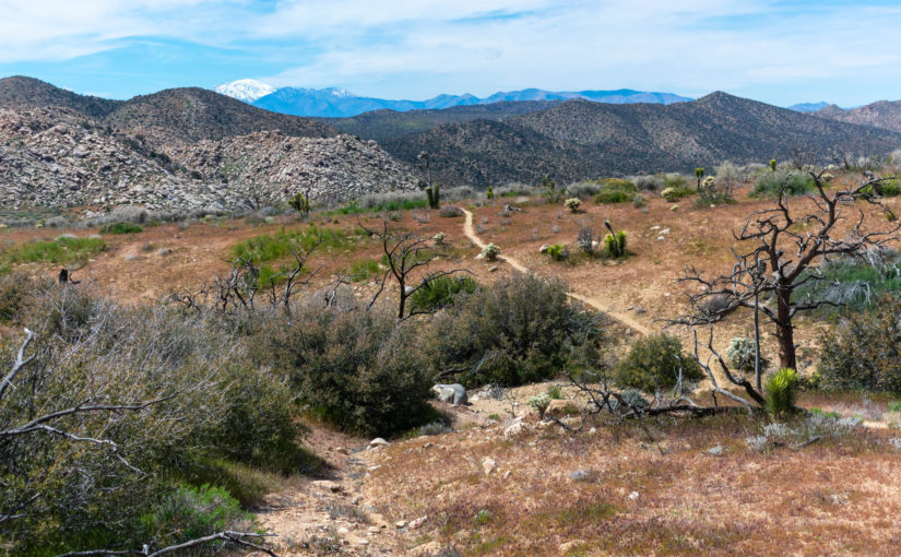
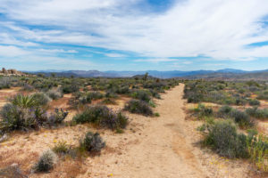
In my research for this hike, I didn’t really see a whole lot of discussion about the section between Upper Covington Flat and Juniper Flats. However, this proved to be my favorite section. Some of it was clearly still healing from a past fire that burned through, but all of it was brimming with life in its own different ways. The trail meandered in different ways and follows ridges as it descended from one area to the next.
By the time that I got to the Stubbe Springs Loop Trail, it was getting surprisingly late, and I was feeling surprisingly tired. My original plan was to consider this side trip as well, but ultimately, I decided to press on a bit further and find a nice campsite somewhere a bit further into Juniper Flats.
I ultimately pulled off the trail and setup a bit before sunset. Watching the sunset from camp, I considered that my first water cache was at most a couple of miles away, but I had plenty on me still. The broken pack sucked, but I didn’t have to deal with it for the night. It was a good day.
Day Two
~19 trail miles
Waking up, I packed up and headed to my water caches first thing in the morning. I left 2 gallons near the Juniper Flats trailhead. Unfortunately, animals had broken into one, and while most of the water was still there, I decided to dump it all out rather than test my luck trying to drink it. Thankfully, the second gallon was untouched and full. I filled up my water bottles and headed on to Ryan Campground and beyond.
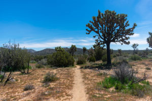
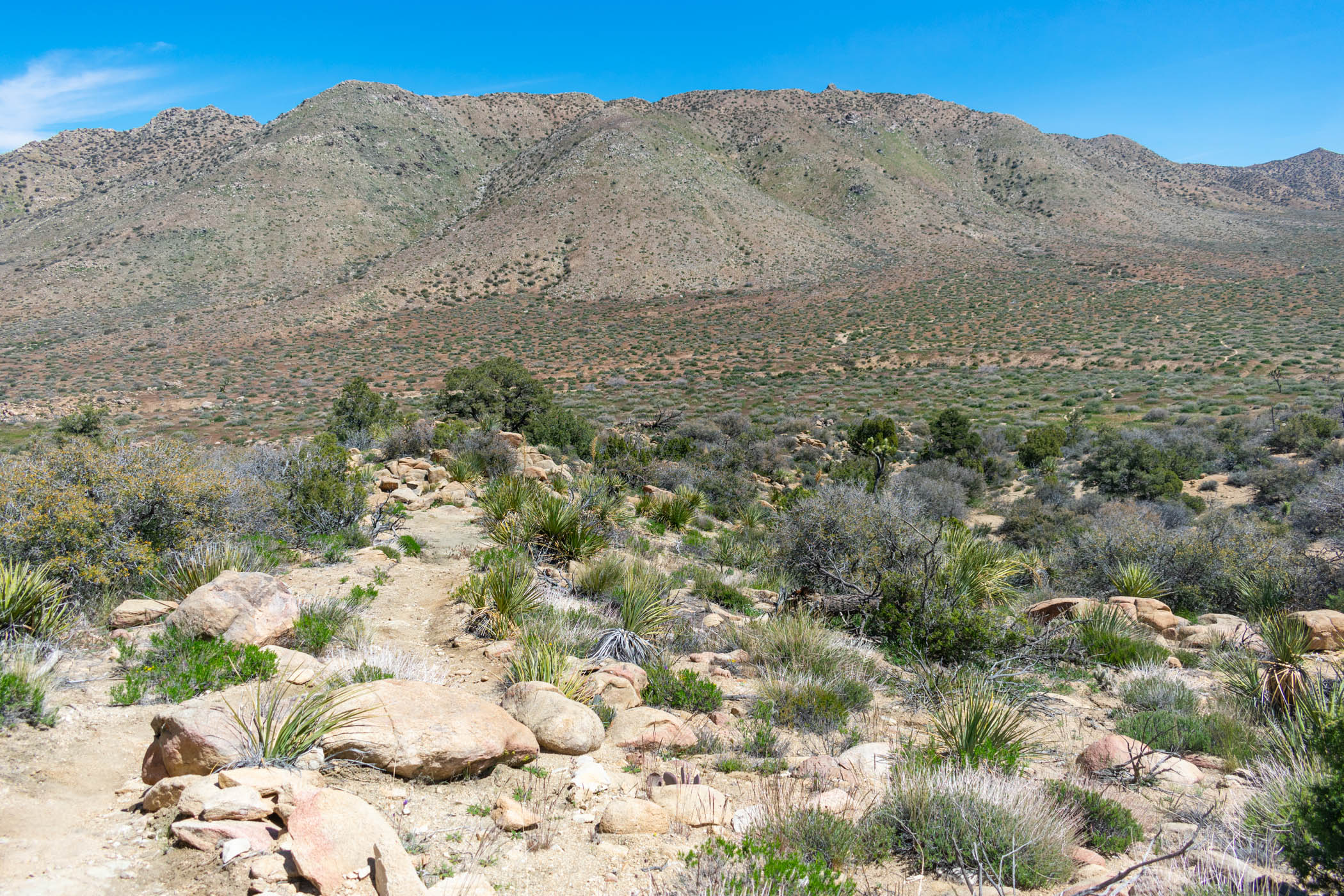
A lot of people talk about the section between Ryan and Geology Tour Road, and also the section between Geology Tour Road and Pinto Basin Road. I found both of these sections pretty remarkable as well. The wide canyon on the shoulder of Ryan Mountain was surprisingly interesting, and the large boulders in the distance and expansive views of the area that followed was all quite impressive.
Near Pinto Basin Road is also where I really began to see the most wildflowers. Of course, with the crazy super bloom that was happening this spring, Joshua Tree got some of it, too. Earlier in the hike did display quite a few wildflowers, but the end really packed in a lot. I also had my last gallon of water cached here, along with hordes of others.

From Pinto Basin Road, the hike primarily seemed to follow along washes all the way back to the trailhead I left Mirja at to begin. The washes were especially vibrant with wildflowers. While the flowers don’t seem to bother me as something else out there blooming in the Mojave, I was still quite happy that I had taken some Allegra with me and taken it already!
Conclusions
I have to be honest that taking well over a month to type up the trip report has probably led to me not including some details or thoughts I may have otherwise. And I think that’s actually the most important part of my conclusions on this one. Unfortunately.
Otherwise, the CRHT in Joshua Tree is a pretty straightforward hike. If I was to do it again, I would make damn sure the taxi service or whatever ride I’m using between trailheads actually understands. That experience sucked. I also would love to do more side trips and not have a broken pack for basically the whole trip!
I would certainly recommend this to anyone interested. Definitely do it in an appropriate season, go properly prepared (cache water, and wear appropriate clothing), etc. It’s a wonderful 35 mile trek!


