After a few months with family, I finally got back out on the trail this weekend. On Friday, October 18, I set off once again on the California Riding and Hiking Trail through Joshua Tree National Park. While I completed this same trail earlier this year, I decided to instead yo-yo it this time (i.e. complete it in both directions), plus add some side-trips. In total, I completed 86.5 miles.
Background
Back in April of this year, I took two days to complete the California Riding and Hiking Trail in Joshua Tree National Park. At that time, I used a local taxi service to take me from the North trailhead to Black Rock Canyon, and I simply hiked the trail one way. With more time and thinking over it for a while, I decided that I wanted to revisit the same trail, but this time, going both ways and attempting some side-trips while I was at it. I put together a 5 day plan, starting again at Black Rock Canyon, and this time ending back at the same spot. On Friday, I set out.
Now, before I go on, I want to update a bit on how I’m back here in Joshua Tree, doing this hike. I’ve spent a few months with family in Southern California, staying off the road and not doing the nomadism thing, instead focusing on a new job and going back to school full time. Things have been busy. However, as October set in, I decided to get back in the car and do some nomadism once again. I stayed some time in San Diego before going up to Big Bear, staying a week at a USFS campground. Alas, the desert has (kind of) started to cool down, and I came out to Joshua Tree.
For this one, I didn’t make any big changes in my pack. I took out my Mountainsmith Day Lumbar Pack, using a 15L REI stuff sack strapped to the top to carry food until I ate enough that it all fit inside the pack, itself. Pretty standard carry for me. Check out my lighterpack for details on the pack.
This is a desert hike, and there are no significant water sources along the route. All water has to be cached beforehand. I dropped off two gallons near the Juniper Flat trailhead, two more near the Twin Tanks trailhead, and an additional two near the North trailhead, where I would be turning around. I originally thought of only putting one gallon at the North trailhead, but knowing that the birds broke into my cache in my prior go at this trail, I figured it would be a good idea to have an extra gallon at the turn around point which I could pick up and carry in the case of unfortunate events.
With that all said, I was ready to hit the trail!
Day One
16.7 miles
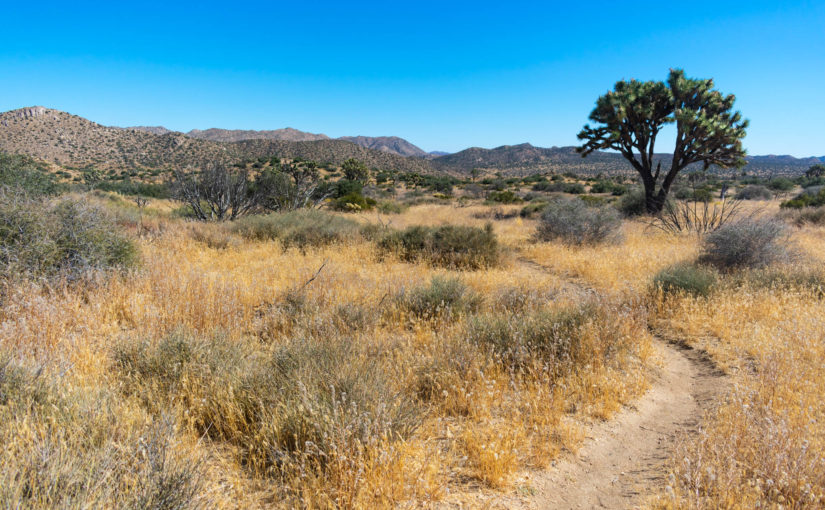
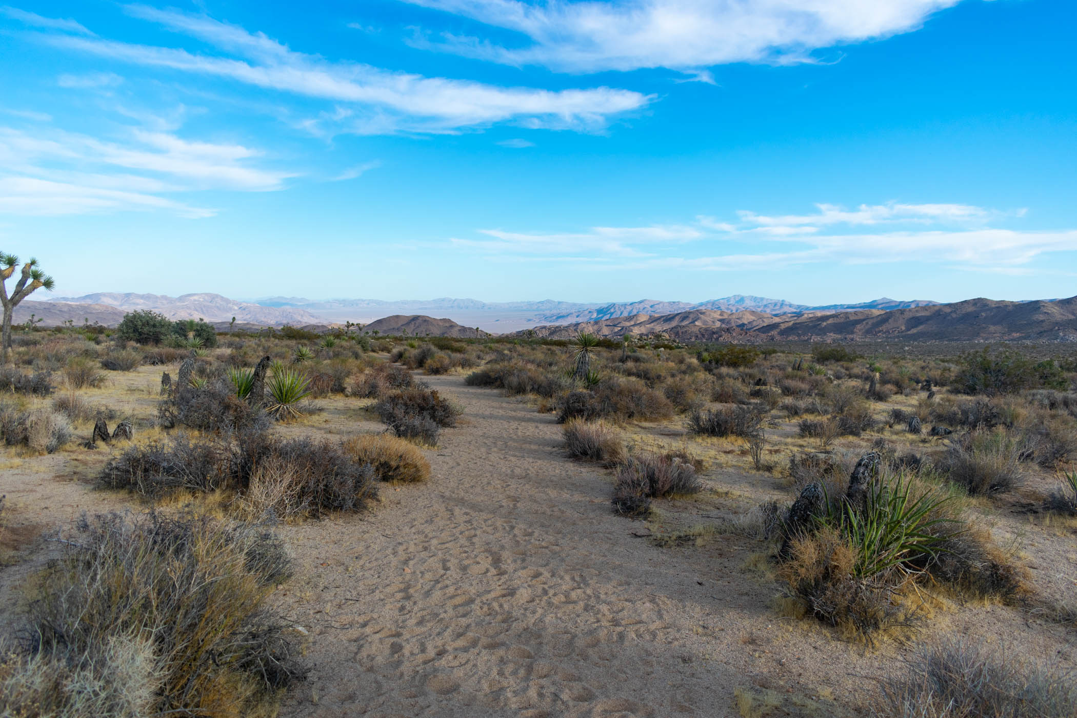
Having some work to do in the morning on Friday, I ended up hitting the trail around noon. This was somewhat earlier than I had planned, actually, but I was glad to get the good start. From the trailhead parking at Black Rock Canyon Campground, I set out and began following the California Riding and Hiking Trail deep into the park’s wilderness.
The route goes up and down a few hills before climbing up a wide wash to Upper Covington Flat. Last time, while hiking up the wide wash, my pack burst at the waist straps–catastrophic for a lumbar pack. I was still able to finish the hike, but it sucked. Thankfully, nothing of the sort happened this time!
Near the top of the wash, I suddenly caught fast movement near my feet. With all sorts of sticks and twigs on the ground, I thought it clearly must have been one of them, but I looked down just in time to watch a small snake bite the lowest rung of my left shoelace. Too small to pierce through my shoe, it slid, leaving two long marks on the dust of my shoe from its fangs as I pulled my foot back. Shortly later, the shoelace would snap right about where the snake bit. Of course, the concern would be rattlesnakes in the desert, but this one looked more like a California Striped Racer–a non-venomous and actually pretty cool snake. I counted my luck, watched the snake speedily rush away from the event that was probably much more stressful for it than it was for me, and carried on to Upper Covington Flat.
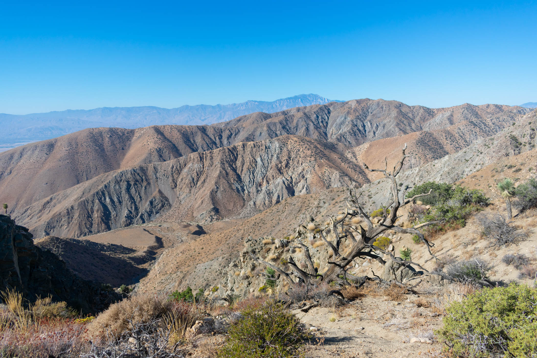
At Upper Covington Flat, I set off on my first side-trip: Covington Crest Trail. While the actual CRHT begins to take a downward trend, this trail continues a bit more uphill to a pretty cool viewpoint. I hung out to check the view for a little bit before setting on back to the main CRHT and dropping down to lower elevations.
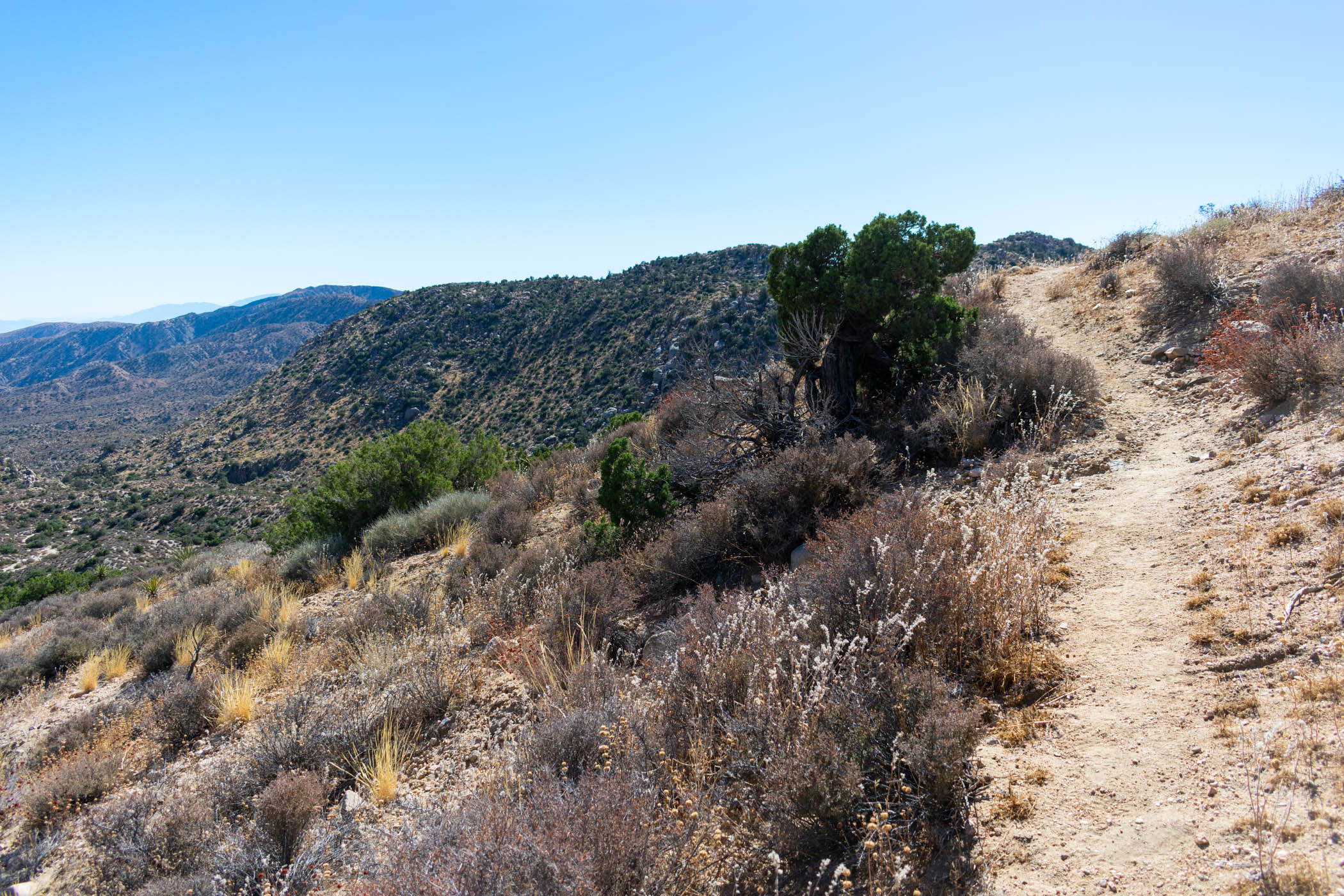
Last time that I did this, I specifically noted that the trail between Upper Covington Flat and Juniper Flat was my favorite for this trail. Once again, I can confirm. The views are constantly changing, the terrain challenging but engaging, and even on a second time through, novelty abounded throughout. I spotted countless reptiles, from long, skinny beauties to short and fat horned guys, and even a couple more snakes–no rattlesnakes or tortoises, unfortunately.
As I made my way down toward Juniper Flat, I found a great campsite a little bit off trail just as the sun set and made camp. As night fell, the stars littered the sky with innumerable beauty, dancing with the faint cloud of the Milky Way. I drifted to sleep.
Day Two
23.28 miles
Waking up as the sun tried desperately to peak over the mountains to my East, I ate breakfast and enjoyed my wonderful campsite. I tried to take a picture of the spot in the morning, but it didn’t turn out, unfortunately. Nonetheless, I prepared myself, packed up, and hit the trail.
It wasn’t long before I reached the turn-off for Stubbe Spring Loop. Last time, I had chosen to skip this route, but I’ve actually been wanting to get down there to check it out. This morning, I had only started with a liter of water, and I had already drunk about half of that by the time I reached this point. I decided to go on anyway. What is an extra seven or eight miles on half a liter of water? That water was gone well before I was halfway through this loop.
Stubbe Spring Loop really surprised me. Coming from the Western side, it takes a winding downhill through torturous terrain before turning and making its way uphill, over one bump and then another, before more closely following washes all of the way up to the turn off for Fan Canyon View. Although I was out of water already, I opted to take the half mile trip and see what Fan Canyon was all about. It turned out to be one of the more interesting viewpoints along the trail, in my opinion. Not disappointing at all.
As I began to make my way back towards the actual CRHT, I began to acutely feel the fact that I hadn’t had any water in some time. I normally drink quite a bit of water when hiking, especially in the desert. Often, this means I’m tending towards a little over-hydrated, if anything, but I typically will sweat enough–especially in the desert–to make up for it. Hoping my usual pattern was persisting, I ate a little food to get saliva moving in my mouth and kept pushing on.
Hiking in the desert without water, even as my usual over-hydrating self… is stupid. Don’t do it.
Eventually, I reached a road, which I thought was the CRHT. As it turns out, this road leads back to the Juniper Flat parking area, so it’s as good as the CRHT, but it is not, in fact, the CRHT itself. I pondered why a sign that I passed for a trail said “Stubbe Spring Loop” leading further North, but kept hiking past it.
Still a couple of miles from the Juniper Flat parking area, where I had cached two gallons of water for myself, the thirst was getting to me. I sat in the shade of a joshua tree, took off my pack, and resigned to taking a small rest.
“Why not see if I can get a little water out of this jalapeno tuna packet? They’re always super juicy!”
I opened up a tuna packet, squeezed the juices into the bottom of the packet, and downed it like a shot of shitty whisky. A shot of shitty whisky would have tasted better (especially if it was Fireball or something). Both might have had the same effect at that moment: almost immediately, I began gagging and spent what felt like an hour–probably closer to a couple minutes in reality–dry heaving on the side of the trail.
“Heat exhaustion?!” I pondered. Other than the random bout of dry heaving, I barely felt actually dehydrated. Getting awfully, annoyingly thirsty, but not much else. Nonetheless, I didn’t dare take the risk. Keeping my umbrella overhead to keep the sun off, I collected myself and pushed on to the parking area.
Reaching the parking area, I jumped across to find my stash of two gallons of water, immediately opening one and dumping it on my head, letting it pour down my head and over my body. I downed countless small sips, hoping not to aggravate my stomach again. I sat in rest. It wasn’t long before I was feeling better and set off towards Ryan Campground, where I stopped for a more proper rest, lunch and micro-nap. It wasn’t long before I was feeling as good as new and hit the trail again.
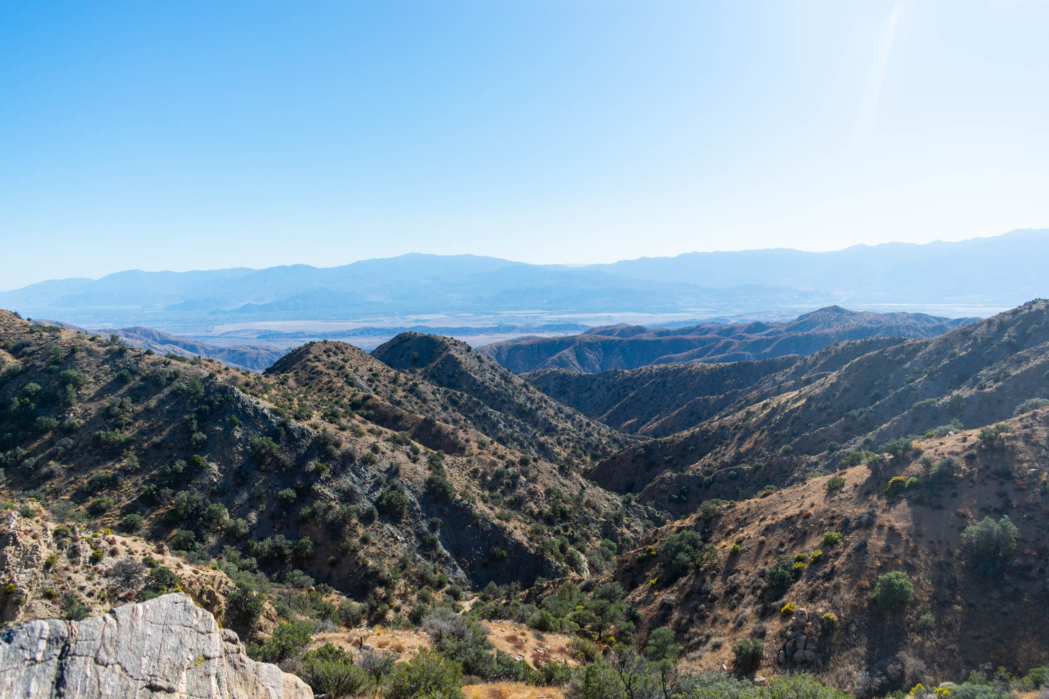
The rest of the day remained relatively uneventful. Crossing Geology Tour Road, I continued on all of the way towards Twin Tanks, where I had left my second cache of two gallons. Thankfully, most of this was finally quite straightforward downhill, with 360 degree views reaching an impossibly distant horizon to the East. I appreciated this section significantly more than the first time I did this trail. Perhaps I just created enough of a separation from the incredibly beautiful earlier sections that I was able to view it a little more openly this time.
At Twin Tanks, I filled up water from my second cache before continuing on and finding a campsite in the rocks somewhat distant from the road. It had been a long day and I was ready to call it as the sun set once again. I drifted off with hopes for the following day.
Day Three
20.39 miles
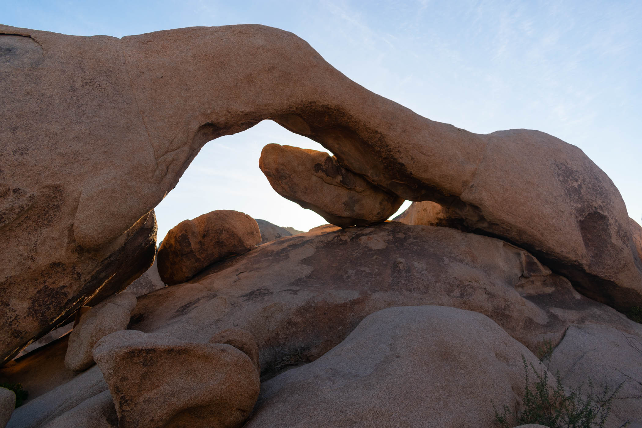
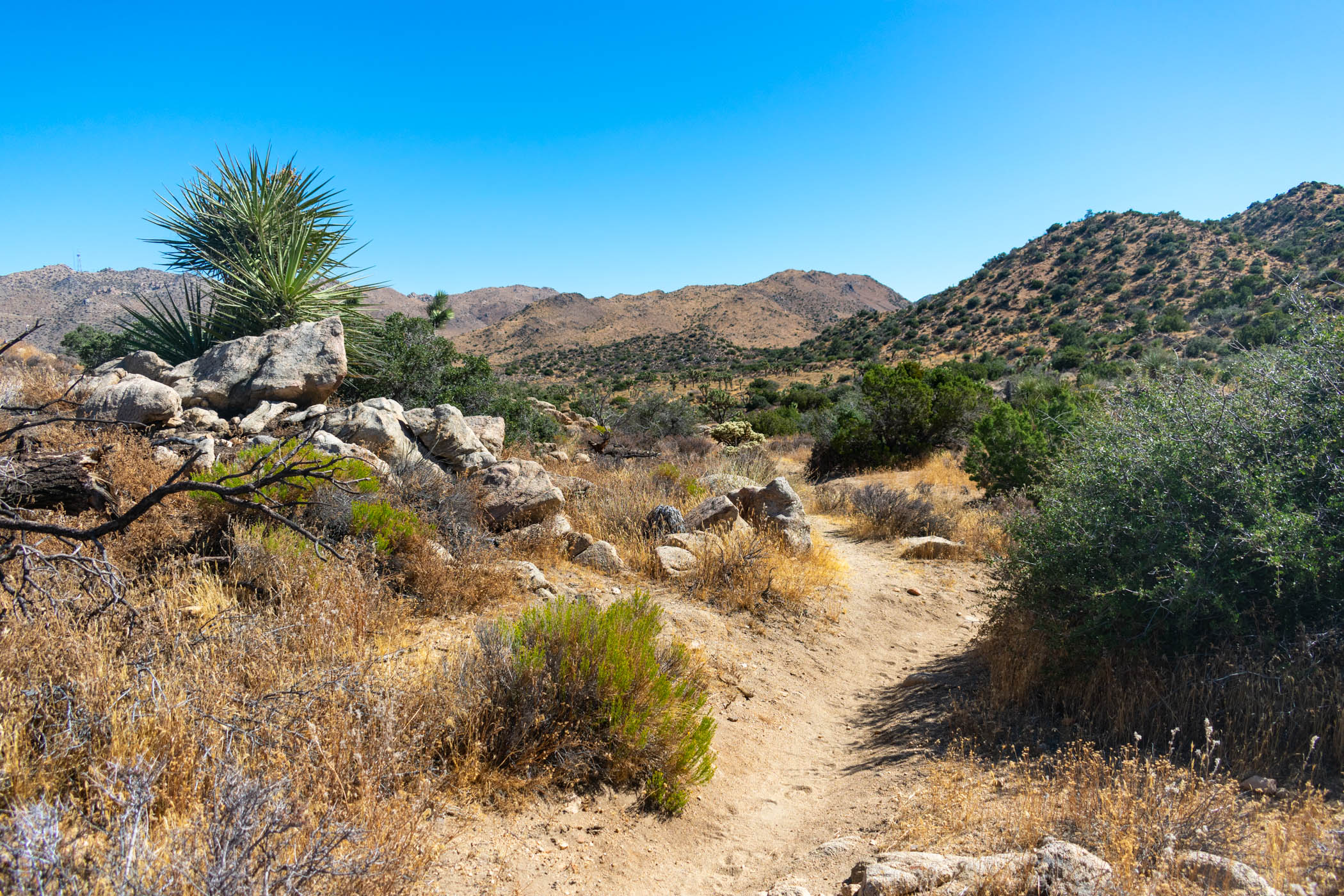
Waking up at sunrise once more, I packed up again and hit the trail. This time, I had another side-trip planned: Arch Rock. It is just a short side-trip, but I skipped it the last time through and wanted to see it. It didn’t disappoint, giving me an opportunity to climb around the granite boulders and take a shot of the well named Arch Rock.
From there, I continued on the CRHT to the northern trailhead. Practically all just downhill now, the hiking was easy and pleasurable, following washes and enjoying the quiet solitude of the park at its best.
If I wasn’t doing a yo-yo, this would have been the finish of the hike. However, stopping at my final water cache, it was time to turn around. I ate lunch, filled my water bottles, and attached the second gallon to my pack. 8.78 liters of water. That was going to be fun carrying entirely uphill back to Twin Tanks and beyond. Not. It sucked.
The extra weight of so much water pressing on my hips and shoulders was nearly unbearable more often than not. I wanted to stop after every second step and give up. While the idea of going downhill first and then returning on an uphill after a good warm-up sounded kinda smart in preparation, I was really regretting the whole damned thing.
Even worse, once I finally got to Twin Tanks again, all of the water that I had drunk in my exhausting climb was to be replaced in full. Filling my usual 5 liters, I grabbed the second full gallon and attached it to my pack. As if I hadn’t just spent the last hours desperately drinking water in hopes of lightening my pack, I was back to a full 8.78 liters of water again. And for even more, often even steeper uphill the entire rest of the day. Torture. Absolute torture.
Alas, shortly before reaching Geology Tour Road once again, I spotted a clearing next to a large boulder just as the sun set. I ran over and threw my pack on the ground. Exhausted. Exasperated. Done. The boulder was perfect to block the majority of the wind that had prevented me from using my umbrella all day, and I was just happy to call it a day and get some sleep. Was I really going to do two more days of this shit, as I originally planned?
Day Four
26.13 miles
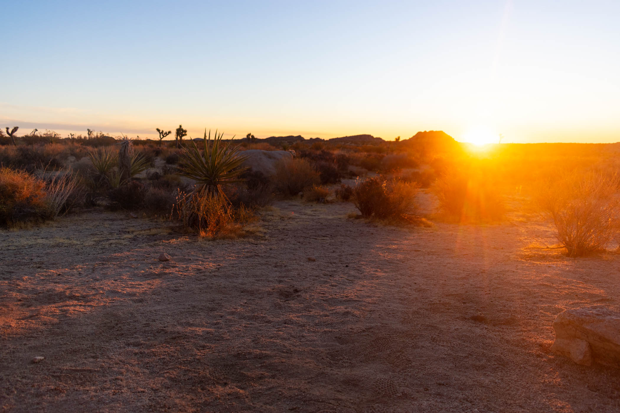
Waking up, I enjoyed the sunrise that the wide views from camp gave me. Was this some kind of twisted reward for the torture I had put myself through the last couple of days? No. I still had two more days of this torture planned, and I was still carrying well more than my standard 5 liters of water–already heavy without the added load. Nonetheless, I nervously laughed at my own misfortunes, packed up, and hit the trail once again.
Thankfully, the trail remained moreorless uneventful all of the way to Ryan Campground once again. At the campground, I immediately spotted an unused table, which I stopped and grabbed an early lunch at.
“No need to hurry,” I thought. “I could practically do what remains in a single day, if I really wanted.” I took my time eating and relaxing, drinking enough water to finally be down to my standard five liters before setting out.
This time, I took the actual California Riding and Hiking Trail as it climbed from Juniper Flats toward Upper Covington Flat. While this section sure is my favorite in terms of scenery and entertaining hiking, the way up is monstrous. I savored every time the trail dipped downward for even the shortest of dips and grew increasingly frustrated with the ever increasing steepness and difficulty of the uphills.
The constant challenge began to put the thought in my head that surely I would be finishing on a fifth day, because there was no way I was keeping up a realistic pace up these hills. However, every time I looked at the time, it felt as if time itself had slowed to a pace even below my own. As I climbed the literal stairs towards Upper Covington Flat, my constant cursing in the wind began to couple with a strange excitement of the possibility of finishing a day early.
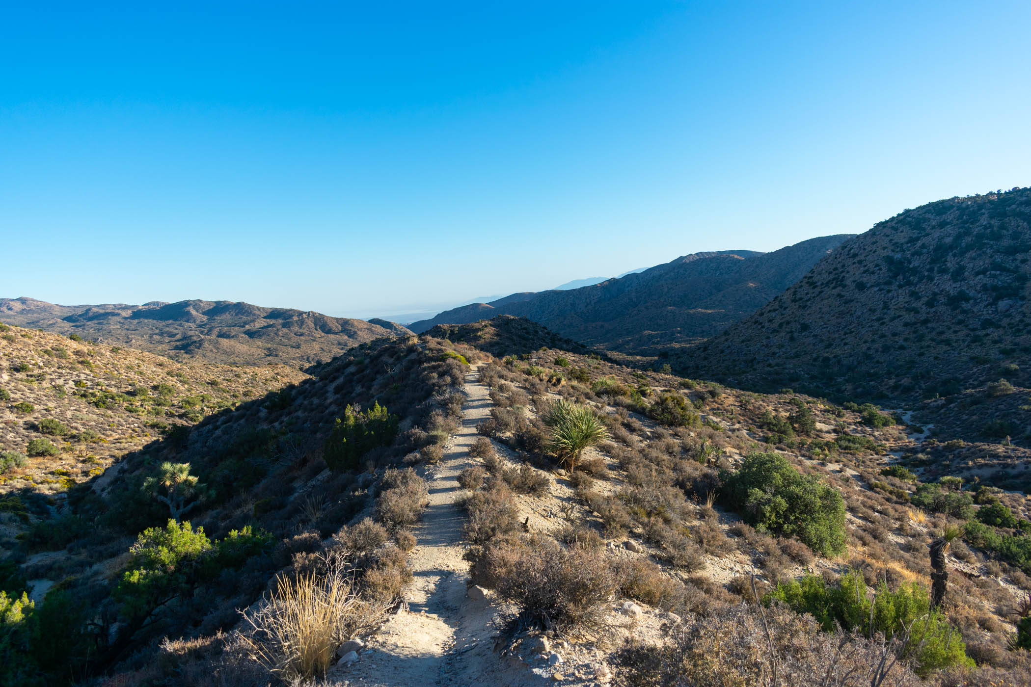
I didn’t much like the idea of camping anywhere well beyond Upper Covington Flat. It seemed logical to just continue on, by headlamp if necessary, and finish it at that point. Further, once reaching Upper Covington Flat, it was only mid afternoon and far too early to stop. I made up my mind. I would just finish it on the fourth day, hiking up Eureka Peak and making my way back to the car. On I went.

I hiked up Eureka Peak once in the past, but not from this direction. Following a confused mixture of dirt road and overgrown trail, I charged on. At one point, the trail became nearly vertical as I summitted… a damned false summit! I let out a victorious scream anyway, cursed the wind preventing the spot from being a truly great resting spot, and continued on to the real Eureka Peak.
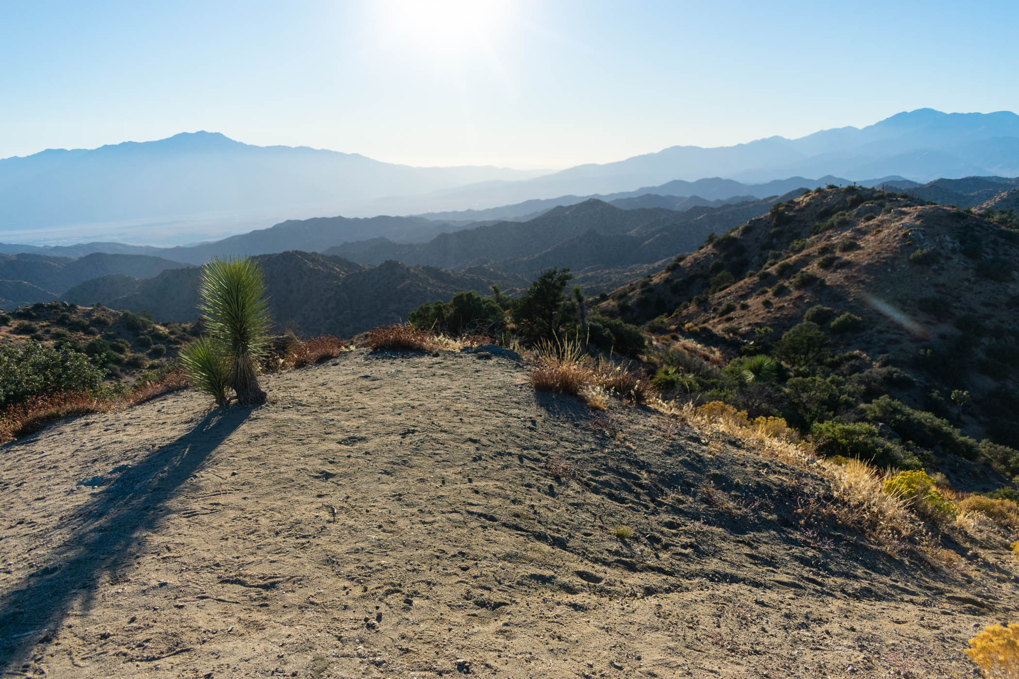
In all of my exhausted hiking and pushing on, I half assumed I would be lucky if I reached Eureka Peak before sunset. Maybe I would even actually see sunset there if I was so lucky. Instead, I arrived a good hour before sunset. While the sun began to give a dramatic effect to the canyons and mountains visible from the peak, it still sat moderately high in the sky. With the wind continuing to blow, I decided not to hang around for sunset, instead continuing on down Eureka Peak Trail, back to Black Rock Canyon.
I had a difficult time finding my way down from the peak. While something of a trail existed, it was strange and difficult to follow. My only solace in my confused, frustrated head was the regular footprints suggesting perhaps I was on the right track, before a true trail opened up into a wider wash and carried me on.
As the sun set, I followed signs for the 0.4 mile Fault Trail, which was actually surprisingly cool, despite the up-down nature of it being torture on my sore muscles. And then it was back on the CRHT for the last mile back to the car, my headlamp lighting the trail and illuminating countless tiny spider eyes watching me pass by their homes with beautiful glimmer.
The hike was done!
Conclusions
While I originally set out to do this hike in five days, I ended up finishing it in just four. Of course, I had originally also given myself the optional side-trips of Contact Mind and Quail Mountain, neither of which I actually completed, saving several miles. Nonetheless, I ended quite satisfied with what I did do. At 86.5 miles, this was a wonderful, challenging hike!
Water is always a concern in the desert, and I’m not too surprised that I had a run-in with that concern once again. It would have been possible to get an extra water cache up in the Convington Flats area with a car that handle those dirt roads, but I didn’t even try. Heat and lack of water gets even the most experienced and knowledgeable out there. My tendency to over-hydrate on a hike helps me, but that can run the risk of electrolyte issues. Dialing in of my own systems and self-awareness with them is a never-ending process, and I think this hike proves that well.
Trying to satiate thirst with a shot of fishy jalapeno juice is probably a terrible idea.
Carrying 8.78 liters of water sucks something special, but I am glad to have devised a system to make that work. Future hikes I want to do will certainly challenge me with similar insane water carries, and the more I can dial in systems of supporting myself through that, the better.
Overall, I had an absolutely amazing hike. I overcame my challenges with a little bit of grit and a little bit of brain. Amazing!
And something I have otherwise neglected: on Joshua Tree National Park’s alerts remains a notice of a missing hiker, Paul Miller. On July 13, 2018, he hiked into 49 Palms Oasis in the park and has not been heard from since. Search and Rescue teams have yet to find any sign of him. Even day hikes into these wildernesses can be surprisingly dangerous, and over a year after he went missing, this man’s family remains anxiously waiting for word of what happened to him. Stay safe and keep an eye out for our fellow hikers.


Amazing experience. Thanks for sharing. And the photos.