Following an 80 mile attempt at a long route through the badlands of Anza Borrego Desert State Park in March, I have continued working on lengthening that route. As I explored potential avenues, I created a long loop exploring the badlands. On Friday, November 22, I set out to attempt the new route, ultimately completing a shortened 111.41 mile version of it.
Foreword
As my previous attempt at a route through these badlands, this is not meant to be an efficient route, much less an easy one. I like to imagine that there is no real reason anyone couldn’t do this route, but realistically, it is a pretty advanced route.
One should have experience with hiking in desert badlands, cross-country travel, route finding, and to some degree, scrambling off-trail before attempting this route. As there is little to no water available along the route, effective caching is also necessary, sometimes through stretches that can be hard to impossible to get to by a standard vehicle (a good 4WD/AWD with decent clearance can go a long way). Many of the washes and land features change from year to year or from rain event to rain event, meaning my experience may very well be impossible to follow again in the future.
There. I got the disclaimer nonsense out of the way. I feel obligated to it for this kind of trip report.
I began this trip as one passing rain event came to an end and another began looming on the forecasts. The wet washes proved a small impediment to caching water that I was able to work around by carefully choosing cache locations, even though it meant a couple of potential 30 mile water carries. More importantly, I knew I was going to have to cut the hike short. I ended up cutting the route to 5 days–much too short for the full loop I had devised. Thus the route described here does not even fully overlap with my previous attempt. I’m finding even 9 days would be difficult for my full route, but I hope to get out and do the whole thing in the future. I do feel that I have proven the viability of a larger loop route. This trip report will serve as one more piece of that puzzle.
Day One: Borrego Springs to Ocotillo Wells
23.33 miles
After camping a night in Ocotillo Wells, I woke early and drove to Borrego Springs, where I began the hike. I opted to park in the same place that I had last time I did another section of my route in March, leaving a small note on the dash with my phone number. Again, I don’t want to disclose the specifics, because it is not a secure parking spot.
Pretending that I started at Christmas Circle (I actually started from my secret parking spot), the hike began with a 4 mile road walk along Palm Canyon Drive, running East out of Borrego Springs. This was the first time that I hiked this section with daylight and being fresh. It was significantly nicer than every other time I’ve hiked this route. I even had a small chat with a bicycler heading out for a ride on the same temporary path before we diverged ways.
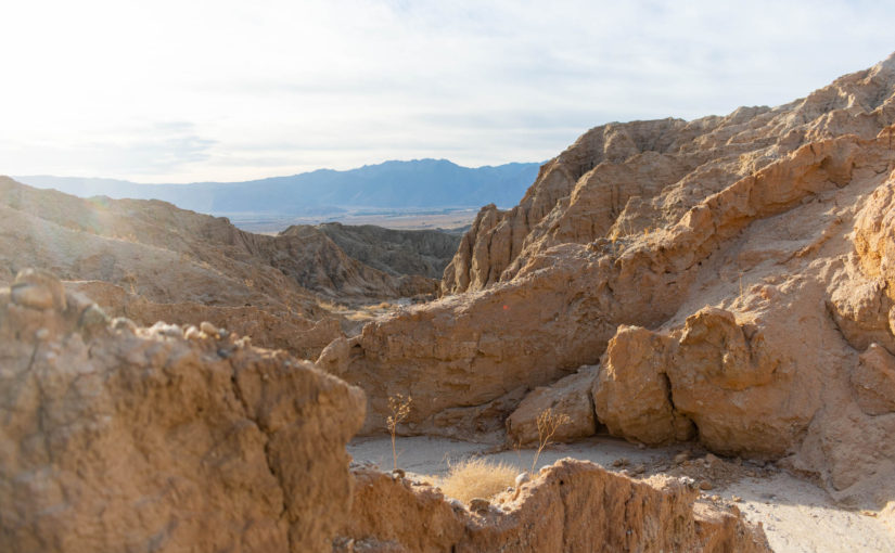
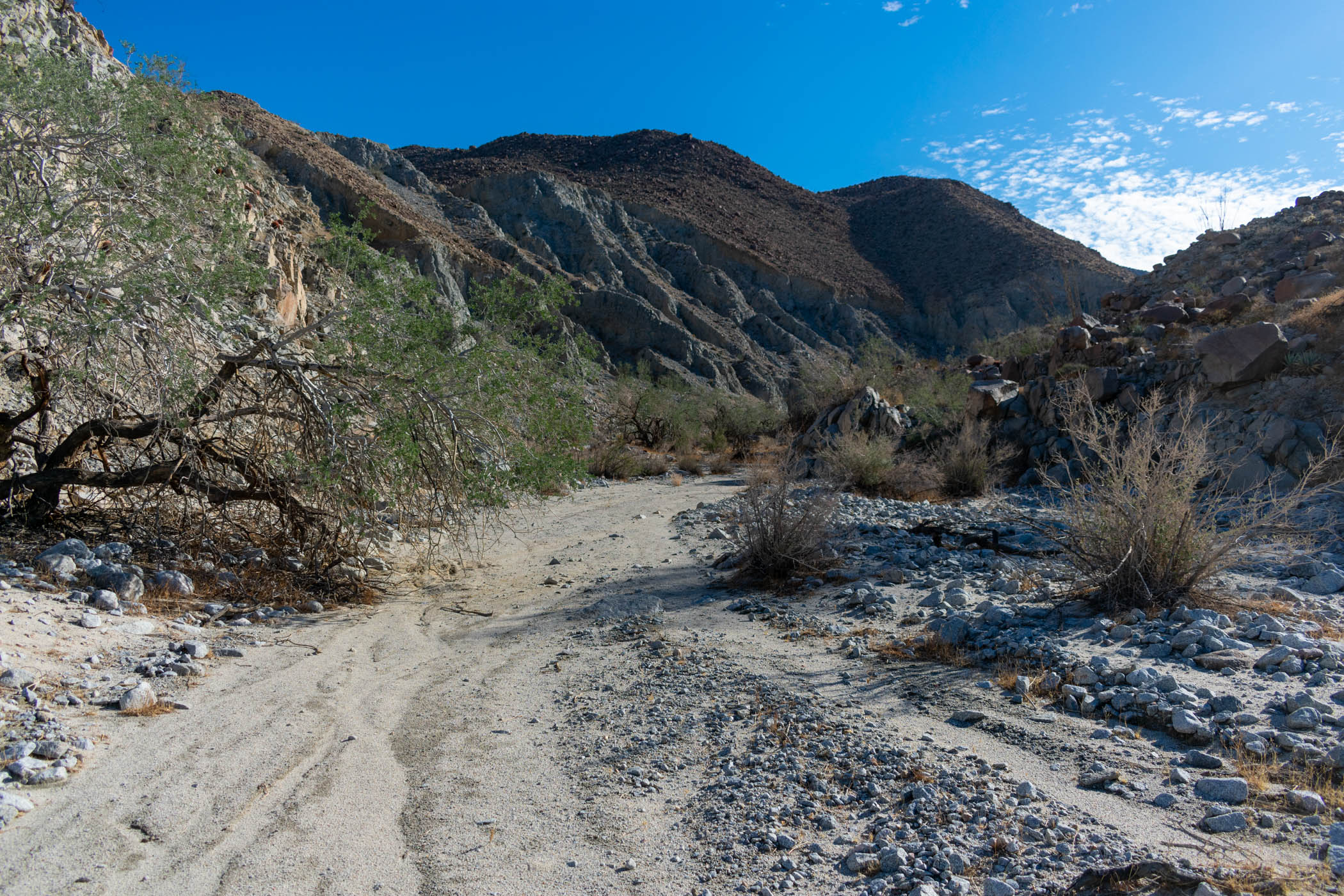
Turning down Old Springs Road, I passed by the land dump and on to the sandy roads headed towards Borrego Sink. The way seemed to get increasingly muddy and difficult to hike as I went. This only continued to get worse as I followed on down Borrego Sink Wash. The beginning of badlands formations to my side gave the sharpest bit of enjoyment as I slid my way, desperately searching for the driest parts of the wash to find footing.
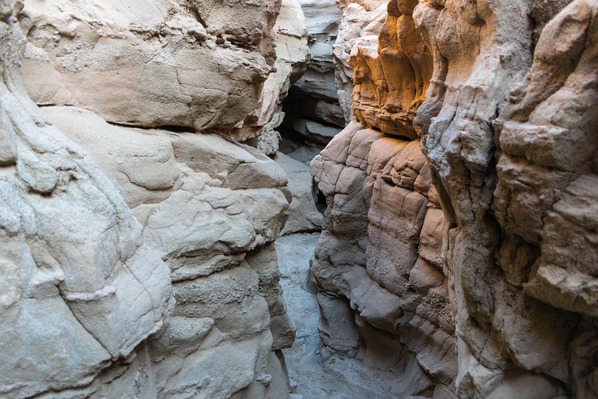
Alas, I reached and began heading up Borrego Mountain Wash. Although beginning quite wet as the hiking prior, it began to dry out into something actually reasonably passable as the wash narrowed into a small canyon. As I approached the slot canyon, aptly named The Slot, I ran into three small groups of people there to explore. Less than the last time I traveled through the area, but reasonable for late on a Friday afternoon. Nonetheless, it still required taking off my pack and lugging it through the narrow walls, occasionally even lifting it above my head to make it through.
After a small break for a well deserved meal at the parking area for The Slot, I carried on, turning down rides into town–I was ready to hike the full route, after all. I turned on to the Goat Trail as the sun began to set, making my way towards Ocotillo Wells. It was dark as I descended onto Highway 78, the occasional lights strewn about the town providing evidence of the land below.
A last couple of miles alongside the highway to the staging area and campground at Ocotillo Wells State Vehicular Recreation Area, and I found one of the last remaining established campsites. I sat at the table and prepared camp for a terribly restless night. Between off-roaders of different varieties driving by regularly with bright lights on (some reasonable, some not) and one group partying with loud music, literally until the sun came up, the sleep sucked. I took what I could get.
Day Two: Ocotillo Wells to Harper Flat
15.27 miles
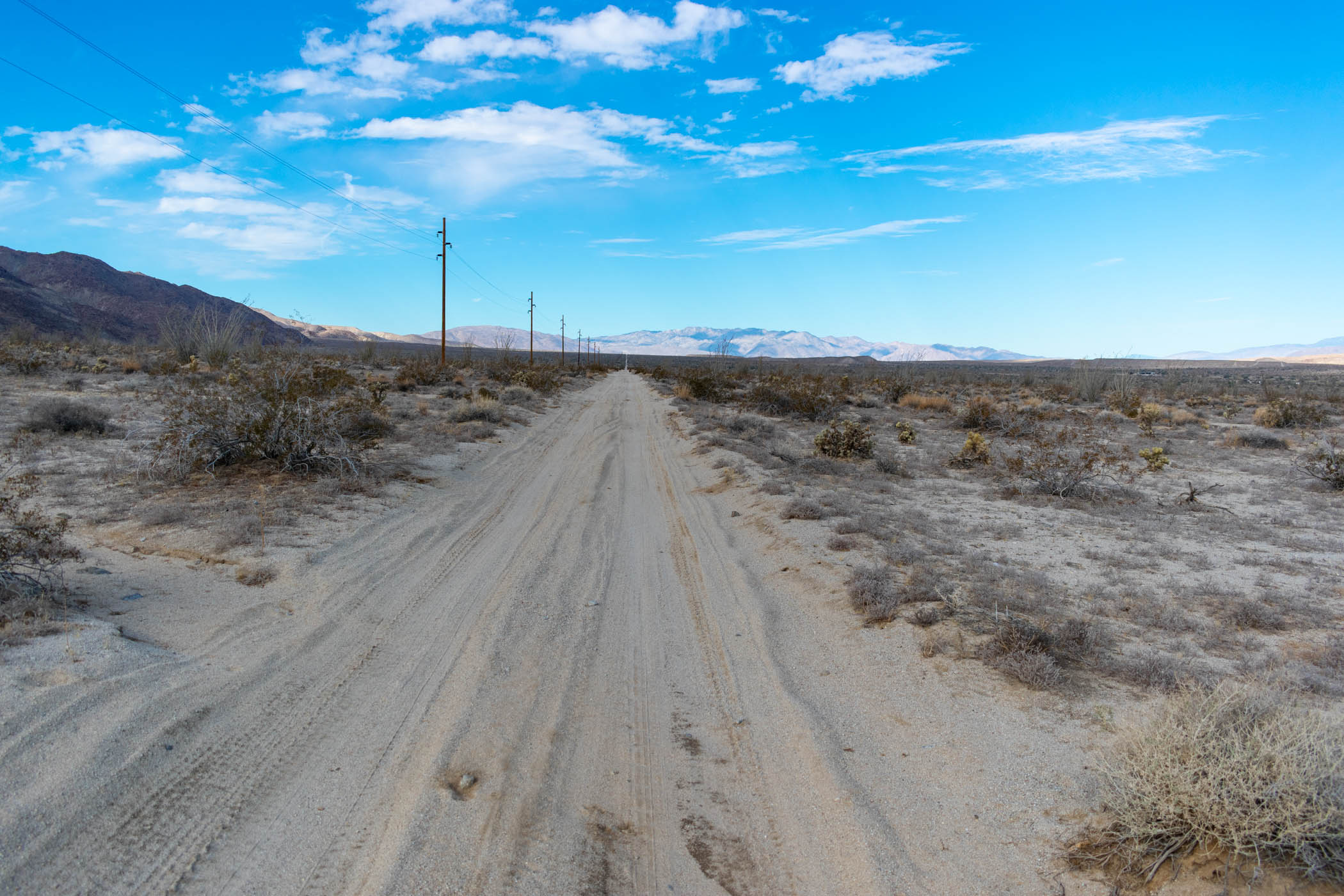
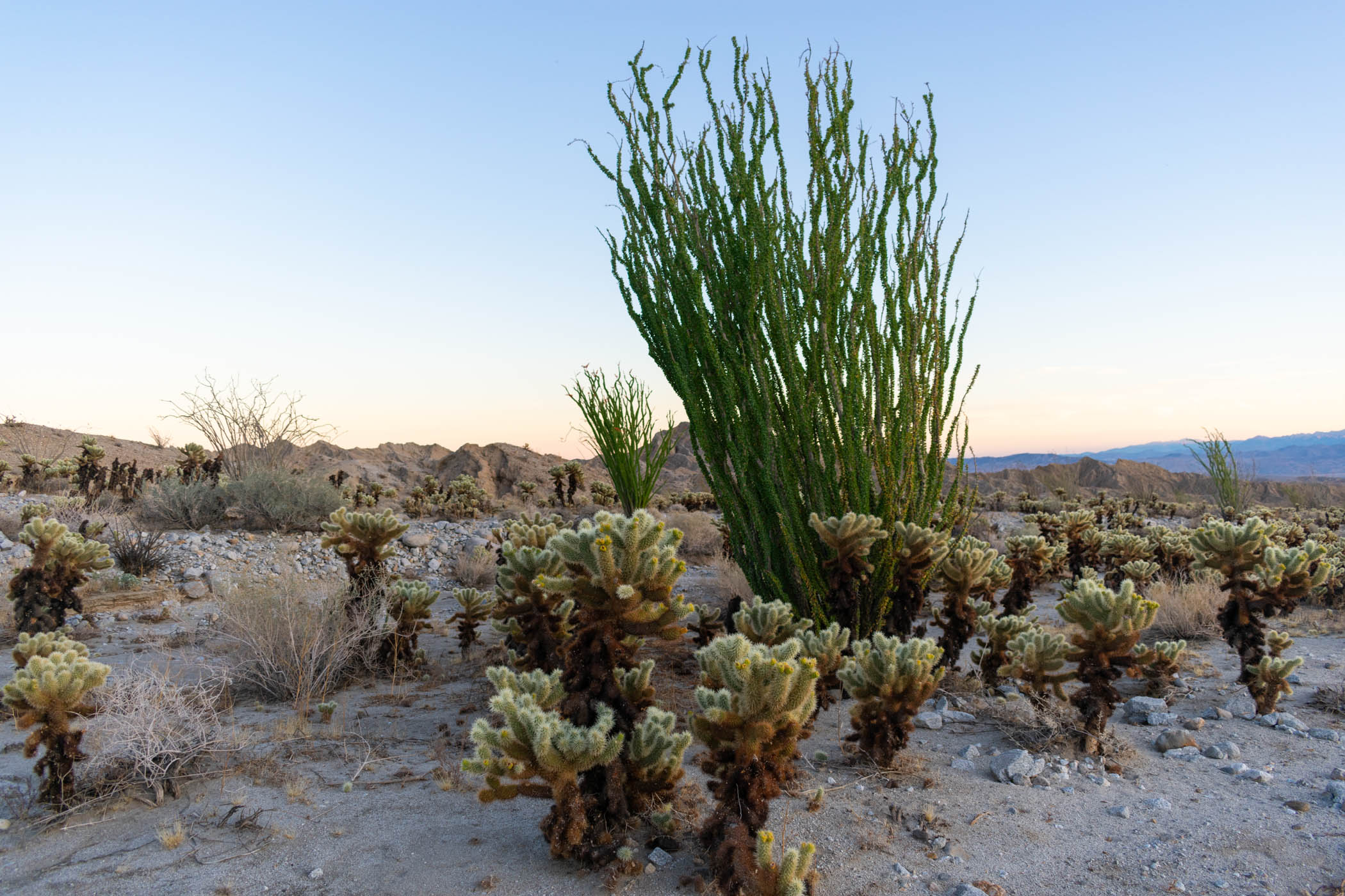
Exhausted from a night of little to no sleep, I gave up when the sun came up and sat up to prepare for a day of hiking. I packed up, ran across Highway 78, and began hiking down the dirt road labeled Main Street, until it hit Old Kane Spring Road. The roads are largely uneventful, although Old Kane Spring Road leads to the Cactus Garden, a popular spot to see many different kinds of cacti present in this desert.
At the wash I marked to start heading up Harper Canyon on my GPS, I had previously driven out two gallons of water. The next stretch would be a long one before I got to my next cache. I loaded up, grabbed a bite to eat, and headed up the wash.
The wash began wide and confused. I ran into the occasional dead end, but a quick scramble up the many many boulders revealed a larger, wider wash just on the other side. Ironwood trees were everywhere–a forest of them. While not easy per se, the hike was interesting as I arrived into Harper Canyon itself. A car parked at the end revealed an easier route up than I had followed, and footsteps in the sand enlightened a sure way up the canyon.
After a sleepless night and a long morning of hiking along dirt roads, the way up Harper Canyon seemed to last forever. The occasional scramble over small boulders, around large boulders, and up a dry waterfall here and there made the hiking more difficult. It seemed like an enjoyable day hike that was tortuous with a heavy pack and the circumstances of my day. Nonetheless, I embraced it for what it was and enjoyed the canyon itself.
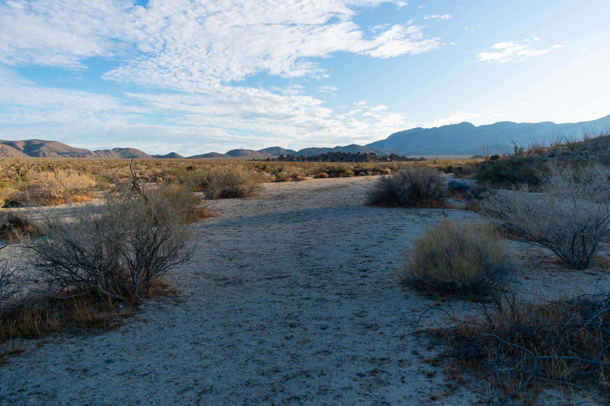
Alas, the canyon opened up into Harper Flat and the hiking became relatively flat–still trending uphill, but only slightly. I followed the wide wash as the sun set in front of me, when I spotted a good enough campsite and lied down to finally get some sleep. I enjoyed the starry night of this remote area, once widely occupied by indigenous people. A few shooting stars passed overhead, and I slipped into sleep, really not caring that the mileage on the day was low.
Day Three: Harper Flat to June Wash
19.21 miles
Having a relatively good night of sleep in the silence of the remote Harper Flat, I packed up camp and began walking up the same familiar wash again.
Before long, the familiar wash disappeared and I was left to find a way to a different wash within the flat. The route was not obvious, so I headed primarily by compass and probably more blind hope than I like to admit. Having never been up there before, I really had no idea if the wash I was looking for would be clear or obscure. I found hope in the discovery of the faintest evidence of what could be described perhaps as a tiny, dry creek. I followed it East as it opened wider and fell into a large wash, heading North and South.
As I followed the new wash South, presumably being the upper reaches of Pinyon Wash, it became increasingly clear that this would take me the right way. Before long, I found myself walking onto and through a group of Jeep drivers who had set up camp and were preparing for morning breakfast. Staying hello to their dogs who ran to sniff and investigate me, and secondarily the actual people who seemed almost too tired to comprehend a strange, scruffy looking hiker suddenly passing through their camp, I passed through and continued over the hills to Hapaha Flat.

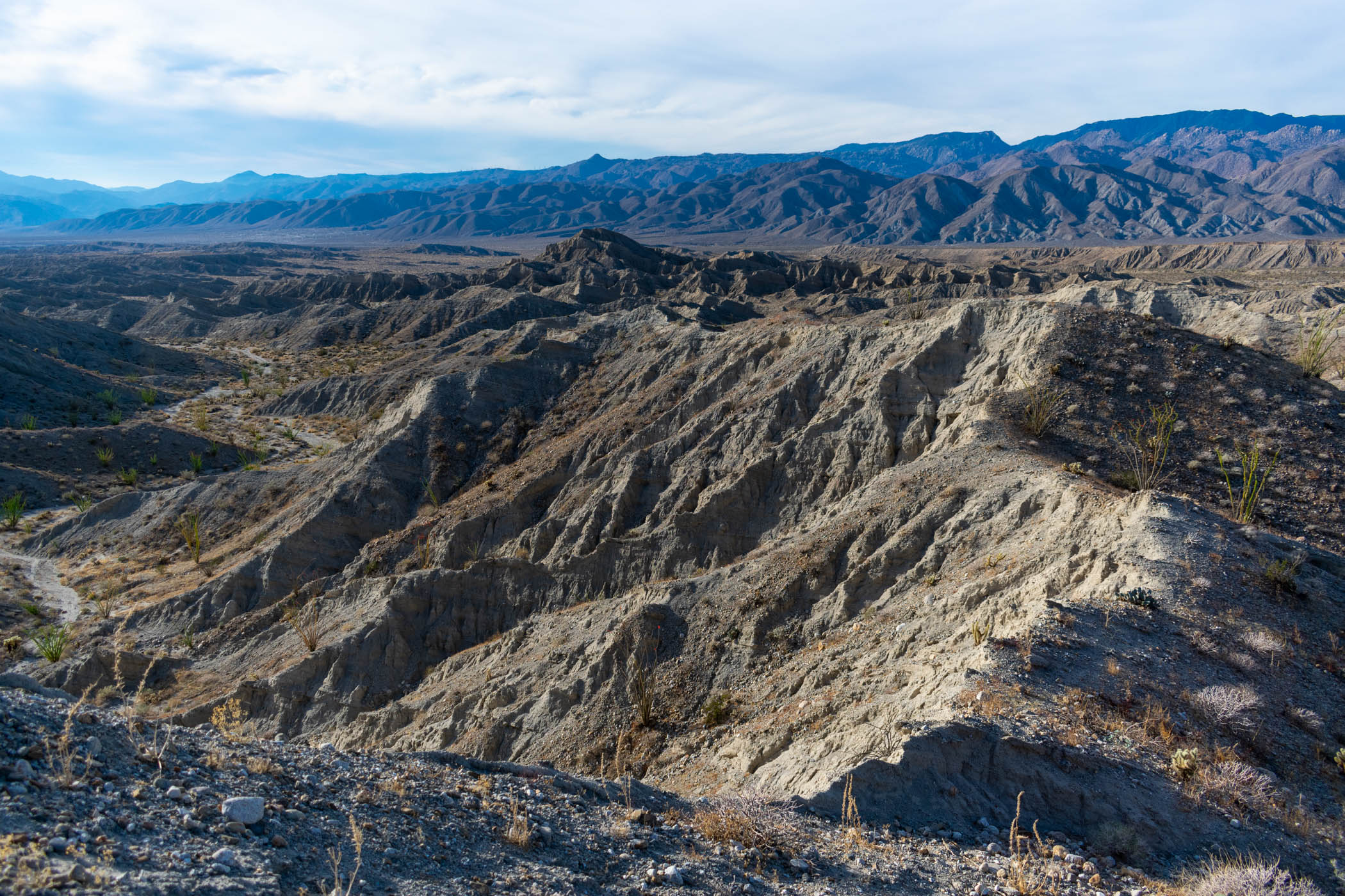
Hapaha Flat was surprisingly interesting, especially as the views to Carrizo Valley and what seemed to go all the way down into Mexico loomed constantly ahead until the large canyon walls of Fish Creek Wash obscured them. I enjoyed the downhill hiking and the clear path forward.
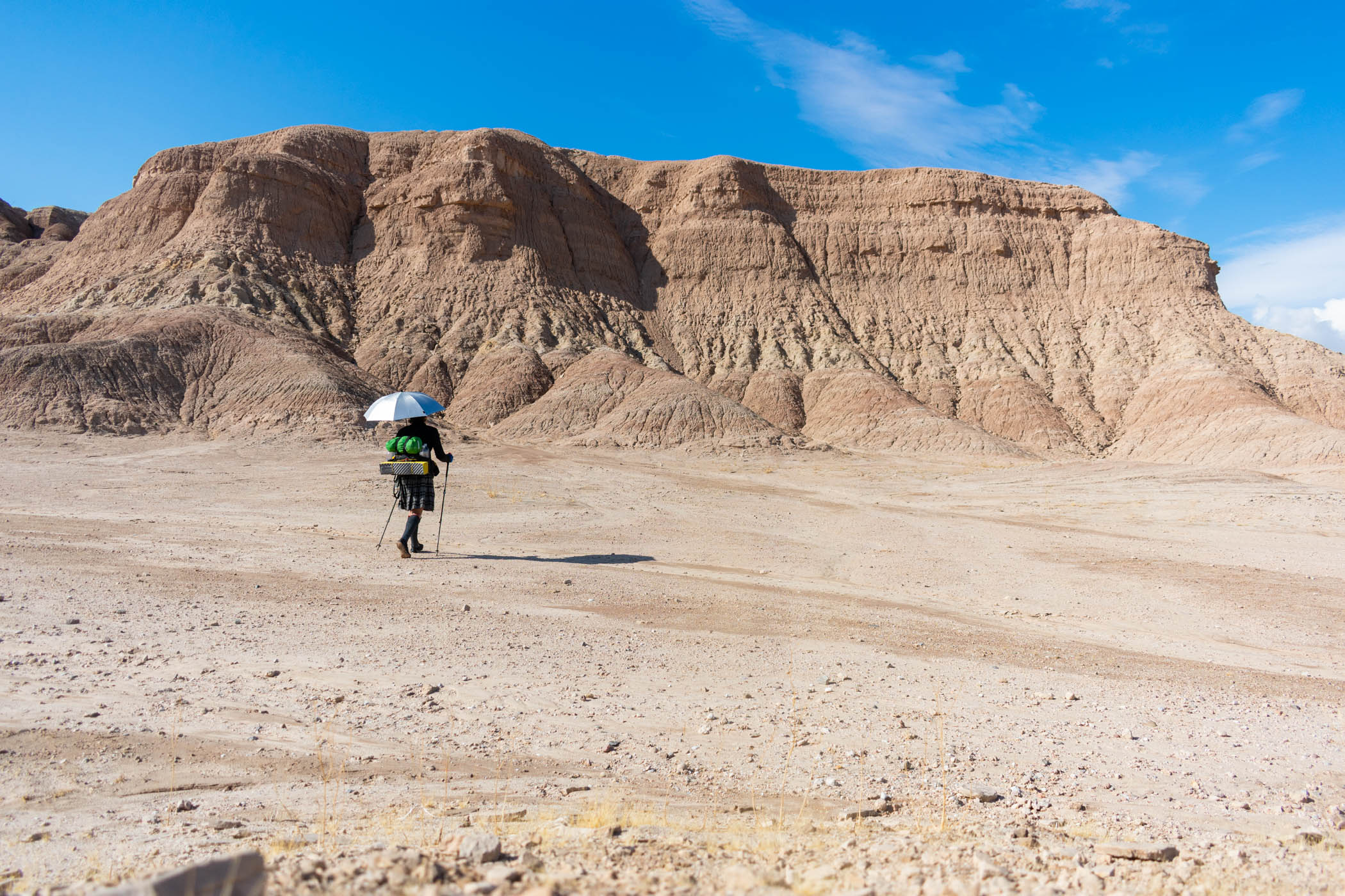
It was still early enough as I began hiking into the canyons of Fish Creek Wash, watching the geology of the walls change constantly as I continued on. The campers I passed through earlier passed me in their Jeeps, shouting complements at my umbrella and the distance I had already made through the morning as they passed.
As I passed by Olla Wash, I stopped to consider walking up to the mud palisades. They made a special appearance on my intentions for this hike, but this would be the first that I ultimately decided to pass on in the interest of time. I enjoyed the variety of different formations of Fish Creek Wash enough before heading up Sandstone Canyon.
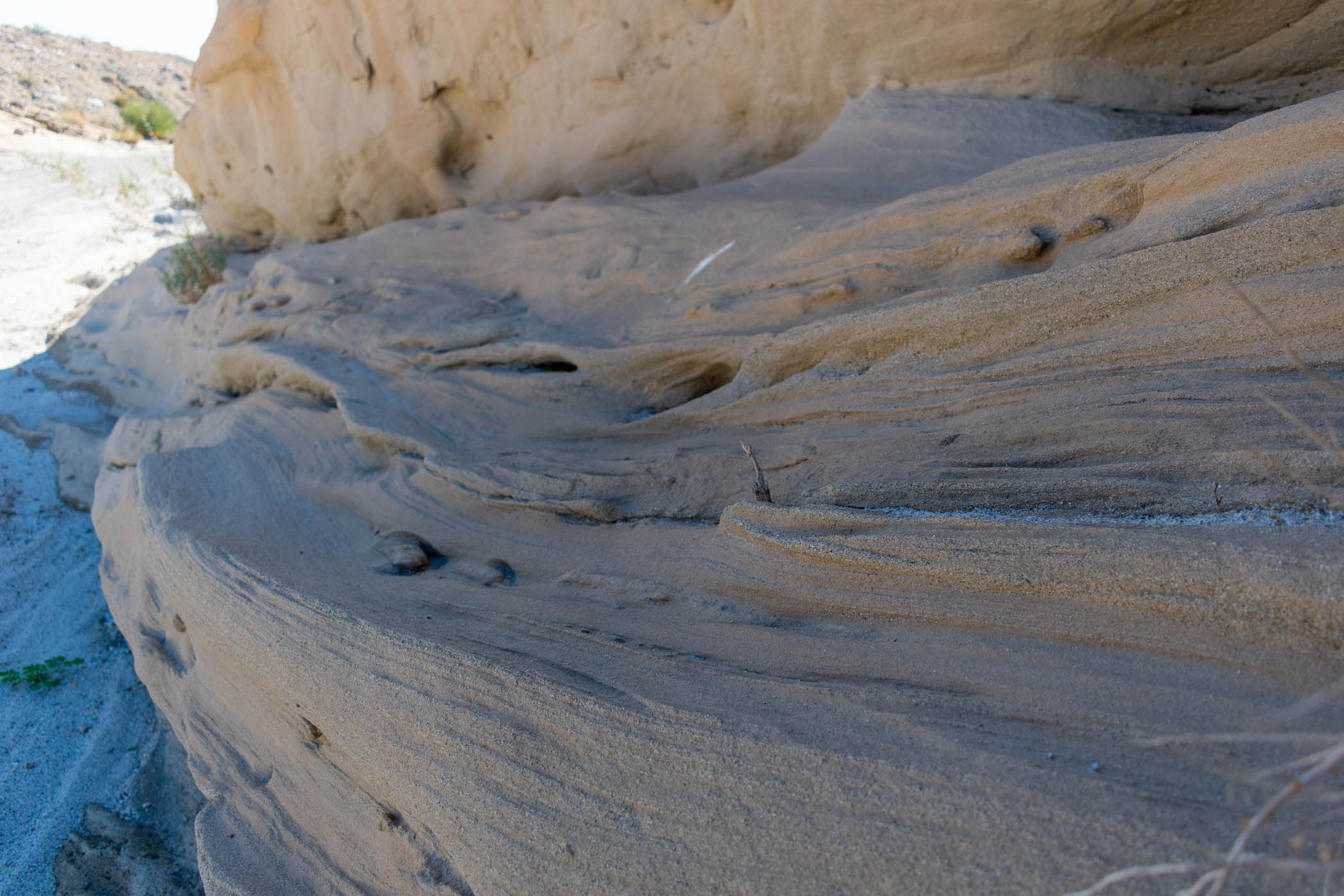
Sandstone Canyon proved to be very interesting itself. Tall, sandstone cliffs on either side, the hiking provided ample shade and the occasional narrow side canyon to peer down. It might be interesting to actually stop and walk down them some day, but again, I hadn’t the time.
A somewhat late lunch was marked at a spot full of Jeeps, including the campers I had started the morning passing through. They stopped to watch others navigate a treacherous section of the canyon for vehicles, and I stopped to chat with them and eat some lunch before continuing on my way.
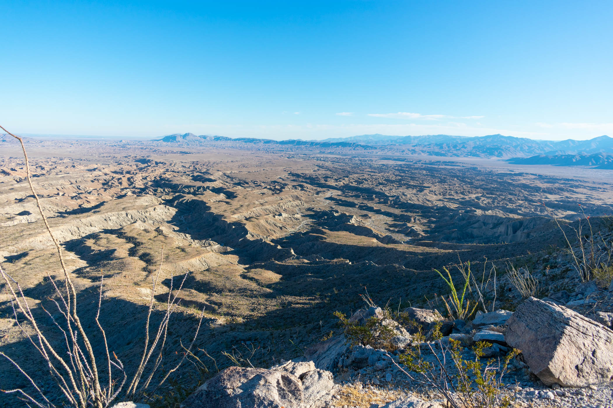
Somewhere in Sandstone Canyon, the plan was to simply start scrambling up to Diablo Peak. My GPS route was taken from Peakbagger, but I had never done it before. The route out of the canyon proved to be steep and exhausting. With no trail and just a steep scramble up undefined, sometimes terrifying near cliffs, I was left once again to embrace the suck. I drank the last of my water before even making it to the high point, with its expansive views over the Carrizo Badlands and Carrizo Valley.
Then it was still another scramble down to June Wash and out to the sandy road where I had left another cache of water. My knees ached and complained as I stepped down boulders and navigated around cacti. The sun began to set as I found easier hiking in June Wash, itself, ultimately finishing to my water cache by headlamp.
Finally reaching my water cache, I found a nearby place to setup camp and went to sleep. Knowing another scramble awaited me that I hadn’t ever done before, I wanted to save it for morning and simply enjoy having a full cache of water at camp.
Day Four: June Wash to Ocotillo Wells
29.39 miles
Another good night of sleep. I was ready to see how far I could make it. I packed up my gear once again and hit the sandy road labeled as June Wash by signs, although it really heads up some unnamed wash. Eventually the road ended, but I continued to follow the wash to its terminus, where tall, steep cliffs dominated. There, the route was… up!
I picked one ridge and started up. This was sketchier than any of the previous scrambling, as it was steep, narrow, and came with little to no clear path. Nonetheless, I made it up and walked along the edge of the fin to find another wash headed down on the other, Western side.
The new wash was riddled with ocotillo, cacti, and other prickly things, as well as plenty of its own rocks and difficulty passing. It remained relatively easy compared to the scramble up the ridge to get there, however, and it eventually joined Arroyo Tapiado.
At this point, having watched the weather, I decided that I would not be following Arroyo Tapiado all of the way. My original, ideal route would follow such, continue on to Indian Gorge, up Sombrero Peak, and so on. One alternate I viewed early on was to head down Arroyo Tapiado and do all of Arroyo Seco del Diablo as well, but this too seemed to be increasingly unmanageable as the incoming weather seemed untenable to walking in these washes. I followed Arroyo Tapiado only as far as I could make a cut over directly to Diablo Drop-off.
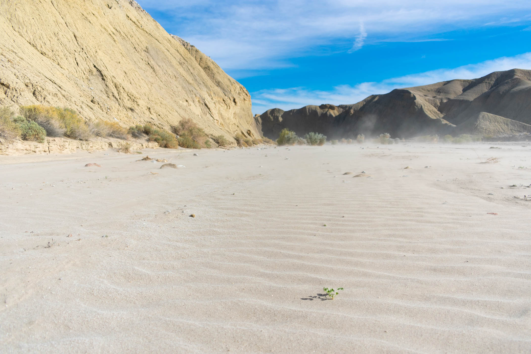
As I made my way down Diablo Drop-off and back on to Fish Creek Wash once again, the wind began picking up, blowing sand everywhere. The occasional car passed by, but I found myself fighting blowing sand in my eyes more than ducking out of the way of vehicles.
Fish Creek Wash carries on through Split Mountain. I stopped to enjoy all of the different geology throughout the area, including large areas of rock absolutely full of shell fossils. While I thoroughly enjoyed the area, including a look at Elephant Knees, I found myself taking few pictures and simply trying to push on.
On the East side of Split Mountain, I grabbed another cache of water as the sun set. I had hoped to still take a route going by the Elephant Trees, but I quickly found myself realizing that it would be pointless in the dark and simply adding miles. As the sun set, I changed my mind and decided to hop onto Split Mountain Road for a long road walk into Ocotillo Wells.
While I have previously complained about the road walk into Borrego Springs that would mark the end of this hike once more, the hike into Ocotillo Wells is truly worse. Much longer and with much less variation, I found myself hiking along by headlamp, desperately wishing it would just end. I passed by the Iron Door bar without stopping, opting to use my last efforts to get to the Ocotillo Wells SVRA campsite that I stayed at Friday night once again.
It seemed to take absolutely forever, but alas, I finally made it. Walking into the campground, I found it significantly darker than the night before, and significantly quieter. It was hard to spot all of the established sites, but I grabbed the first one I saw and called it. It turned out to be the same site I stayed at before, but this time, the sleep came easy and more or less lasted the night.
Day Five: Ocotillo Wells to Borrego Springs
24.21 miles
Once again, I found myself facing a decision about routes. The original route I had hoped to accomplish would set me out to the Pumpkin Patch before traveling through the Borrego Badlands back to Borrego Springs. Unfortunately, for that route, I was looking at 40 or so miles, which seemed untenable for wanting to finish on this very day, before the forecasted storms came in. The alternative I had drawn would take me back through The Slot, essentially repeating my first day, but I wanted something new. I took out my topographic map and began planning something entirely new, winging it.
I headed North along the main road of the camping area, making my way to Fault Wash. While unsure if this would work out at all, I found myself having a great relief when I spotted a sign clearly marking Fault Wash. I turned on the barely visible wash and followed it North for what seemed like forever.
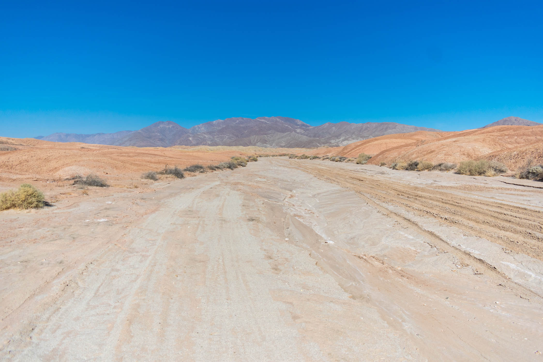
Fault Wash seems to start off somewhat barren, but it really only becomes more so as one progresses up its windy reaches. Where the beginning is marked by small bushes and the occasional larger tree, small cliffs begin to mark its edges before the terrain turns into small hills of various, barren, muddy hills with nothing truly standing upon them. I found myself thoroughly enjoying the variety of geological formations along the entire way.
As tall fins began to mark the sides of the route instead of the colorful, muddy hills, the route went through a sharp turn and suddenly ended in Short Wash. From there, I followed Short Wash on to Fonts Point Wash before making my way up to Inspiration Point, a familiar marker of past hikes out in this desert.
From Inspiration Point, it was a drop down to Inspiration Wash and out to Palm Canyon Drive to Borrego Springs, which is a familiar route to me from previous hikes, too. I always enjoy the short variety of badlands formations along Inspiration Wash, and this time was no different. Somewhat surprising to me, however, as the intricate formations turned increasingly into sand dunes and cliffs of compacted sand, the ground became increasingly saturated with water, at times leaving me struggling to keep my footing.
Contrary to previous excursions, I chose to jump up to the sand dunes of Old Springs Road Preserve. With the sun setting, I found a route that I hoped would send me on to the main road, and sure enough, it worked out. Navigating the sand dunes by headlamp, I made my way back to the main road to head onward toward Borrego Springs.
As I walked along Palm Canyon Drive again, I checked my phone and found a message left from a local sheriff, calling to inquire about my car left parked in Borrego Springs. Trying to return the call, no one answered. I left a message stating I was on my way to pick up my car, but was left with no idea whether or not my car would actually be there. The road walk after this seemed to go by the fastest it ever has for me. Perhaps fueled by anxiety about the possibility of having no car to return to, I found this road walk easier than ever before.
Alas, my car was still there at the end, although given good evidence that this parking spot isn’t a good choice for the future. I changed my clothes into something clean and headed out, the hike successful.
Conclusions About The Route
While I mention some of the changes I would have liked to do in this hike already, my full route would have continued South further as well as including a stop out to the Pumpkin Patch on the Northern end. On the Eastern end of the more central sections, I would have included a stop at the Elephant Trees area as well. That said, I feel the need to explain the Southern end better.
Ideally, I would have continued down Arroyo Tapiado, eventually making my way out to Indian Gorge and up Sombrero Peak. From Sombrero Peak, a jaunt along the In-Ko-Pah mountains would lead me to Gasp Benchmark, following the ridge down into Carrizo Canyon and out to Sweeney Canyon. That would lead to the Carrizo Badlands Overlook, down Canyon Sin Nombre, and up Arroyo Seco del Diablo.
Small side-trips that I skipped along the way include the Mud Palisades, Vista del Malpais, and Font’s Point.
At one point, I was hoping to include a route through the Ocotillo Badlands just to the East of Ocotillo Wells. However, continuing research on that possibility hasn’t been promising, as private land issues exist with significant portions of it, and there is not a clear route that would work. I do still have some interest, but unfortunately, that may not be an option looking forward.
Between my previous 80 mile one-way route, this new loop, and prior day hikes I’ve done, I believe that I have proven the viability of the full route, including possible alternates and possibilities of shortened versions. While I would have loved to actually complete the whole thing, I will have to save that for another time and just be satisfied with the proof of it as a valid route this time.


I’m sure that in the first paragraph of this blog, you really meant to say “November” 22, not “December”. If that’s the case, I’m sure you can edit it.
Oh my! Good catch! Fixed. Thank you!