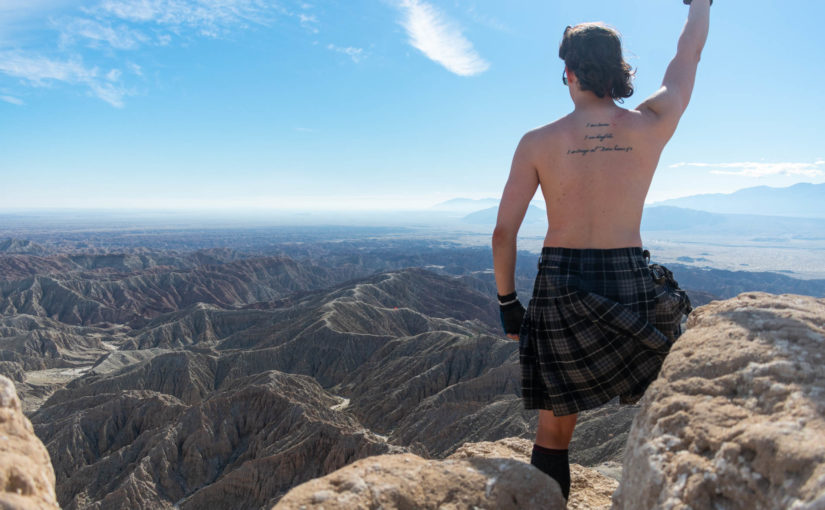
I woke Thursday morning to temperatures hovering around freezing, cold as hell in Blair Valley. Struggling to gain the motivation to pack up my gear and begin heading out, I delayed as the sun rose. Within hours, I would be setting off on a planned nine day adventure to finally complete the Anza Borrego Badlands Route that I had been working on for the last year, taking over 180 miles of hiking and another 25 miles of hitchhiking to complete a full loop through the desert.
Day One: Cottonwood Campground to Carrizo Canyon
14.14 miles
Once I finally got myself out of bed and packed up, I headed to Cottonwood Campground in McCain Valley Recreation Area outside of Boulevard, CA to begin my trip. All prepared, I hit the trail around 10am–later than I had originally desired, but late enough for the sun to rise and begin warming up the morning.
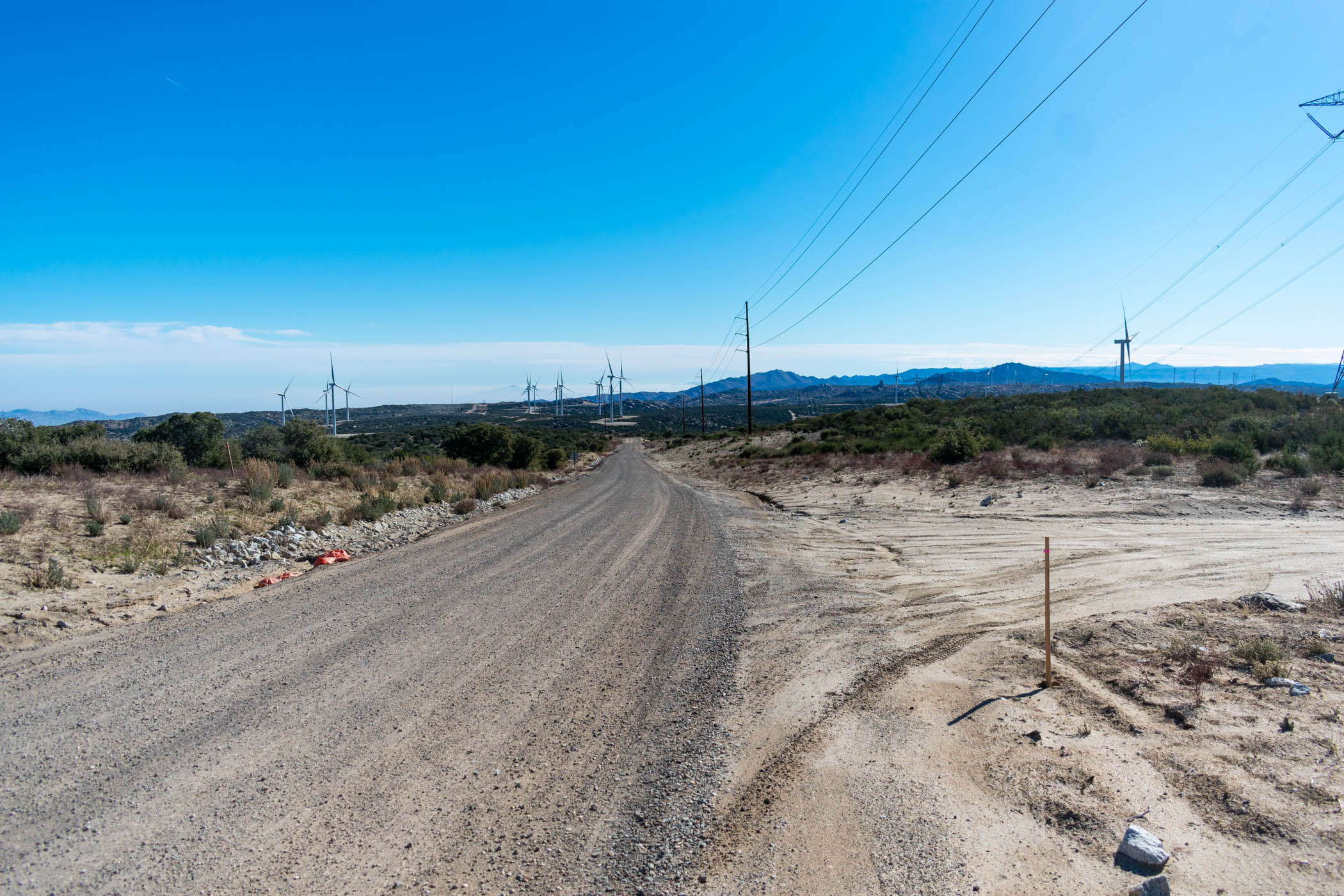
Leaving Cottonwood Campground, the hike began along a well manicured dirt road. Some construction crews were working on maintaining a section as I drove in, and I walked by en route to the high point of the entire hike, located just shortly after the beginning. From there, the rest of the day was spent hiking downhill.
Along the road, I turned on Audible and began by listening to the book “How to Hide an Empire: A History of the Greater United States” by Daniel Immerwahr. I really enjoyed listening to this book, covering the history of US Imperialism, from the times of conquering the continental US over indigenous tribes, to the Phillipines and other colonies, to today’s effects of globalization as an effective global colonization of its own kind.
I found the book especially fitting as I also slowly work my way through “Drug Warriors and Their Prey: From Police Power to Police State” by Richard Lawrence Miller. The book essentially argues that the War on Drugs is effectively a slow holocaust and a war on ordinary people (worth noting: the Holocaust was on ordinary people). In a world where we worry so much about foreign gangs that got their start in US prisons as an effect of our War on Drugs, I can’t help but find the connections between these two books. Of course, as a student, I’ve largely focused my studies on addiction and substance abuse, so it’s also the main topic of US imperialism that comes to mind for me. These books work together to form an interesting history and lens at the damage the US has done in the name of its own, often entirely misdirected, interests.
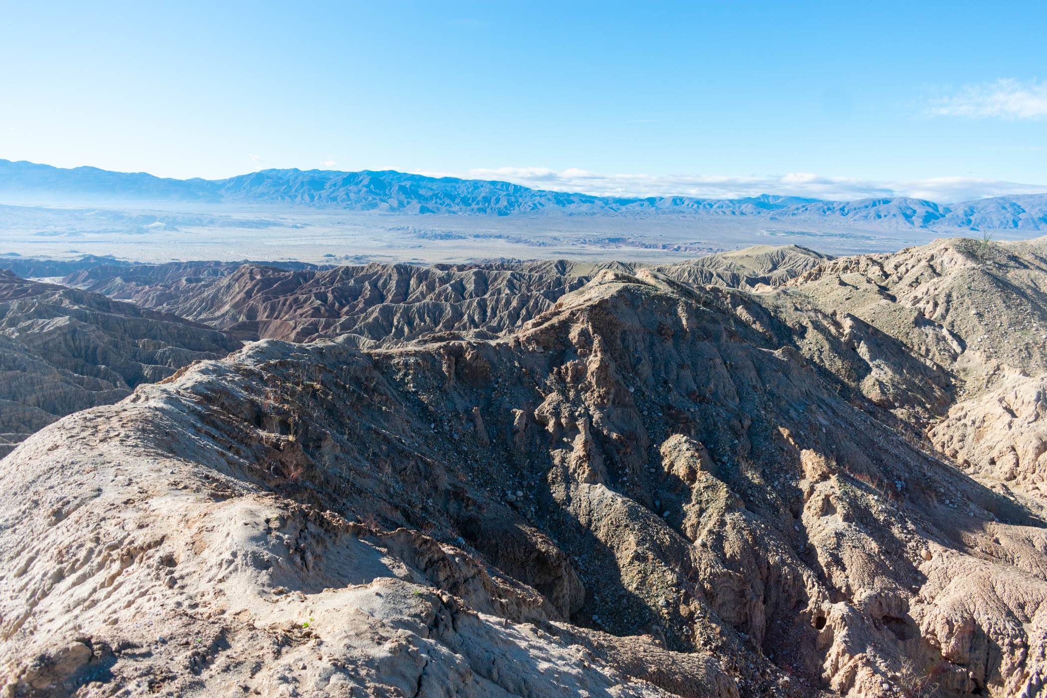
Eventually, I hit a point I had marked on my GPS, where a trail verged off to the left. Taking the route, I followed my route as it descended the mountains en route to Gasp Benchmark, eventually vanishing atop the ridge marked by the benchmark.
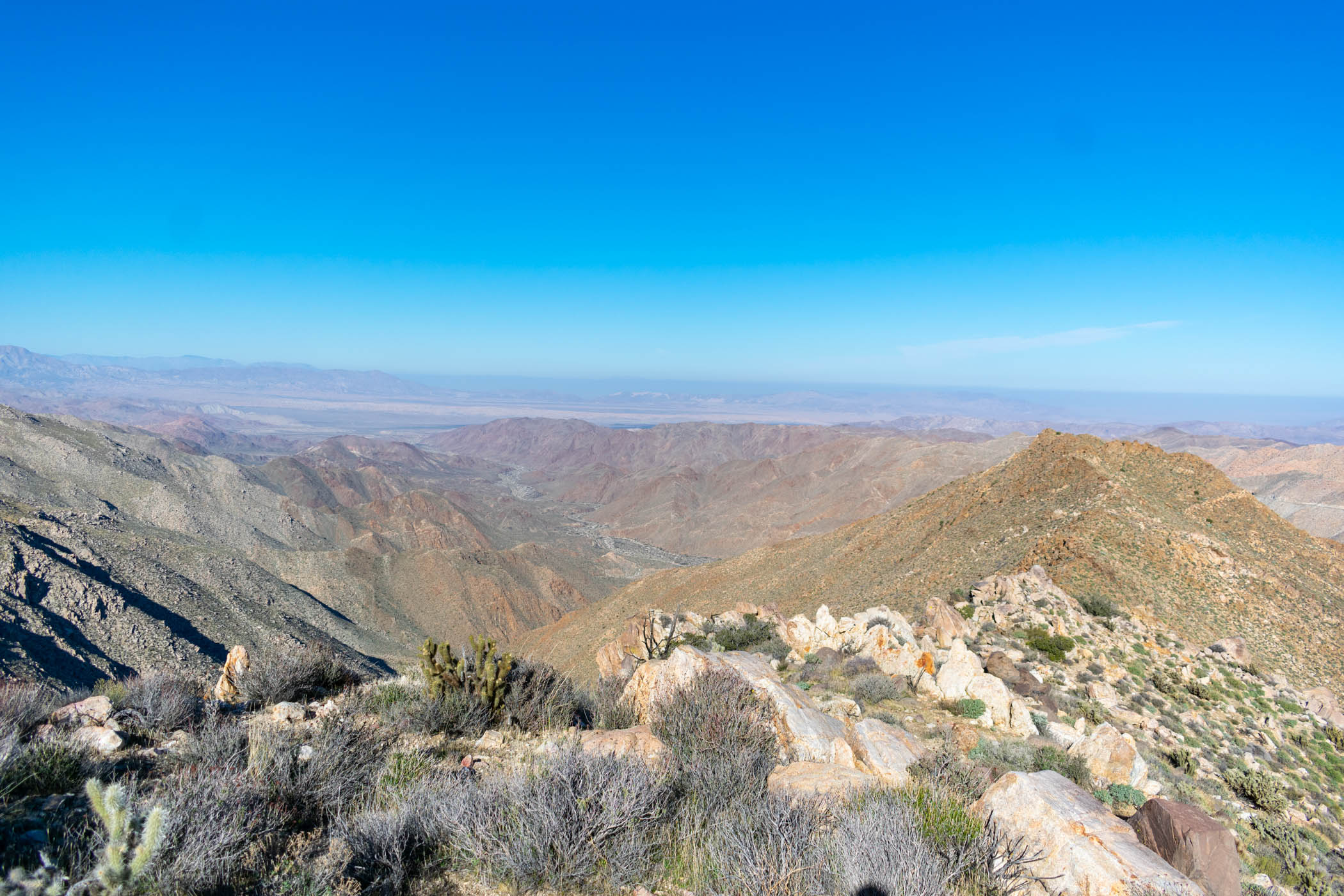
The ridge down to Gasp Benchmark has long been one of my favorites. The first time that I tried an attempt at a hike throughout the badlands, I made it a point to begin with this hike, and I missed doing it in my second attempt. While the scrambling is long and tiring, the way to Gasp Benchmark, itself, is an absolutely fun hike.
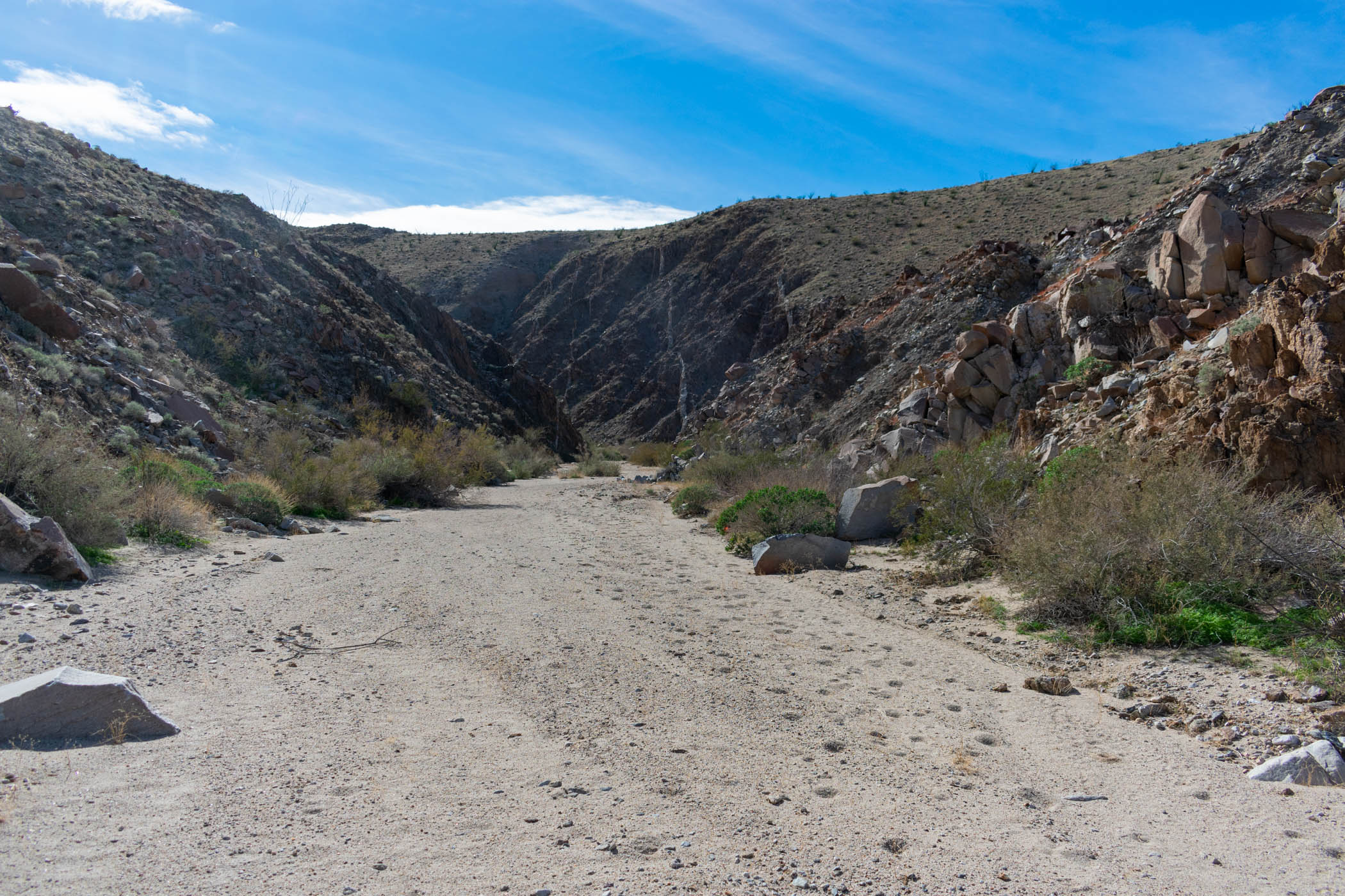
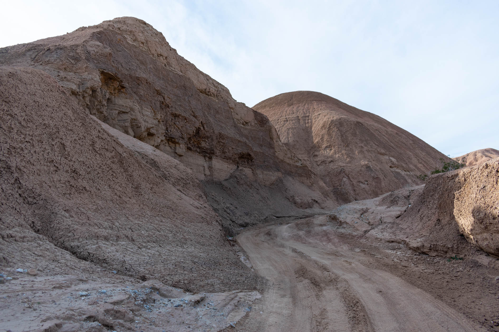
I found the peak register and continued my way traveling down the ridge, dropping into Carrizo Canyon. As the sun began to set, I still hadn’t made it nearly as far as I wish I had. In the interest of not trying to route find at night, I dropped down into the side canyon closest and began trying to follow it out to Carrizo Canyon, itself. This proved difficult, with the route not always easy to find, covered in thick brush, palm trees, and boulders.
By the time I made it out of the side canyon and into Carrizo Canyon, itself, the night had set. It was dark, and I followed the wash. When I had hike it previously, I was able to spot and follow a trail cutting wonderfully through the area, but by headlamp, it seemed impossible. I struggled through the rough ground of the wash, taking turn after turn instead of the shorter route defined by the trail.
Alas, I made it to the end of the road–or rather, the beginning of the road, coming from back within the canyon. I had some concern about rain and wind for the night, so I set up my tarp in a clearing just there and turned in for the night, exhausted.
Day Two: Sweeney Canyon to Arroyo Seco del Diablo
21.51 miles
Waking up in Carrizo Canyon, I packed up and headed out. I hit my first water cache early in the morning, filling my water bottles and continuing the hike out to Sweeney Pass Road.
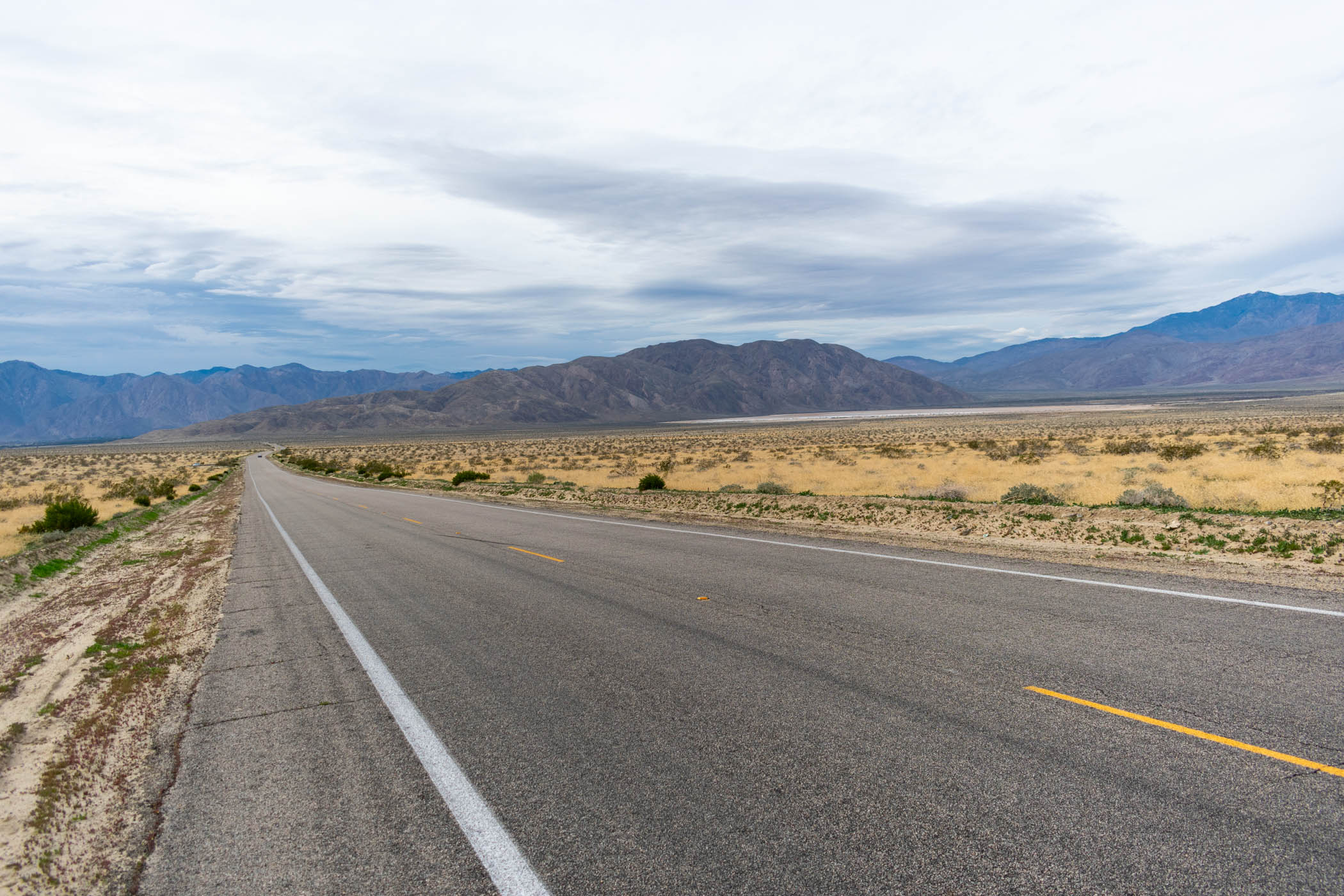
As I turned on to Sweeney Pass Road and began hiking further South once again, an RV passed and pulled over to the side. A lady walked back to meet me and check if I was okay; of course, I was. It was nice to be approached by a kind stranger checking in on a random hiker along the road, but I needed nothing. I continued hiking, turning off of the road to make way up Sweeney Canyon.
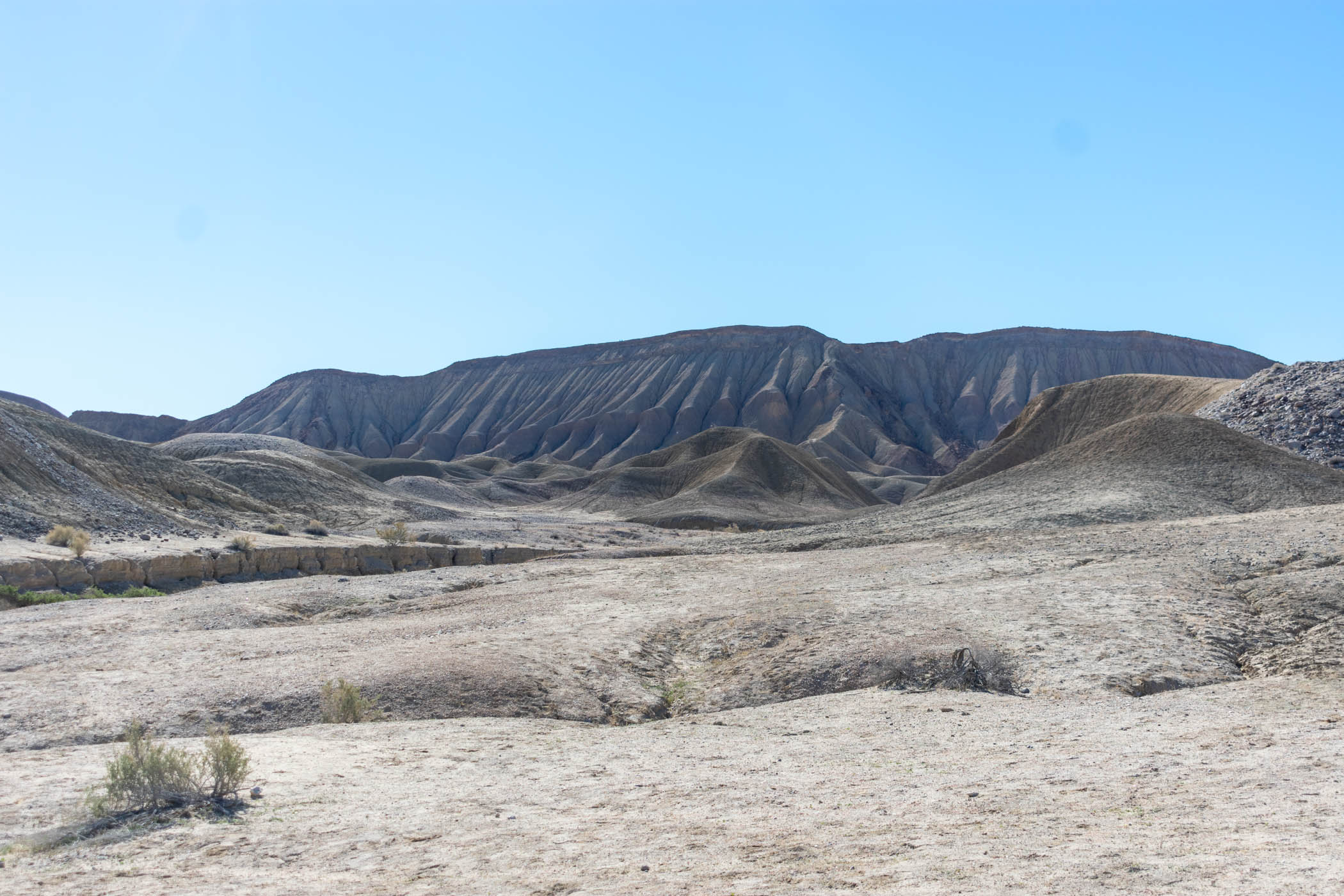
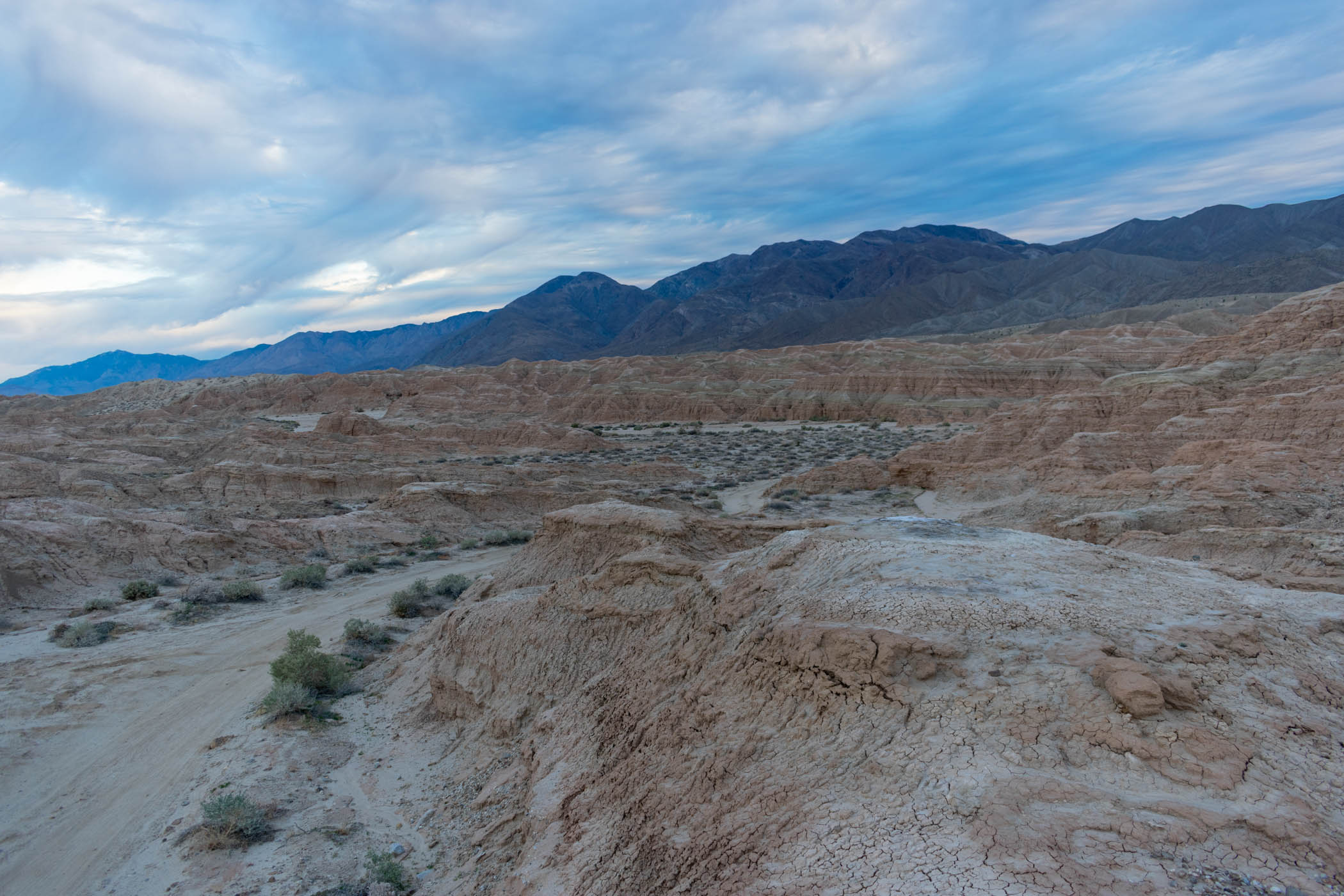
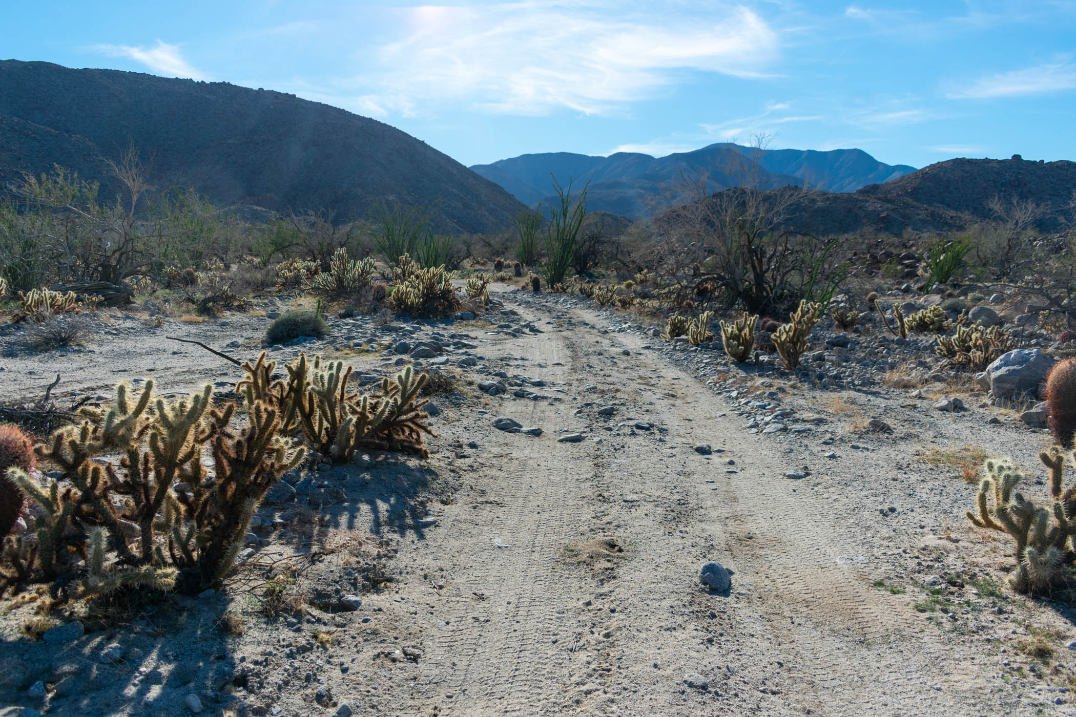
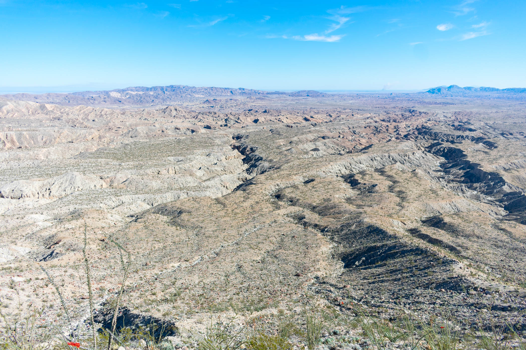
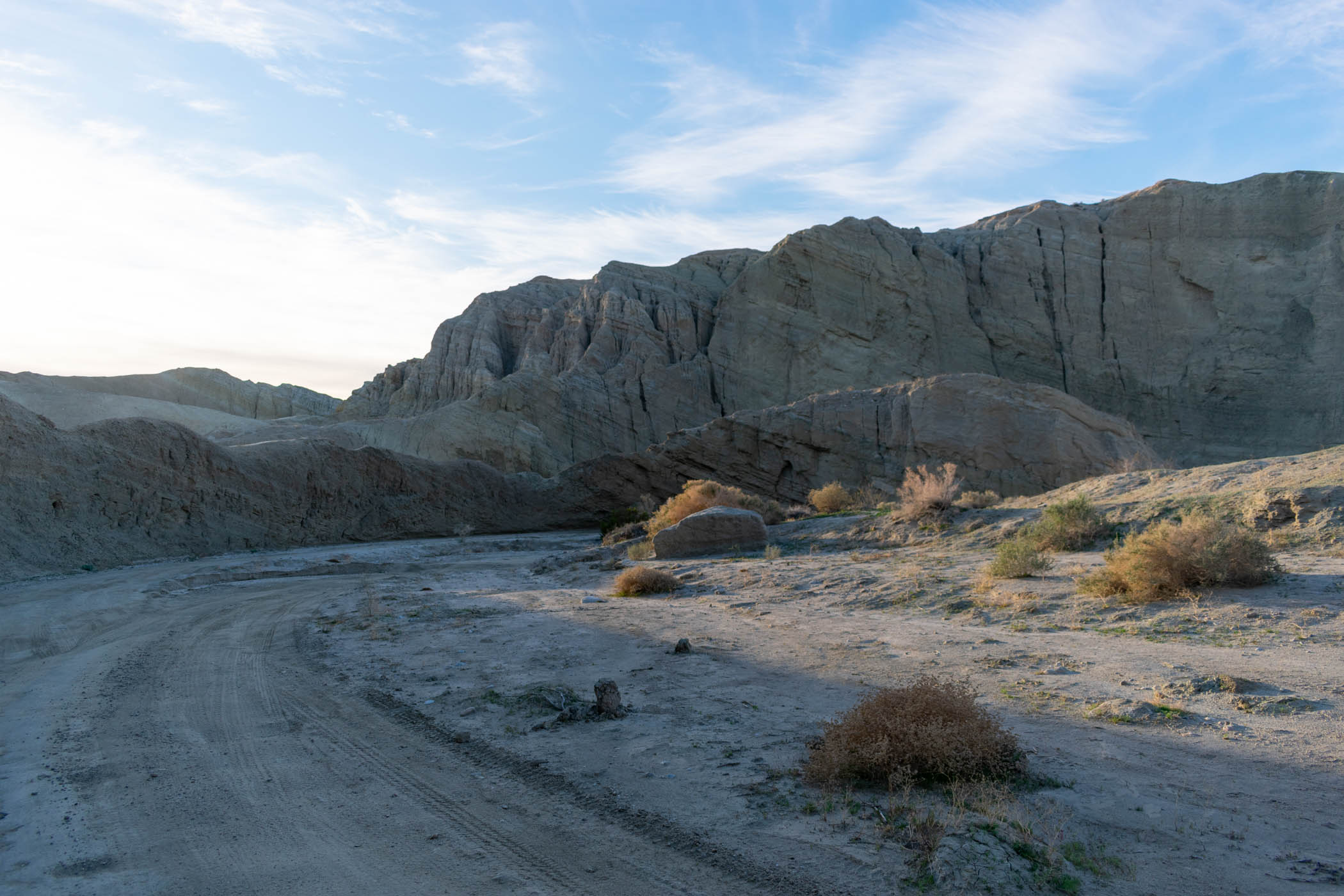
Sweeney Canyon is a really interesting spot, narrowing into walls of multi colored rock before opening wide and flat once again. I was excited to be traveling down the canyon again, making my way up towards Carrizo Badlands Overlook, a favorite campsite of mine.
Stopping to eat at the overlook, I eventually made my way down into the badlands, themselves, following a rough use trail down to the main wash cutting out Canyon Sin Nombre.
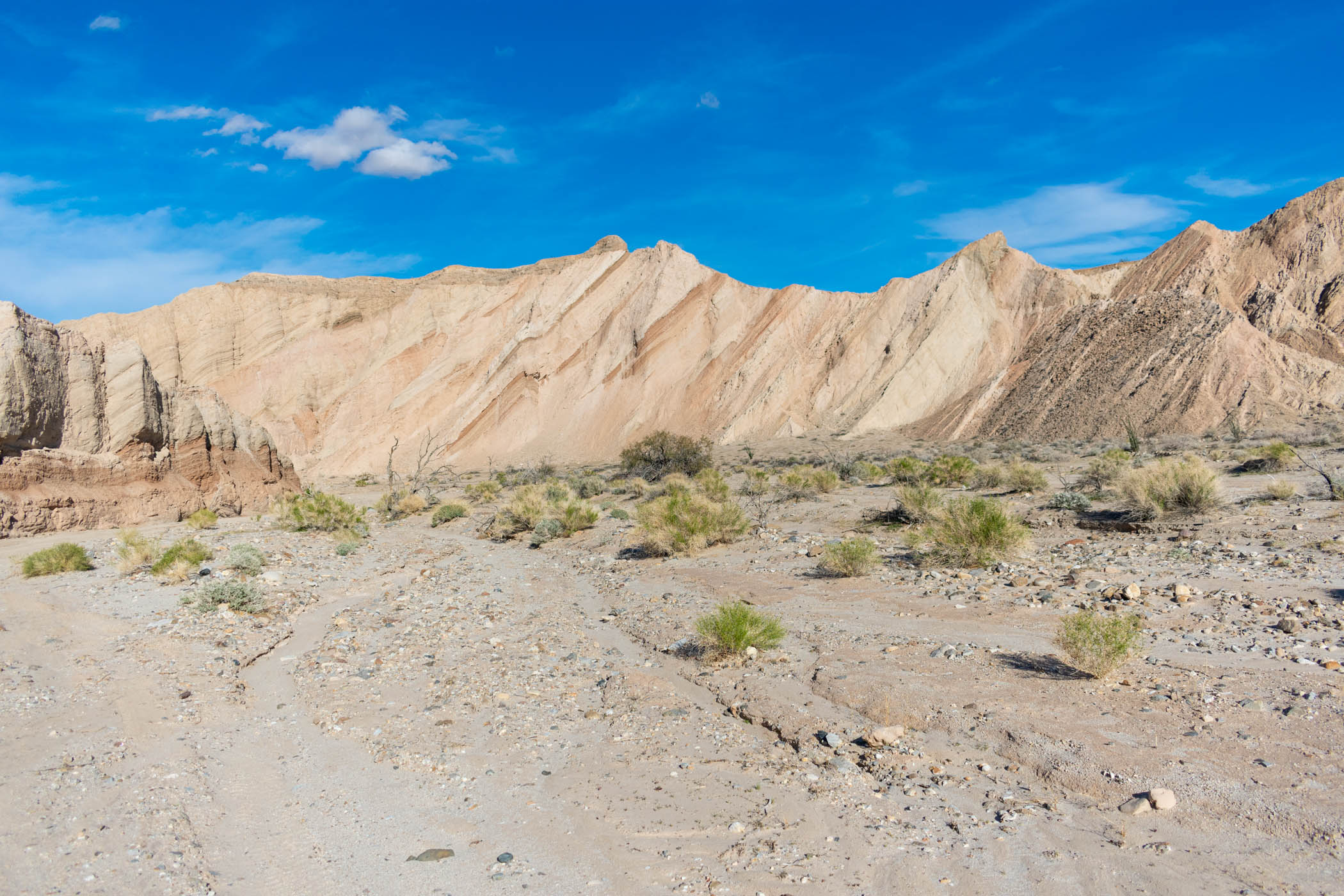
Canyon Sin Nombre is especially a favorite of mine. The varieties of stone walls making the canyon, with side trips of slot canyons and all kinds of fun, it’s an especially enjoyable canyon. I stopped to take a break near the mouth of one slot canyon.
As I sat in the shade, enjoying my rest, a man who was camping nearby spotted me and came to chat. We chatted about hiking and life. He was newly retired after spending many years as a school teacher, and he was especially interested in how I’ve been living my life and what kind of hike I was doing this time. I showed him the full route on my map, talked about quitting my job due to harassment, and Buddhism versus Christianity. I enjoyed the conversation before getting up and moving on.
The route became entirely uneventful after this. I hiked through Vallecito Creek, seeing a few jeeps drive by, exploring their own way. The sun set as I made my way into Arroyo Seco del Diablo, preventing me from taking any pictures of the tall canyon walls as I walked through. I walked for a while by headlamp, nearly all of the way through the canyon, before I found a decent spot to setup camp and called it a night.
As I finished my first audiobook, I turned on another: “Gender Mosaic: Beyond the Myth of the Male and Female Brain” by Daphna Joel, PhD and Luba Vikhanski. Joel is a neuroscientist who took studies showing differences in male and female brains and behaviors and expanded on them further to show that every individual has their own, unique mosaic of “male”, “female”, and intermediate traits. As a non-binary person, I love this perspective, and I further love that the authors argue for a world where we don’t judge everyone based on their genitals. This isn’t a place for a book review, but this is a book I would recommend.
Day Three: Fish Creek Wash to Ocotillo Wells
15.13 miles plus 7.85 miles hitched
In the morning, I woke and set on to Diablo Dropoff, clearly near where I set up camp for the night. The first time I hiked through the area, I really enjoyed the viewpoint, and I stopped to admire a small Christmas tree someone had setup once again.
Dropping down to Fish Creek Wash, I made the way to Elephant Knees and Split Mountain, enjoying the regular views of different land formations along the way. I stopped to eat lunch at Elephant Knees and hiked speedily through Split Mountain as line after line of cars made their way to also check out the area.
Along the way, I finished “Gender Mosaic” and turned on Audible’s version of “The Federalist Papers”. I would make it through some thirty or so of the papers but wouldn’t finish them. Thinking that I am currently in an American Politics course, it seemed fitting, but it is also pretty heavy listening. I enjoyed it for a while.
On the other side of Split Mountain, I stopped by the Fish Creek Campsite before continuing on and turning off the wash into the open desert, heading cross-country towards the Elephant Trees area. The last time I was thinking of attempting this, the sun was already setting and I thought it a bad idea, but this time, it remained quite early. I set off on the route.
While my GPS track was drawn following a wash, I thought it might be easy enough to attempt going simply cross-country in a more direct path. As it turned out, the way was difficult hiking, constantly going up and down over rows of stacked granitic stone, through one small wash after another. Eventually, I met up with the large wash taking me out to the Elephant Trees parking area, but the hike left me exhausted after fewer miles.
I quickly found a spot to stop and sit at the parking area, and almost immediately a group of women came in from the trail to the actual, surviving Elephant Tree. I had missed seeing the tree myself, but they offered me a ride into town. I found myself unable to escape taking them up on it.
Along the way, the women sang me happy birthday–it was my birthday after all–and reminded me that the campgrounds at Ocotillo Wells would likely be busy for the holiday weekend. Nonetheless, they dropped me off at the bathrooms to figure things out.
I found a spot in the campground that I could setup my tarp to block out the light from all of the off-road vehicles around the area. After doing a bit of homework for school, I put in my headphones to block out all of the noise and fell asleep soundly for the night.
Day Four: Pumpkin Patch to Short Wash
22.35 miles
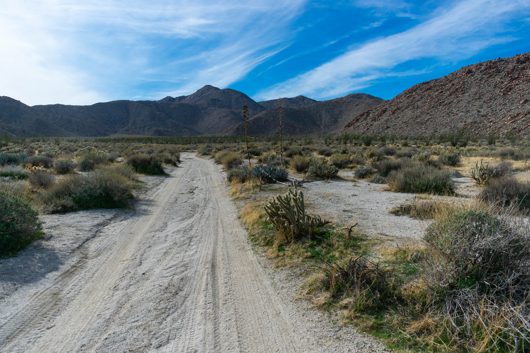
After an early evening the day before, I woke early and set on up the trail from the Red Runner Base Camp area, heading east on Shell Reef Expressway. As the morning progressed, more and more off-road vehicles passed me by, but I continued hiking on until I made it to East Bank Wash. One man who was on a “Make a Wish” trip with his son stopped to interview me with his GoPro, noting my outfit of a kilt and umbrella. A couple of jeeps full of women screamed at me about how they liked my kilt–something inescapably weird to me, to be honest.
The hiking was pretty straightforward and easy to start off the day, although the sand was deep and difficult. From Shell Reef Expressway, I followed East Bank Wash up to Pumpkin Patch Trail, where the scenery actually turned into something new.
Feeling somewhat burned out on listening to “The Federalist Papers”, I switched gears and listened to “Utopia for Realists: How We Can Build The Ideal World” by Rutger Bregman. Bregman envisions a “utopia” in which everyone is given a universal basic income, a 15-hour work week is implemented, and the world embraced open borders. I am essentially for all of these things, especially the universal basic income and open borders concepts, so I found the dive through the concepts interesting and fun.
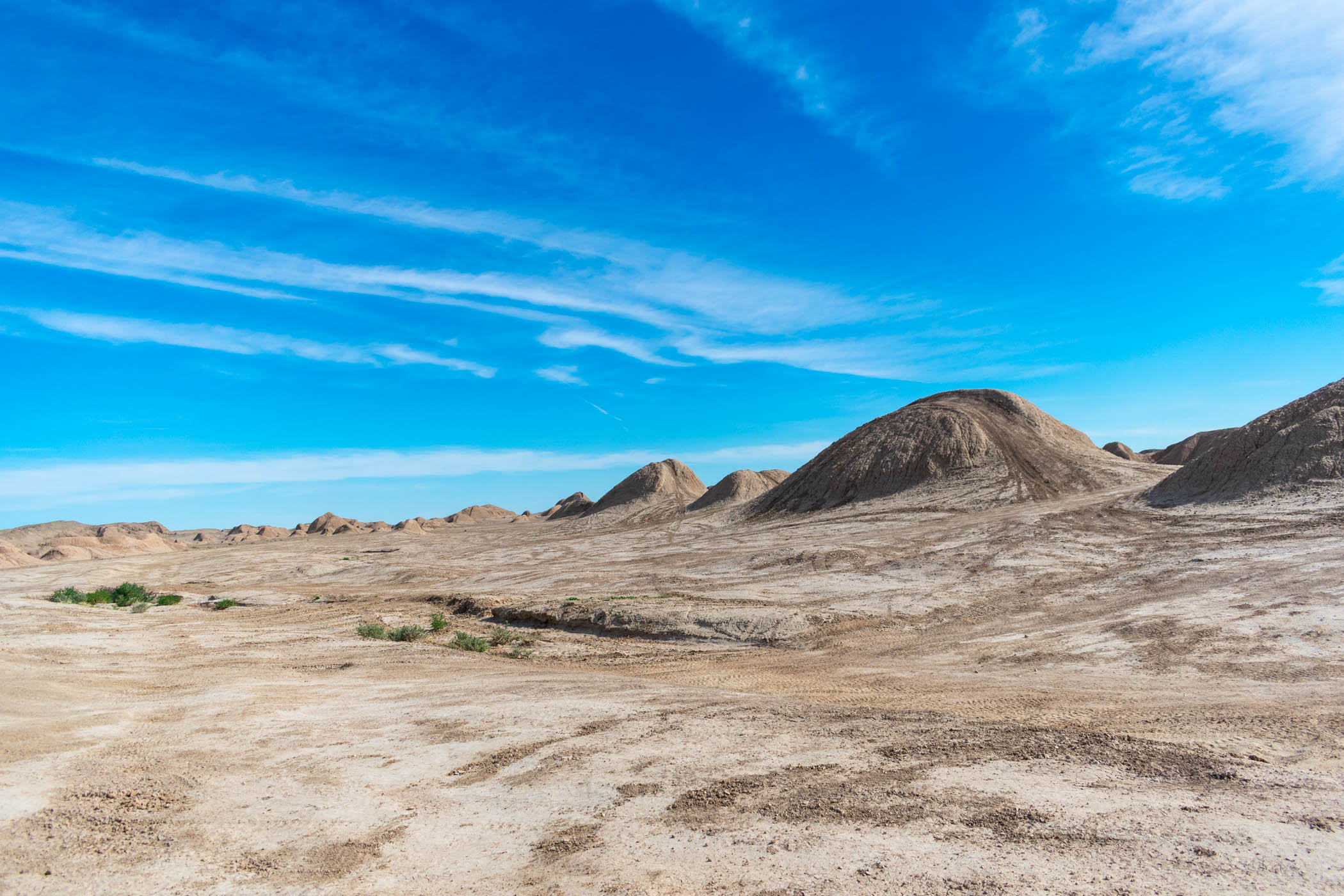
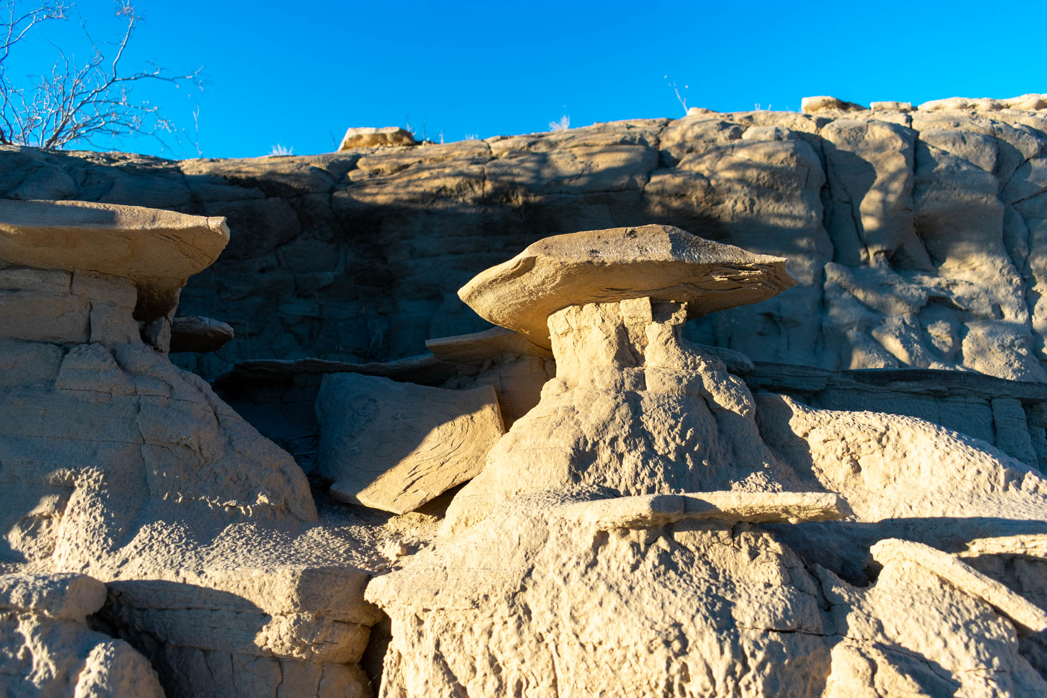
I really enjoyed hiking along Pumpkin Patch Trail. I had to regularly step aside for one off-road vehicle after another, but I kept on hiking on, enjoying the increasingly complex scenery of the badlands. Small fields of concretions would dot the way, but as I got to the Pumpkin Patch, itself, the large concretions behind the fence stood out even above those I had seen along the way.
I stopped at the Pumpkin Patch, taking a break, before heading out on Tule Wash, headed to Basin Wash. Basin Wash was a real highlight for me. While the concretions and varied terrain of the day was interesting, the cliffs of mud on either side in Basin Wash created a particularly interesting scene. As the wash ended and the way turned up the mud hills to the first part of the Cut-Off Trail, I thoroughly enjoyed the terrain I hadn’t expected seeing at this point of the hike.
Once the Cut-Off Trail dropped into washes and crossed over East Bank Wash once again, it became rather dull. Double track marks a lot of this hike, but until the trail met with Fault Wash, it was largely just through nearly level fields of desert brush.
I got onto Fault Wash as the sun set and began following it north. The last time that I attempted this hike, I enjoyed a long section of Fault Wash by day, but after Basin Wash this day, already, I felt like I wasn’t particularly missing a lot hiking it by headlamp. I hiked until I met up with what was supposed to be a water cache I left in the badlands, off of Short Wash.
As I arrived at my water cache, however, it was gone. I had written my name on a gallon of water and dated it for February 1, presumably giving me time to pick it up after some recovery at the end of the hike. However, the gallon was entirely gone. Even worse, I drank all of my water en route, assuming that I didn’t need to ration with a water cache coming so soon.
I thankfully had cell service on a nearby hill, which I climbed up and made a post on social media complaining about the loss of my water cache. However, I didn’t want to hang out on the hill all night, so I climbed back down, setup camp, and went to sleep.
Day Five: Borrego Springs and Back
18.44 miles plus 13.89 mile and 3.07 mile hitches
As I woke up in the morning, I quickly packed up my gear and headed up the hill to check if I had any messages about my missing water cache. As it turned out, my father texted me that he tried to drop off a gallon of water down Palo Verde Wash, leaving me vague GPS coordinates. I decided to head down and see if I could find it instead of continuing on my planned route.
As I hiked down Palo Verde Wash, I looked side to side in the area of the GPS coordinates I was sent, but I never spotted any water gallon. There was simply nothing but the desert plants inhabiting the wash.
I kept hiking out to the road, briefly looking around as I went.
Reaching the road, some six or so miles from where I had begun and still without any water, I ran across the street and stuck my thumb out to the first car that headed down the road in the direction of Borrego Springs. And this time, luck payed out–the car stopped and picked me up.
An older man stopped, whose wife had died a couple of months earlier. He was visiting a car show for old cars, which he personally spent a lot of time restoring himself. He spent the drive describing a lot of his life and recent thoughts with me. He talked for some time about having his feminine side, which I thoroughly enjoyed listening to as a queer, non-binary person, although he didn’t seem to mean in that way. He took me first to pick up his dog from a dog-sitter, talking about how the dog was struggling with the loss of his wife as well. Finally, he dropped me off at Christmas Circle.
Filling up my water at Christmas Circle, I also dropped into the nearby liquor store. I chugged down a bottle of Dr Pepper, munched on some Skittles, and began walking down the road back towards the badlands.
Would I try to get all of the way back to Palo Verde Wash? Would I just say forget it and skip a major section? I wasn’t sure. I stopped to eat lunch outside of the airport and contemplated after checking with a local off-road tour company and deciding it would cost far too much to be dropped off back where I had started the day.
As I made my way further down the road, I tried to see if I could get someone to hitch me a ride once again, hoping to make it out to Palo Verde Wash. One person stopped but was only going to Old Springs Road Preserve. I decided to pass and just hike the distance if that was what I was going to do.
Finally, a Jeep pulled over. As I opened the door, the man driving immediately asked, “Does the Jeep look familiar?” It certainly did! As a strange twist of fate, it was the husband of one of the women who picked me up near the Elephant Tree area, giving me a ride into Ocotillo Wells. The Jeep was the same Jeep I had ridden in just days prior. He took me out to Pegleg Road–only a few miles at that point–and told me about how someone had recently set the palm trees of Palm Canyon on fire–truly a tragedy.
From where I was dropped off at, across from the intersection with Pegleg Road, I continued hiking along the road. I stopped to call my father once again, seeing if he could give me better insight on where to look for the water he had tried to drop off. He gave me some tips, and I continued hiking on towards Palo Verde Wash.
Along the way, I spotted a van across the street at a turnout, and for whatever reason, I thought that the turnout looked like a good place to stop to rest for a moment. I crossed the street, and almost immediately, a woman popped out of the van asking me if I wanted an orange. It was a delicious orange. Probably the best damn orange I’ve ever had. It might be the hiking talking.
I turned on Pink Floyd’s “The Wall” to make the last of the hike. Like a mad man, hiking down the road and eventually washes, belting out the lyrics I have almost entirely memorized at this point. This remains my favorite album and it motivates me in my hiking surprisingly well.
Finally, I reached and began heading back down Palo Verde Wash once again, making the 6 mile or so journey back to where I had begun. I kept a strong eye open for the gallon of water my father tried to leave for me, but there was simply no water. Instead, I simply tried to ration my water to leave enough for the next day.
Alas, I setup camp at the same spot I had the night before. I climbed the hill to call my father to ensure him I was going to be alright. As I spoke to him, I also checked the weather again, seeing a chance for rain overnight. As I setup camp, I set my tarp.
I seemed to have left one of my stakes back at Ocotillo Wells, but I was able to find a small stick that sufficed. Luck.
Day Six: Fonts Point to The Slot
25.69 miles
Waking at about 2am, a small but regular pattering of rain hit my tarp. As expected, there was the chance of a little bit of rain. I didn’t think much of it and allowed myself back to sleep.
Awaking again, I looked around outside, noting that the wash seemed to be lit as if by streetlights. Suddenly a flash flood came pouring down the wash. I began yelling frantically to myself, questioning what I was going to do with a flash flood rushing down the wash I was meant to be hiking in come morning.
I awoke again. There was no flash flood. It was just a dream. But sure enough, a much heavier rain was falling upon my tarp. My feet were wet. It was significantly dark–dark enough to not see well outside. My feet were wet. I thought for a moment about the risk of flash flood in the wash, but I was camped further up the hill. But my feet were wet…
My feet were wet?!
The rain on one side was falling down my tarp, directly into my bathtub groundsheet. There was a pool of water, and my gear was soaking it all up, including my now very wet quilt. I made several adjustments in the dark, attempted to drain the puddle out of my groundsheet, and tried to sleep the rest of the night. The sleep was uneasy, but successful.
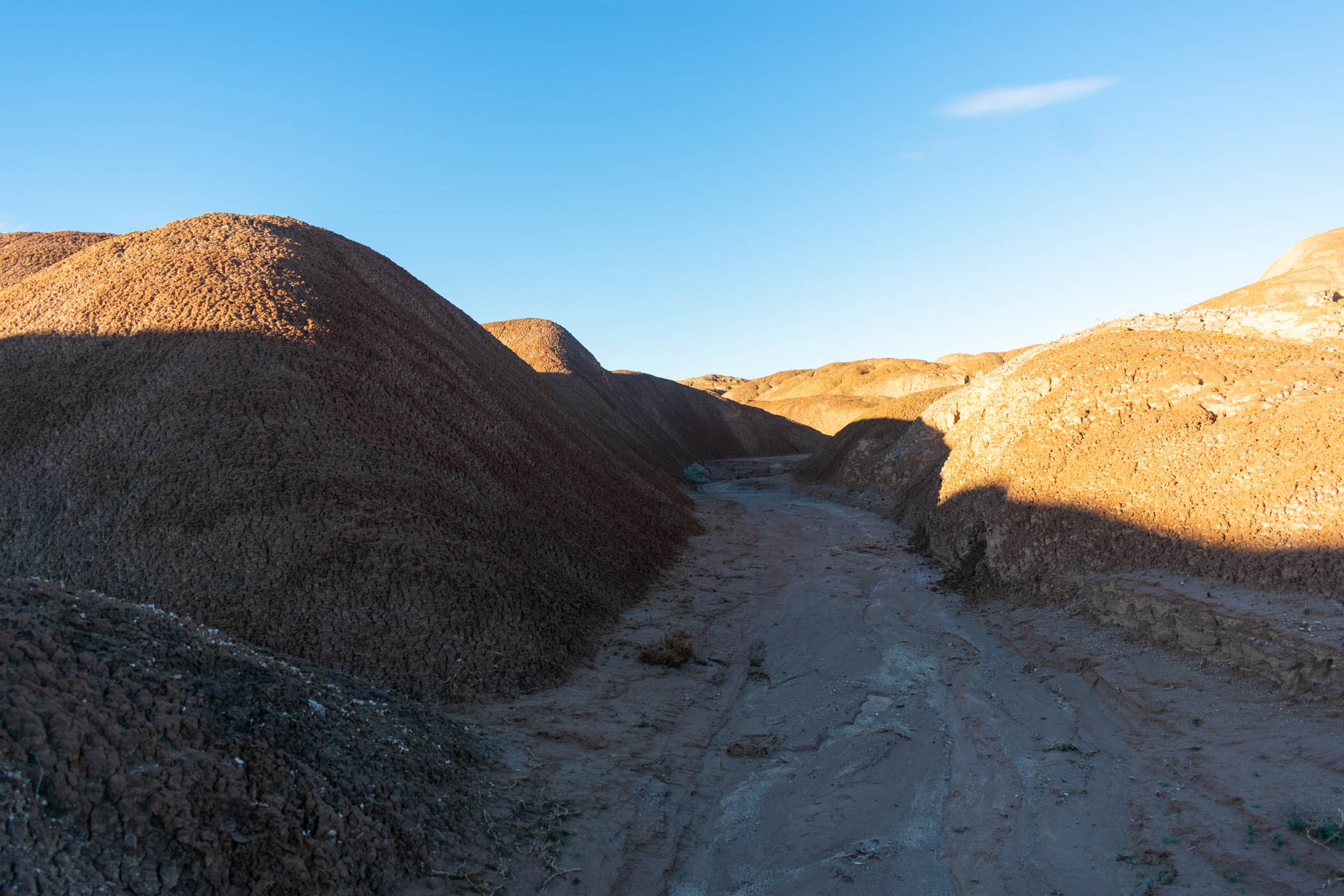
Finally waking up to a wet ground but no more rain, I packed up my wet gear and hit the trail again. This time, I wasn’t entirely sure of the route I was going. I had done most of the route as a day hike a couple weeks before, but I wasn’t sure about finding the connection. It was a maze of now quite wet mud washes, increasingly narrow as I progressed up them.
I turned on “The Information: A History, A Theory, A Flood” by James Gleick. I really enjoyed his more well known book, “Chaos”, and information theory is another important addition–especially in my own fields of both psychology and computer science. I enjoyed the history of the theory and much of went with it as I hiked along.
Eventually, finding my way around, I made it to a set of cairns directing a way up the mud hills. I climbed up the wet mud, my feet caked in a thick under-layer of the red stuff as I went. I worried to myself about the possibility of rain carving tunnels in the hills, but I continued, making my way up.
Alas, I made it up to the cliffs that would ultimately terminate in Fonts Point. The way was a lot of ups and downs, and I promptly marked one spine on my GPS as, “Don’t Die Spine”, due to a sharp drop off on the left and an uneasy drop off on the right, in spots so thin it was hard to find footing. Ultimately, it probably felt significantly more dangerous than it was, as I’m terrified of heights–this absolutely activated that fear.
Making it to Fonts Point, I stopped and took in the views as I ate lunch. In my previous journeys to Fonts Point, there was always a crowd, but this time: nothing. I had the entire area to myself. I enjoyed it while I could and headed on to Inspiration Point.
From Inspiration Point, the track was more familiar to me. Following a track I had done several times before this, I dropped down Inspiration Wash before making my ways out to the sand dunes of Old Springs Road Preserve. I, of course, got lost momentarily within the sand dunes, but looking at my GPS track, I was able to find the right way and make it out to the road again. I had successfully done the section I almost skipped the day before.
Heading down the road, past the landfill, I continued on to Borrego Mountain Wash as the sun set. Making my way up to the Slot in the dark was somewhat unsettling as cliffs increasingly closed in. All of the way until I was in a slot canyon, The Slot. I continued making my way through by headlamp. Bats seemed to jump out at me around every other turn, chasing me along to avoid disturbing them further.
Finally, I climbed out of the canyon and began following Buttes Pass for several miles before finding a decent campsite and calling it for the night. I considered trying to make it back to Ocotillo Wells for the night, but my legs ached and sleep sounded all too attractive to continue.
Day Seven: Harper Canyon to Split Rock
20.9 miles
Waking up at my strange campsite atop Buttes Pass, I decided to try heading down a small canyon. It was not on my GPS track, and having done it now, I can’t possibly recommend it. I successfully made it to the bottom of the canyon, seeing it strewn with broken down off-road vehicle parts. Somehow.
I began cutting cross-country back towards Red Runner Base Camp. Along the way, I ran directly into a fence, jumping it and quickly continuing on. Thanks to the fence, I decided not to adjust my formal GPS tracks to it for any future runs of this route.
As I reached the campground, I stopped at a table to write up a discussion post about partisanship in Congress for my American Politics class. Somehow, I ended up spending the better part of an hour on homework and this discussion post, despite having spent most nights along the trail also working on the same homework. It made for a nice break from the physical toils of hiking before setting back on my way, however, and also gave me a perfect time to finally dry out all of my wet gear in the sun. I also found my missing stake to set my tarp, lying on the ground where I had camped nights before.
The way from there followed primarily uphill dirt roads on to Harper Canyon. It was entirely uneventful.
In my previous attempt, I followed a wash up to Harper Canyon, but I had noted that a dirt road seemed to get closer, potentially offering an easier route. As I shuttled water caches about the desert, in fact, I found the start of this route and opted to take it this time. As I discovered, this route actually went to and through the Cactus Garden, a large area containing the majority of the different species of cactus present in Anza Borrego Desert State Park.
I enjoyed the easier hiking while I could and made my way to the much more difficult scrambling up Harper Canyon. Some of Harper Canyon is quite easy, simply following a wash, but at times, it includes scrambling up and around large boulders, with a final push over some small dry waterfalls.
Alas, I made it to Harper Flat as the sun set. Given my loss of time on Day 5, I decided not to setup camp there, instead opting to continue on. Eventually, the wash I was following disappeared, as I expected, and I simply tried to blindly follow something resembling my GPS track through the thick brush of yucca and cacti before finding a wash on the other side, heading up to Hapaha Flat.
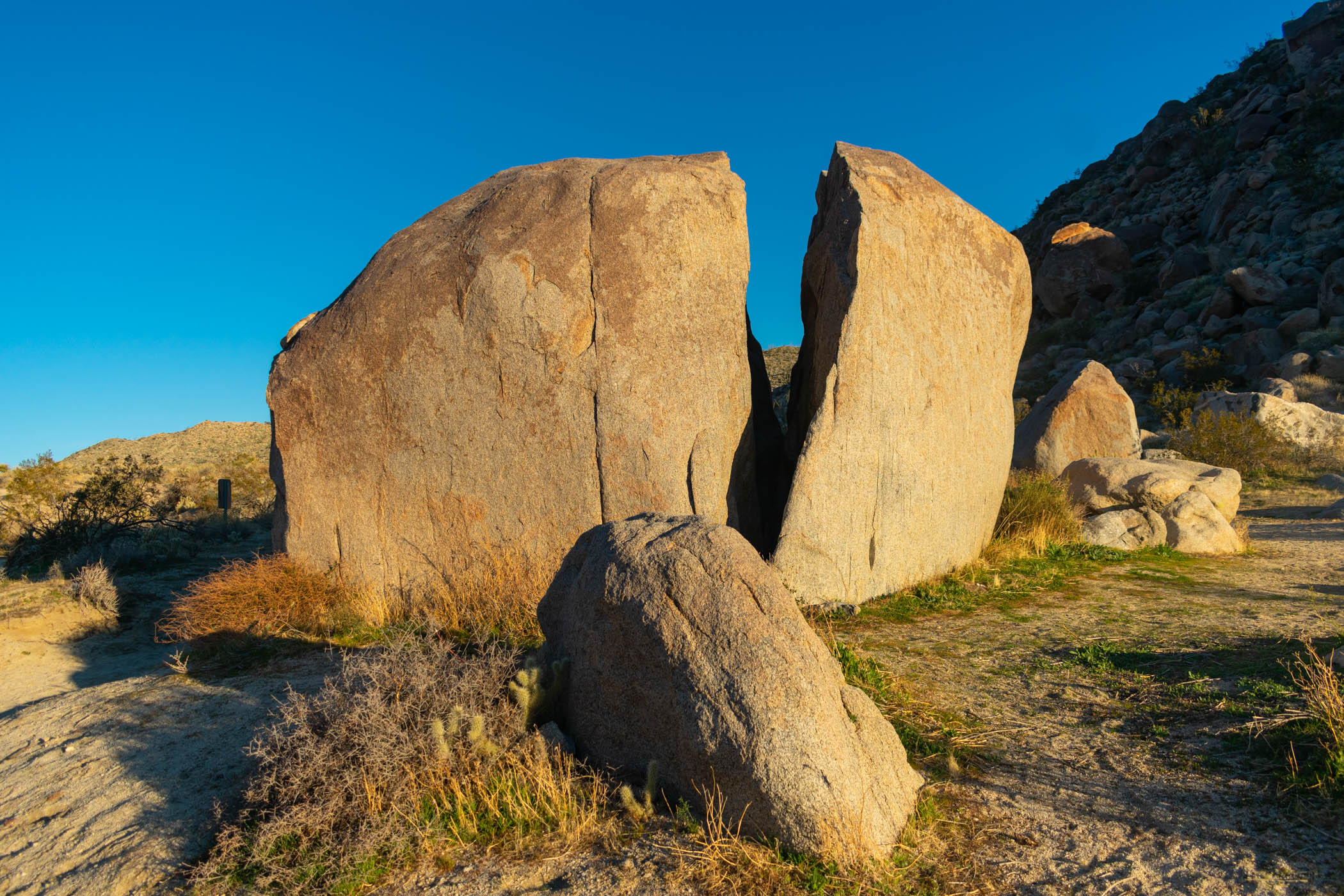
Despite all of the difficulty, I was able to make it all of the way to Split Rock, where I finally decided to setup camp for the night. I was able to complete the majority of the uphill work, leaving me to primarily downhill hiking in the morning. I had walked by Split Rock without even noticing it on a previous attempt, so it was also just nice to take in the landmark.
Day Eight: Diablo Peak to Arroyo Tapiado
21.83 miles
Waking early at Split Rock, I packed up my gear and continued down to Fish Creek Wash and beyond. The hiking was easy, heading downhill all of the way to Sandstone Canyon.
Originally, I had wanted to make a stop up Olla Wash to the Mud Palisades. However, as I became increasingly pressed for time, I realized that this 4 mile side trip could put an end to the goal of finishing with nine days of hiking. I would either have to choose the Mud Palisades or another day of hiking. I stopped to eat lunch at Olla Wash before finally making the decision to skip the Mud Palisades, hoping to do them again at some later date.
As I hiked, I also began listening to “Complex PTSD: From Surviving to Thriving” by Pete Walker. As a survivor of PTSD and a history of different traumas, this book has been on my list for a while. Sometimes, it’s really difficult to listen to (or read) books about the subject, but I felt like I could handle it on this hike. I listened to it through, enjoying the insight on the topic and the ideas for helping deal with different aspects of CPTSD that are prevalent throughout the book.
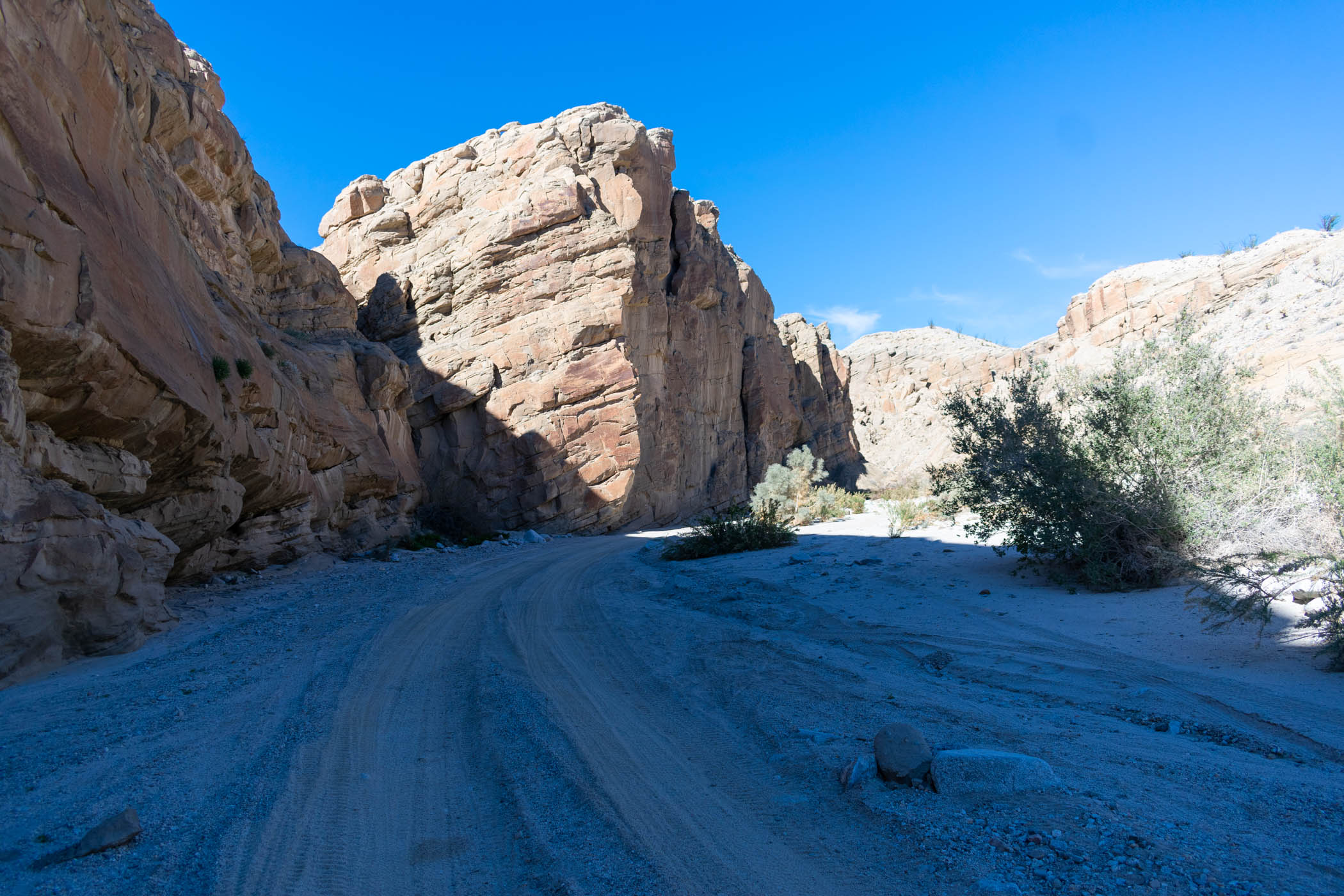
Arriving at Sandstone Canyon, I made the turn and followed the narrow canyon forward. I particularly enjoyed this canyon the last time that I came through, and this time was no different, except for the lack of people. It was nice to hike in silent solitude through the towering sandstone walls.
As I reached the spot where I had marked to begin the scramble up Diablo Peak, I immediately began. As the last time that I did this, the hiking was quite difficult. I pushed on for a solid while and made my way to the summit, where I finally stopped to take a break.
As I began to head down from the summit, I decided to take a route quite different from the one that I had drawn for my GPS. Unfortunately, it didn’t take long to realize that the route was not going to properly head to where my water cache down June Wash was. I also had no idea if the route would provide a viable option down. I quickly headed down a side wash, scrambling my way down. Aside from one slip, scraping the hell out of my right hand, I was able to drop to June Wash and my water cache by following this.
Finally, I dropped onto the road intersecting with June Wash in the badlands and followed it to essentially its end. My route called for a somewhat sketchy climb up over one ridge, which I did in my previous outing to the same area, but I thought I would try an easier, less sketchy appearing route up the same ridge. As it turned out, I had to drop down slides from the thin spine and back up a couple of times, ultimately not saving any energy or sketchiness at all. Once again, my originally drawn route was actually the better choice.
Finally, as I dropped down the small wash on the opposite side, the sun began to set. I made way into a wash that would eventually meet with and become Arroyo Tapiado, hiking into the night, by headlamp. After a while, I found a good campsite, clearly used before, and setup camp for the night. I went the entire day without seeing another soul.
As I finished my audiobook in the dark, I found some difficulty trying to make the last miles. I tried out several different pieces of music before saying screw it and turning on “The Wall” again. Of the music I had downloaded to my phone, it seemed the best to keep me going again. Tired and screaming out lyrics once again, it kept me going the last leg of the night.
Day Nine: Indian Gorge to Sombrero Peak
22.09 miles
Waking already surrounded by the mud walls of Arroyo Tapiado, I packed up and began heading down the wash. I had hoped to have a little time to at least visit one of the mud caves in the area, but I was wanting to finish this day, with quite a number of miles to do in order to make that happen. I skipped them all, continuing to hike on through the wash.
A dog barked at me as I passed by a camper in the early morning.
I chose to spend the day primarily in silence, saving the last of the battery available on my phones. While listening to primarily audiobooks the whole way was very nice, it was also enjoyable to hike in the silence of nature for the last leg of the trip.
As I came out to Vallecito Creek once again, I traveled cross-country to the other side, picking up on tracks heading South. I followed these until they intersected with Great Southern Overland Stage Route, where I took a break for lunch and began heading up the road.
I was surprised to see that Great Southern Overland Stage Route was partially paved. Not having actually traveled down the way before, I expected a sandy trail. However, much of it was half paved and half sandy. I found it quite interesting as I traveled up the way to finally meet with the true road at the end.
Crossing the road, I continued on to Indian Gorge. From the deep, desert marsh lands of the Carrizo Valley to the end of Indian Gorge, terminating at the way up to Sombrero Peak, the way was entirely uphill. Mile after mile, I climbed. Sombrero Peak seemed to be in a staring contest with me the entire way, exhausting me mentally and physically.
Alas, I hit the base of the mountain and began my scramble up her slopes. I said to myself as I began, “An hour for this next mile would be acceptable.” It ended up taking me two hours to make the short trip up to the summit, including a frustrating false summit as I made my way.
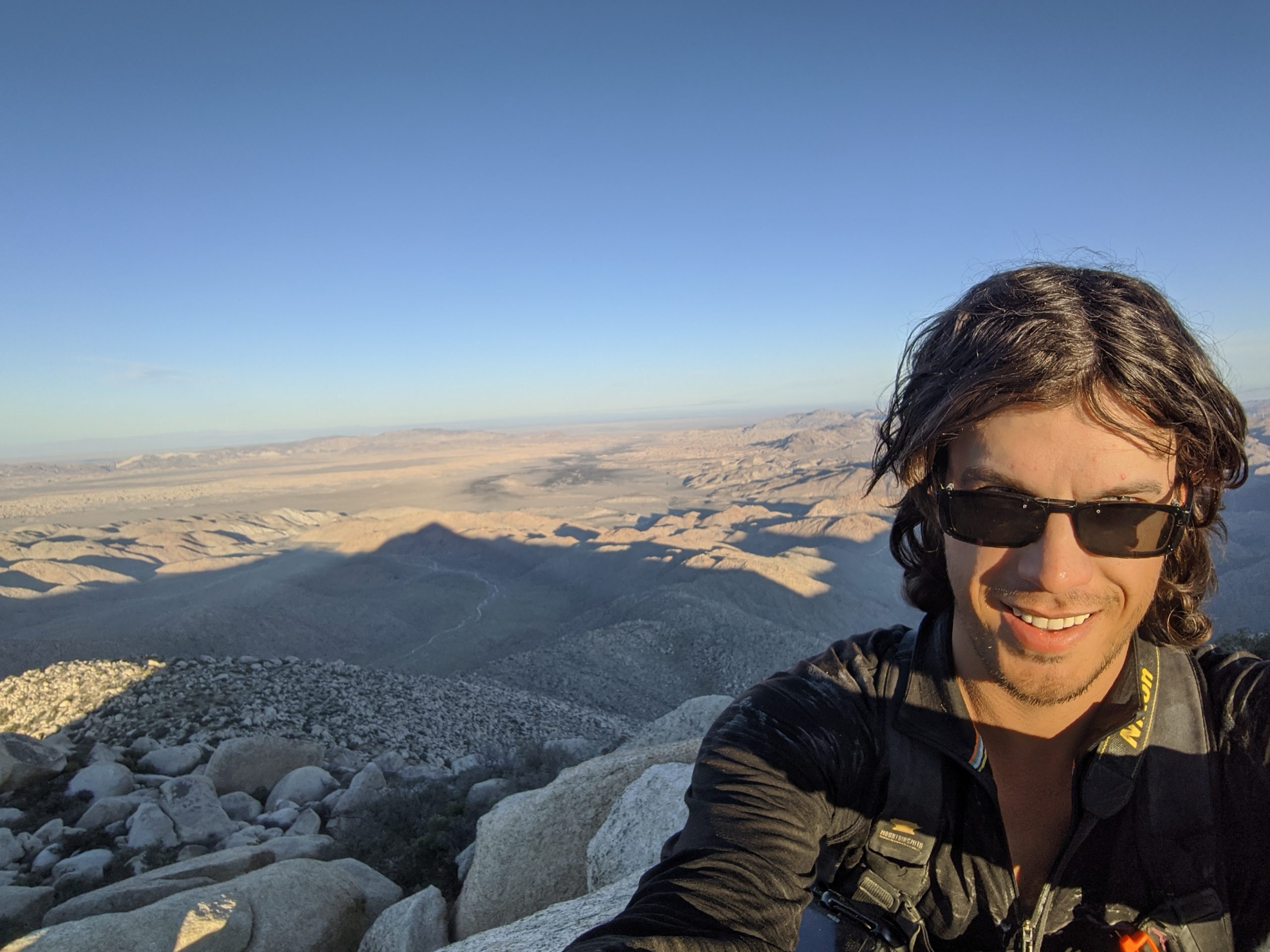
Ultimately, I reached the true summit of Sombrero Peak shortly before sunset, giving me time to climb down the other side in search of a trail back to Cottonwood Campground with a little sun left. In my enjoyment of the summit, I took a couple of selfies on my phone but forget to take a real picture with my camera. Thankfully, I had taken a few on the way up, and the selfies didn’t turn out too bad, either.
Making my way down, I tried to follow my GPS route somewhat closer, quickly losing sight of it entirely as I followed vague footprints. Noticing it after a short bit, I turned back and caught back up to the track, keeping in line as the sun set and twilight began to darken away.
Thankfully, with the last bit of twilight, I found a true trail that headed back towards Cottonwood Campground. I followed the trail by headlamp for a couple of hours. Near the end, I realized that I missed my turn to the campground and somehow ended up behind a fence cautioning against trespassing. I made my way around the fence and back out to the road on which I had spent so much time my first day. I hiked back to the campground, finding my car still sitting there in peace.
The hike was complete.
Conclusions and Route Information
I skipped past several side-trips I would have liked to do on this trip. Vista del Malpais, Mud Palisades, a mud cave or two, and even a couple more of the slot canyons that I pass en route. All of these would have been great additions, and the biggest thing that stopped me was a day spent going essentially nowhere on trail. Otherwise, the hike was truly wonderful. I hope to do it again in the future.
Overall, this loop, itself, is roughly 165 miles. With my day off route, I completed over 180 miles total. It is worth stating that this is an advanced backpacking route, with dangers ranging from cross-country route finding, potential fall and/or fear of heights hazards, some potential for cave ins posing risk to life and limb, lack of water availability along the route, and more. Someone with experience at these dangers will prepare and hike accordingly.
Click the links below to view GPX and KMZ files for this route, if interested. While I began my journey at Cottonwood Campground on the Southwestern end of the route, the loop track begins on the Northwest end, near Old Springs Road Preserve. Included in both files are directional waypoints, each assuming a progression through the loop in a clockwise motion. There are differences in the route in these files versus the specific route that I completed, but the route in these files should be appropriate for a loose following.
Pictures


